If you have had heavy rain and squally winds already today you may have thought that was it for Storm Gareth. Oh no, the storm centre to the NW will bring gales later Tuesday overnight into Wednesday. Hold onto your hats.
12th March 2019
#StormGareth is forecast to bring gales and high gusts from Tuesday afternoon overnight into Wednesday. There will also be more rain with the risk of flooding.
NW England looks particularly at risk of flooding with flood warnings already appearing from the Environment Agency. The morning rain and squally winds were from the frontal bands linked to this large area of low pressure. So the blustery rain was part of Storm Gareth but it is the winds and gales around the low centre which have prompted the weather warnings, The air is colder behind these fronts with more chance of sleet and hill snow in the showers from the NW, even thunderstorms too
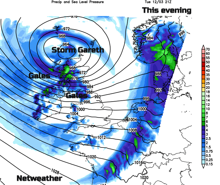
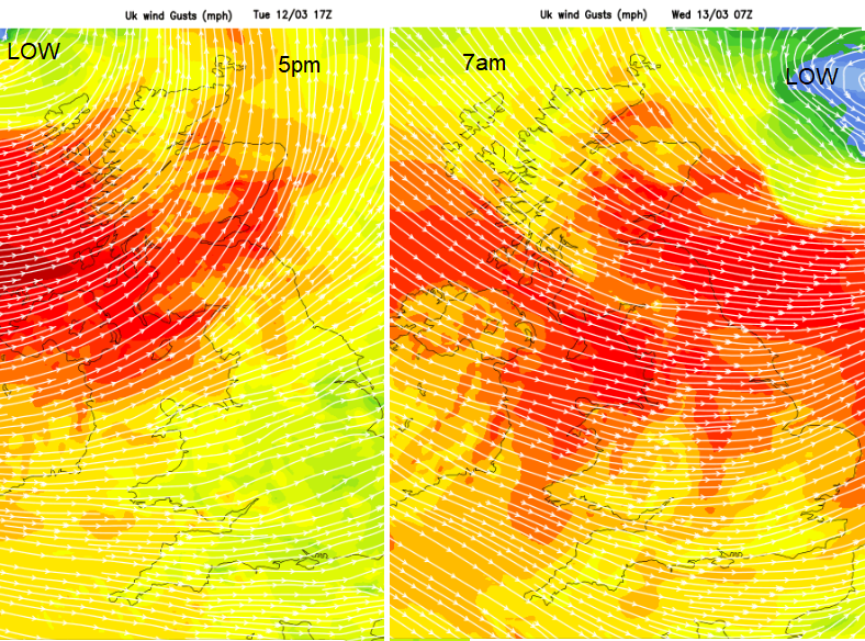
Much of the UK will be affected by strong winds for the middle of the week but the worst of the winds are expected over western Scotland and Northern Ireland during Tuesday pm and the rest of Scotland and the Irish Sea by Tuesday evening rush hour. There will be fresh to strong W or SW winds tonight across the UK with gusts of 60-70mph and gales for Northern Ireland, Scotland and northern England with severe gales for Ireland, the west coast of Scotland. It will sound wild tonight. The strong winds and high gusts continue for Britain on Wednesday morning, veering to the NW and easing down slowly through the day as Storm Gareth heads off eastwards over the North Sea. This deep area of low pressure is the seventh named storm of the season, named on Monday this time by Met Eireann.
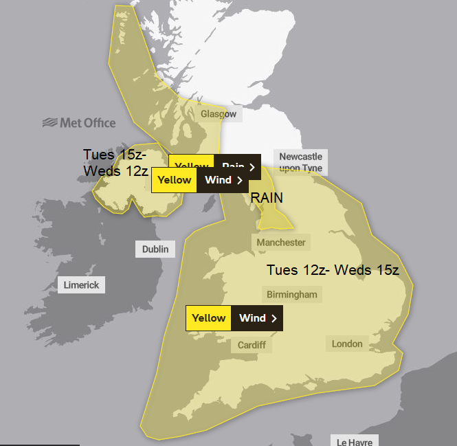
Met Eireann has issued orange and yellow wind warnings for the winds. The UK Met Office has wind and rain warnings out, see below.
Winds
The UK Met office currently has yellow wind warning for Tuesday and Wednesday and rain warning for NW England for much of this week. It is likely that Irish Sea ferries will be affected and there have already been alterations and cancellation to Scottish Island routes. Bridges, railways and more exposed road routes could also be affected. There will be rough seas and large waves making western Britain and Irish coastal areas dangerous.
The winds will ease over all of Ireland by lunchtime on Wednesday but it stays blustery and chilly. The wildest conditions ease across Britain during Wednesday again leaving a blustery cold NW wind.
Rain
There are is a rain warning for NW England from the Met Office, there could be localised flooding, and disruption if there are landslips or debris blown onto the railway tracks. The ground is already sodden and rain just keeps on coming from the west this week. There will also be hill snow with a wintry mix in the showers from the NW.

Overtopping waves and spray are expected as a result of strong winds. Scarborough Flood warning.
River levels are rising as a result of heavy rainfall. Consequently, flooding of property, roads and farmland is possible today Yorkshire Dales flood warning.
Localised flooding impacts are probable in York on Wednesday, Thursday and Friday and across parts of the Pennines on Thursday. Environment Agency for England
Keep an eye on the rain, hill snow and current temperatures on the Netweather Radar. All current wind gusts here. Our Twitter Facebook and Instagram feed.
The 7 day forecast for your location and more chat in the Netweather forum about Storm Gareth, the whole Name our Storms process and Weather warnings, are they working?
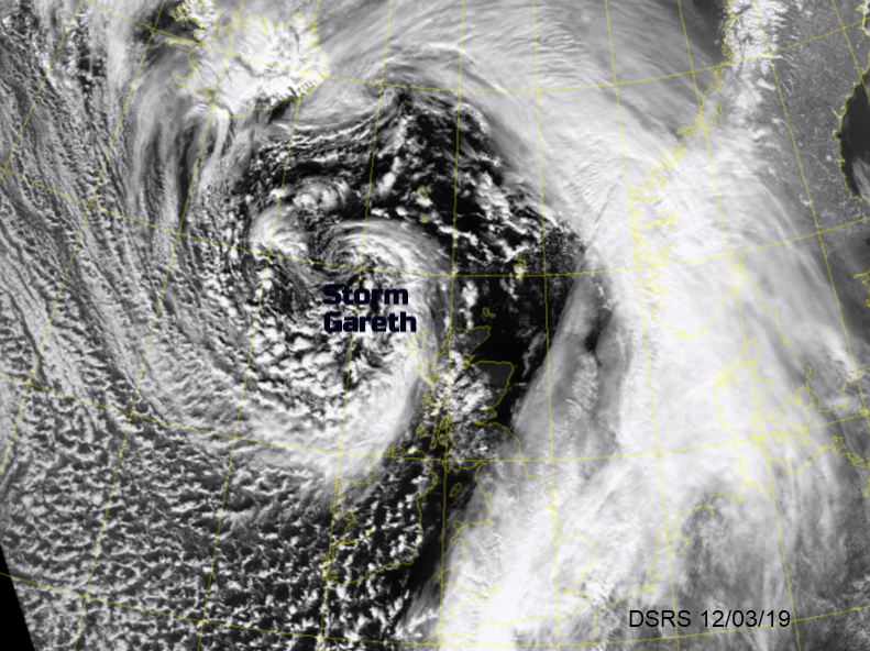
Top image Dundee Satellite receiving station DSRS