Enjoy today's sunshine and easing winds as there will be plenty of wet and windy weather about this week. Storm Gareth - High gusts, heavy rain and wintry on western hills all rattling in from the Atlantic.
Quite a weekend with rain, snow and high winds. There has been a bit more snow this morning in the north and there will be windy, even stormy conditions this week as more areas of low pressure barrel in from the Atlantic.
Up high in the atmosphere an active Jetstream is moving right across the Atlantic toward the UK< empowering these low pressures and herding them our way. The air over the UK isn’t going to be as cold over the next few days so there will be more rain, mainly in the west and hill snow. Scottish hills, the high ground of Northern Ireland and NW England and the Welsh mountains will be the main areas to see a few cms of snow this week.
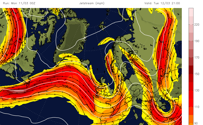
It is the winds giving concern over the next few days with a low pressure heading our way later Tuesday into Wednesday being of particular interest. This might be named “Storm Gareth” by either Met Eireann or the UK Met Office, but wait on them announcing on social media rather than a newspaper.
Update - now named Storm Gareth by Met Eireann due to strength of the winds Tuesday into Wednesday. 11/03 11:30am
At the weekend a little low brought wild conditions and damage over southern England during Sunday morning. Trees fell blocking roads, damaging cars, open spaces including Richmond Park were closed for a time with damage to roofs and fences. The Met Office warnings are driven by impacts, so there was a yellow warning for Wind, but if those high winds and gusts had gone through at say 8 am this morning the impacts/disruption/possible injury or loss of life would have been much worse as so many people would have been on the move to work and school. So, an amber warning is judged to have higher impacts than a yellow, not just reflect a numeric value of say wind speed or rainfall amount
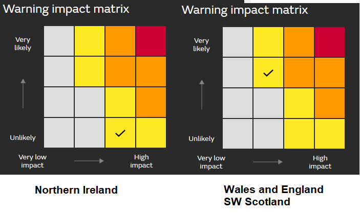
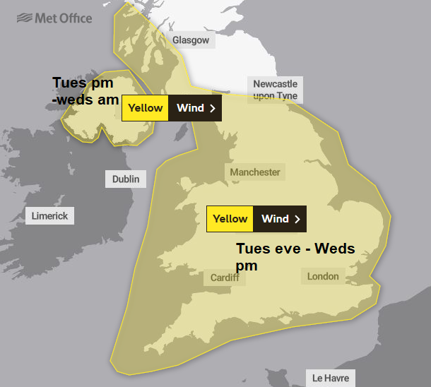
There are more warnings for this week. A warning for snow and ice to start the working week for Scotland, northern England, Northern Ireland and Wales with a nippy but sunny start this morning. A wind warning for Northern Ireland for Tuesday afternoon with severe gales and gusts over 70mph with lasts into Wednesday and then an extension of that warning across much of England and Wales on Wednesday.
Today
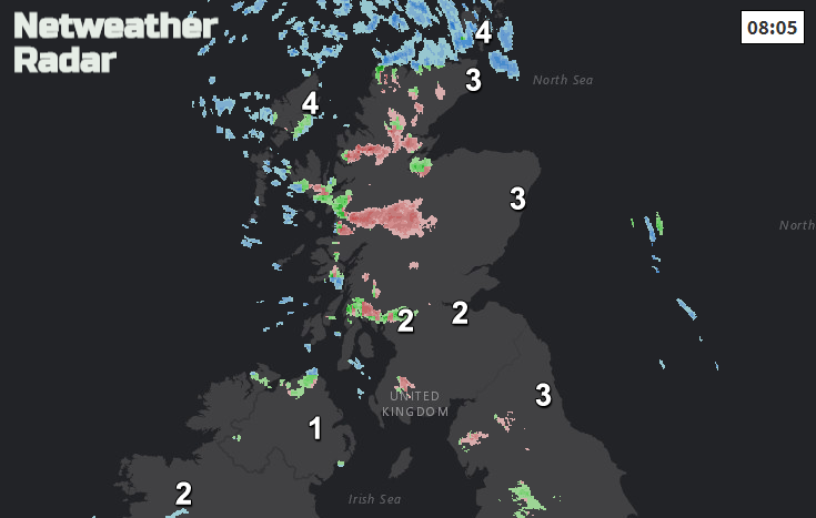
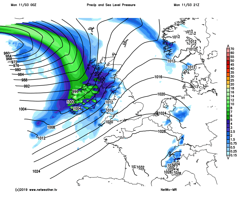
A chilly start this morning especially in the brisk winds across eastern England. There will be plenty of fine, dry and sunny weather about today, with the last of the blustery winds easing down. Temperatures today will be around 8 to 11C. The showers fade in the NW with a fair spring day to come. By this evening cloud will be increasing in the west with patchy rain appearing for western fringes of Britain and over Ireland. This is the low pressure of interest.
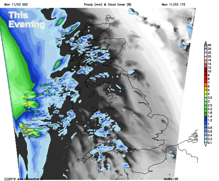
Wet and windy weather moves over Northern Ireland this evening with gusts up to 60mph. This band of heavy rain, northern hill snow and strong winds will head over western Britain. Overnight it will be wet and windy with the warm front moving through, so mild air for southern Britain for a time before the cold front arrives.
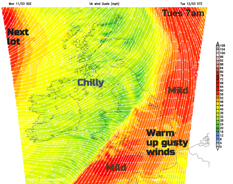
So, a wet and windy start for some on Tuesday with horrible conditions for Wales, SW England up to the Midlands first thing. That frontal rain pushes SE with the gusty winds so by lunchtime the last of the mild air will be being squashed away to the SE with the heavy rain and blustery winds. Behind all this it will be brighter, colder with a scattering of showers.
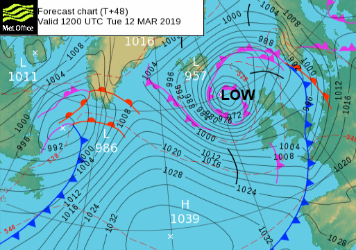
That was the frontal bands of the low, what needs watching is the low centre heading over northern UK and the winds around that.
More wet and windy weather hits Northern Ireland on Tuesday afternoon, this is the first weather warning with rain and snow for western Scotland. The wet, windy and wintry conditions head over the Irish Sea on Tuesday evening with gusty winds through the Central Belt.
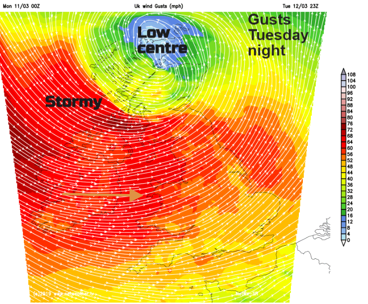
There could again be areas at low levels seeing snow over northern Britain, maybe Northern Ireland in the heavier precipitation as the low spins in. It will be wild through the night with westerly gales, even severe gales for exposed coast and hills, strong winds inland. By Wednesday morning there will be chilly, fresh to strong NW winds over northern Britain and Northern Ireland and strong westerly winds over the southern half of Britain with gusts around 60mph.
It remains windy on Wednesday afternoon but not quite as wild as the low pressure pulls away across the North Sea.
More wet and windy weather from the west on Thursday but not as wild. Quite a week to come.