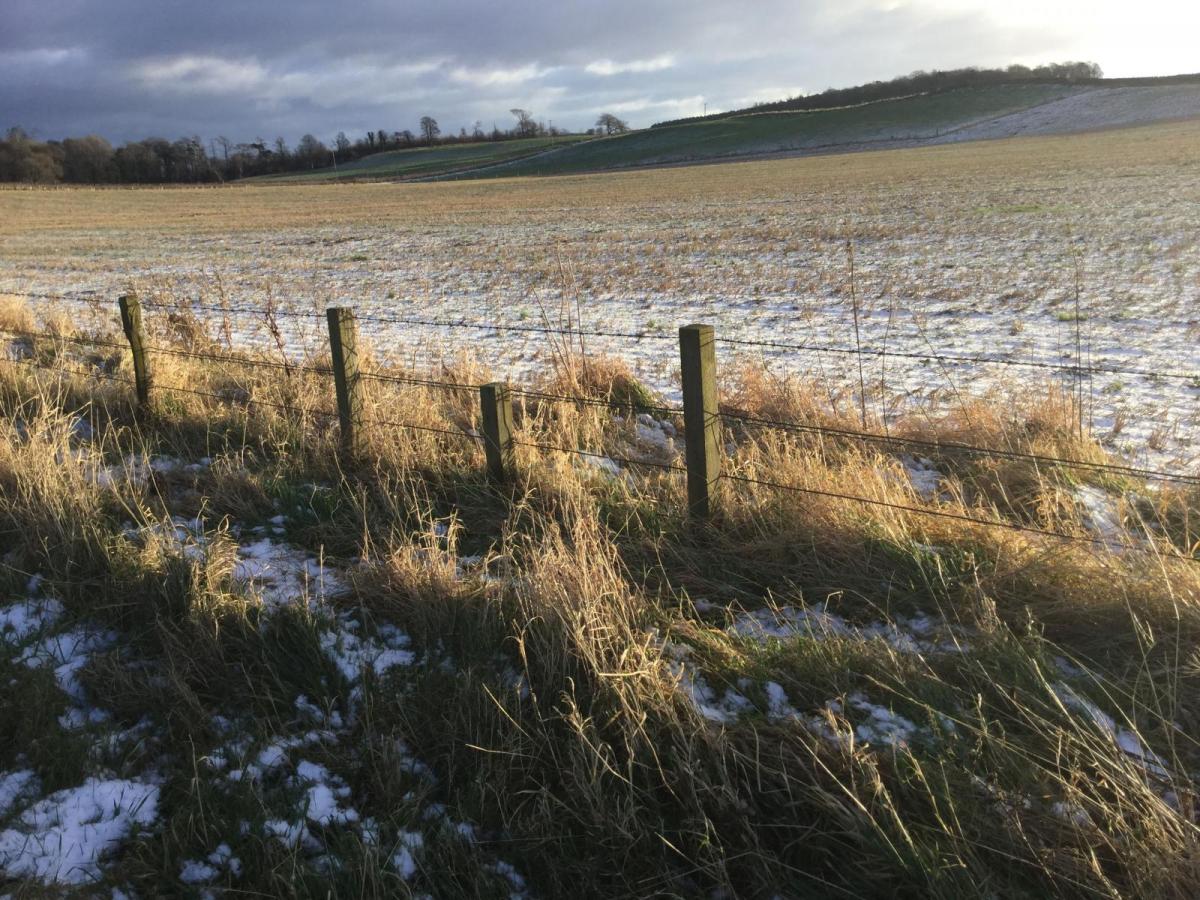
Rain showers, bright spells, blustery winds and snow on the hills. A bit of a chill this weekend but nothing severe. Plenty of showers from the NW. Happy International Women's Day
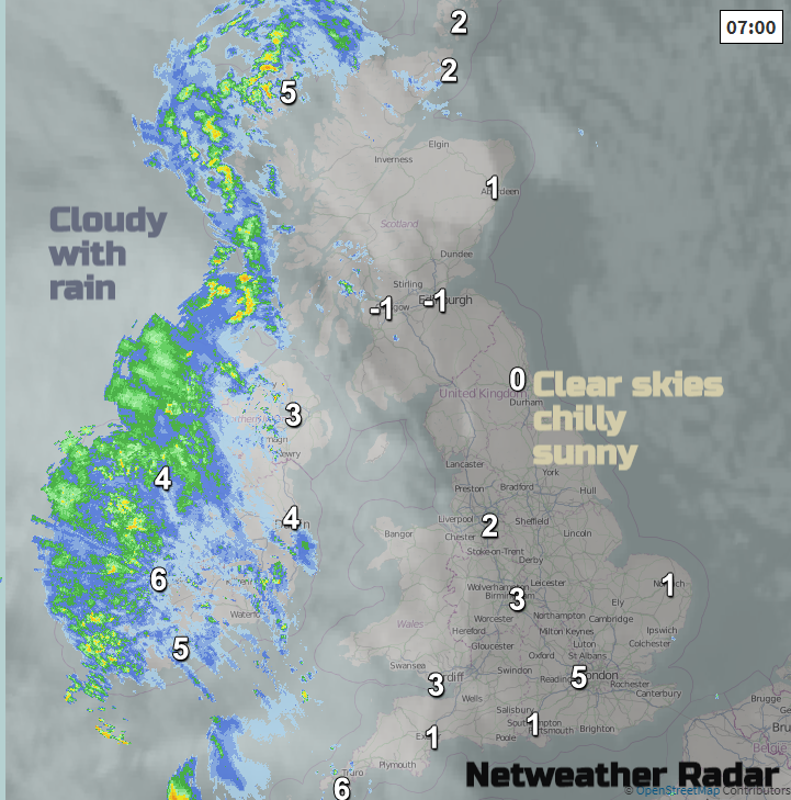
Lots of weather rushing in from the west this weekend with a chillier theme. The midweek low has moved away eastwards now taking one batch of rain and there is a fine sunny but nippy start for Friday across Britain. However, the next Atlantic system is already bringing rain over Ireland into western fringes of Scotland. The weekend looks unsettled and blustery with showers from the west and snow, mainly over northern hills.
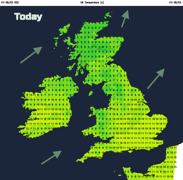
Overnight temperatures have fallen to -4.7c in northern Scotland and yesterday the maximums were 12.5C at Heathrow and around 11C in Cardiff, Armagh and Argyll, still not bad for early March. Today after a calmer start the SW winds pickup and many places will reach around 8C with up to 10C for SE Britain.
The cloud increases today from the west as the rain moves over Northern Ireland this morning and into western coasts of Britain. This will be rather patchy to begin with and not much for SW England, but the band keeps moving eastwards and the day goes downhill for those with a fine, sunny start. Eastern Britain and the SE stay fine for much of Friday even though high cloud increases.
So, Friday evening will be blustery, not too cold out of the wind but with a fair amount of cloud and more rain in the NW. For any sheltered spots there could be a touch of frost for northern Britain and Northern Ireland with the risk of severe westerly gales for the Northern Isles. There will be clearer skies as the rain clears off into the North Sea with showers for NW UK which will include more snow as colder air reaches in.
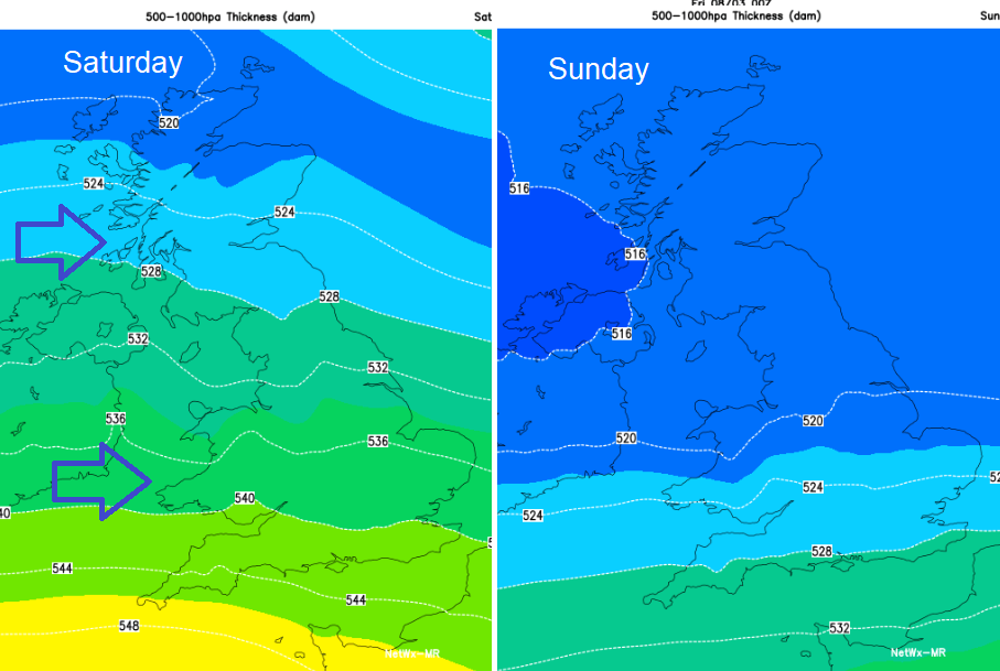
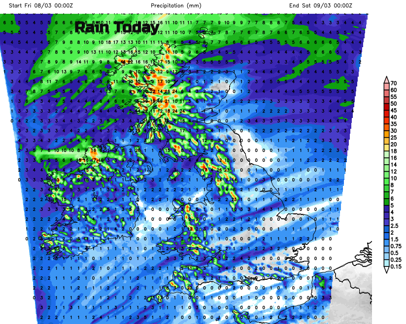
On the thickness chart you can see how the colder air takes hold through the weekend with the showers from the west becoming more wintry.
On Saturday there will be plenty of fine, bright weather about with temperatures up to 11 or 12 for England. Rain will skirt along the English Channel bringing more cloud and clusters of showers will rush into Scotland, Northern Ireland and NW England. Don’t rely on any timings from weather apps at this stage, just keep in mind the risk of blustery downpours. It will feel colder further north or in the wind and the showers will include hill snow with flurries and sleet to lower levels later in the day.
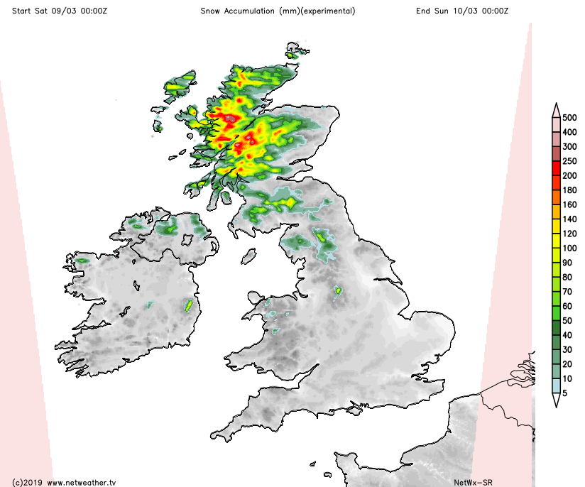
Eastern areas remain more sheltered throughout the weekend but there will be an easing of any rain and wintriness on Saturday evening as the winds drop slightly and a frost returns to northern Britain. Ice looks likely on Saturday night. There is a little low pressure showing, running in from the Atlantic towards southern Britain, that might develop more and bring rain to the south overnight into Sunday. Another low looks to develop in the north and could bring snow for Sunday morning with the main risk for western Scotland. There is low confidence for the details but there will be colder air, the risk of snow from the NW and a push of rain from the south. How far north that low and rain reaches varies on the forecast models.
After that another clear, cold but sunny slot for Monday morning before more wind, rain and hill snow whisks in from the west.