It's all a bit soggy out there midweek with more rain today in the north and a scattering of hefty, even thundery showers for England and Wales. A colder NW flow by Thursday and widespread frost into Friday.
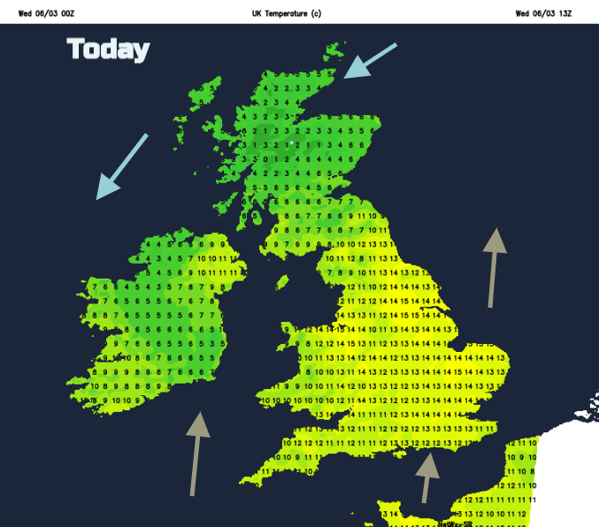
For the middle of the week, we have a low pressure right over the UK with lots of rain, blustery winds and snow over the Scottish mountains. There is some mild air caught up in this frontal system and plenty of cloud with temperatures to start the day around 8 to 10C. Most areas stay cloudy but in any brighter spells there will be a taste of fine weather before hefty showers scuttle through. It’s an unsettled day before it turns colder for the end of the working week.
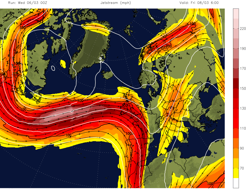
Last week there was high pressure stuck over us with settled, fine, dry and warm weather, the jet stream buckled around that block. Now there is a powerful jet working across the UK, right at us. Again, the US has a massive area of very cold air and the temperature contrast invigorates and powers up the jetstream which then heads across the Atlantic. There will be more low pressures coming our way, so more wind and rain.
Today’s low has already brought localised flooding after heavy and persistent rain overnight. There will still be tricky conditions on the roads with standing water and spray although the frontal band is clearing away from eastern England, there will be plenty of showers across England and Wales today. These will include hail and thunder with a few bright spells breaking through the cloud. In the mild air, temperatures could reach 12 to 16C, so feeling mild.
Convective storm forecast - "A few organised bands of showers and short-lived thunderstorms ...Hail and isolated/sporadic thunder and lightning is possible ... Locally enhanced wind gusts may accompany the heavy showers and storms along with a risk of localised flooding."
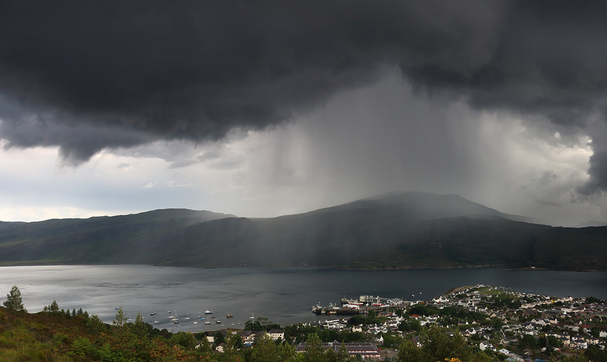
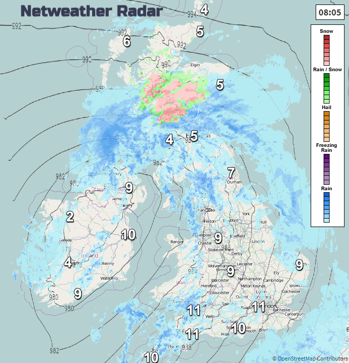
The main frontal rain swings northwards from Northern Ireland, northern England and the southern half of Scotland, right over Scotland today with a curl of rain reappearing for Fermanagh and Tyrone this afternoon. There will be snow on the hills and mountains of Scotland inland today with high rainfall totals for Cumbria and SW Scotland
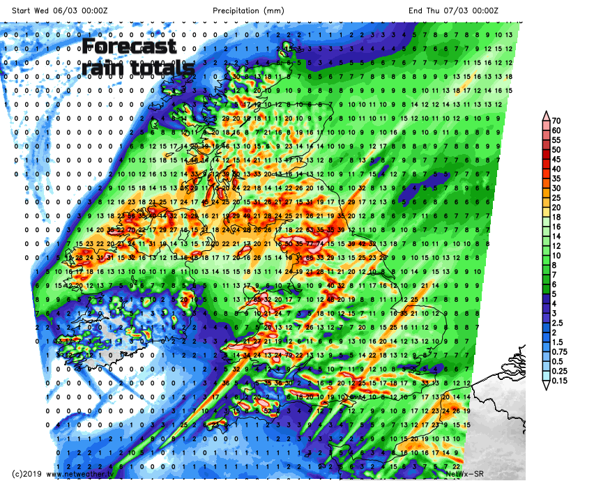
Ahead of the rain, there have been clear skies overnight resulting in a frost and temperatures down to -6C in Grampian. Now there is more cloud now and the rain band will reach Orkney this evening. Across the rest of Britain, there will be a scattering of heavy downpours. These will move NE from SW Britain with some areas seeing shower after shower and other areas missing most of them. Just keep an eye on the radar to see where they are and which direction, they are heading in.
This evening a tuck of colder air begins to flow around the top of the low pressure. This will set up a chilly NW wind for Thursday. As one area of showers clears from the SE tonight, more showers push in from the far north and NW. There will be more cloud and wet weather but with more of a wintry mix.
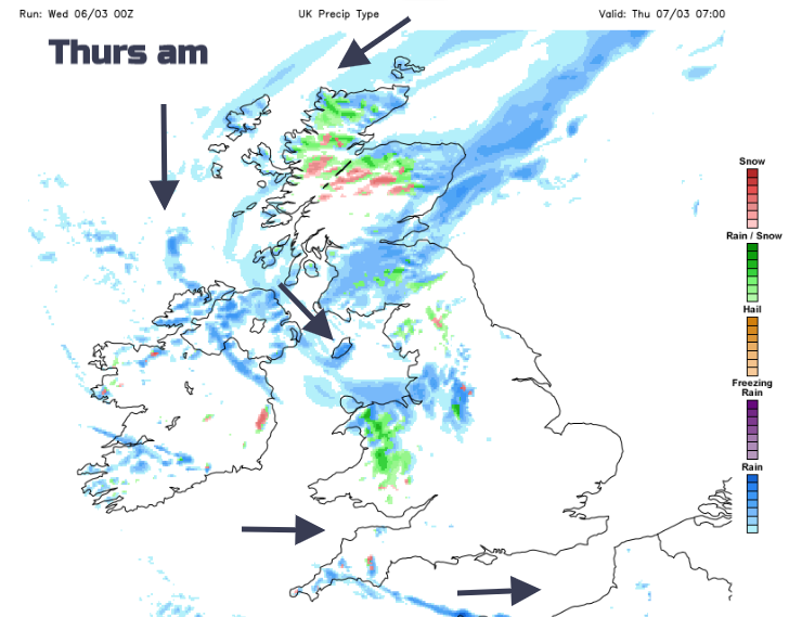
Sleet and hill snow with a damp chill in the air. After today’s mildness, it will feel quite different. Southern England and south Wales should stay quite dry but elsewhere it will be an unsettled and chilly picture. The SW then NW winds pick up through the day adding to the cool feel with temperatures of 5 to 9C.
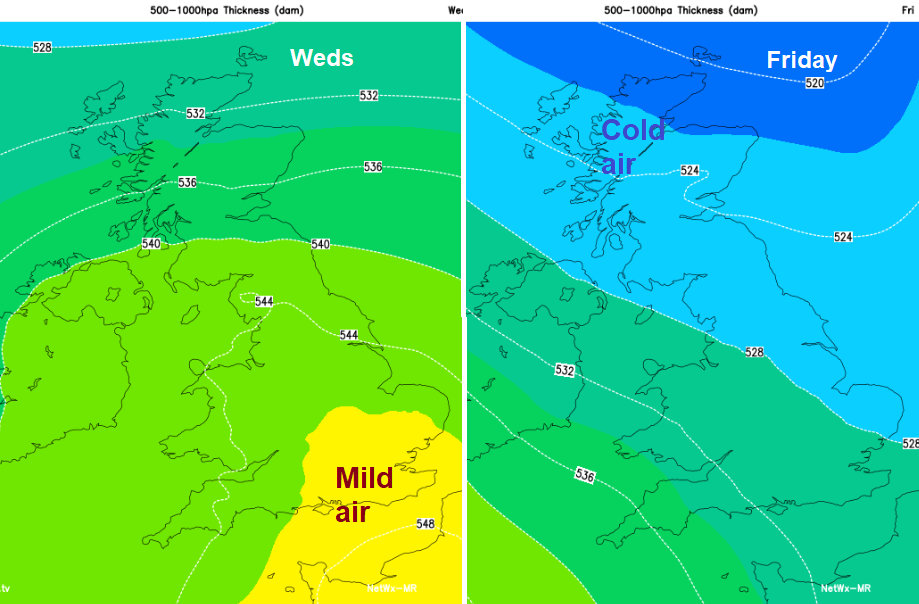
During Thursday night, the skies clear as the rain and wind pulls away into the North Sea it will turn colder with a widespread frost. This leaves a fine, sunny day on Friday after the cold start but by the weekend that active jet will be throwing more low pressures our way, with blustery winds, rain and hill snow too.