It's a new month, put away those warm and sunny memories and let's get back to proper UK weather with Atlantic wind and rain. This weekend looks lively, with Storm Freya but uncertainty to be aware of.
It’s a grey and cloudy 1st of March. For many areas, temperatures are still up above the average of 7 to 9C but it’s still quite a change from earlier on this week. March will continue to cool off but there is wet and windy weather on the way this weekend. Update: Storm Freya Sunday/Monday
Today there will be light winds, only picking up to a moderate southerly as a frontal band of rain arrives over western Ireland at teatime. Ahead of that, it is a quiet settled day. Some parts holding on the grey skies, a little dampness and feeling cool, even chilly at 7 or 8C. Where the sunshine breaks through, more likely for Wales, SW England, NE Scotland, through the Irish Sea and North Channel the temperatures will lift with 11 or 12C as the maximum.
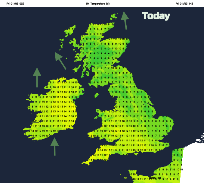
Co. Armagh and SW Britain could see 13 or 14C and feel fine later in the afternoon before the rain.
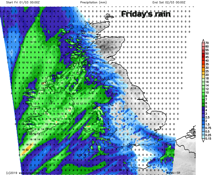
There will be heavier bursts of rain as the band moves over western Britain tonight. The winds veer to the west behind the front and the rain becomes more patchy as it reaches eastern Britain before dawn. As it clears off into the North Sea there will be bright spells and sunshine, but the next weather system will already be showing itself over Ireland.
Weekend wind and rain
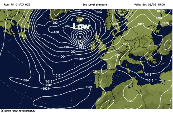
Two things happen this weekend. A large deep area of low pressure moves to the NW of the UK. This brings rain from the west later on Saturday and during Saturday night. It doesn’t reach SE Britain. Saturday turns windy everywhere with a fresh to strong SW wind, quite a change from the recent calm. It looks very windy for the Western Isles with SW gales overnight. The low stalls over Fair Isle, so Sunday morning stays windy north of the Central Belt.
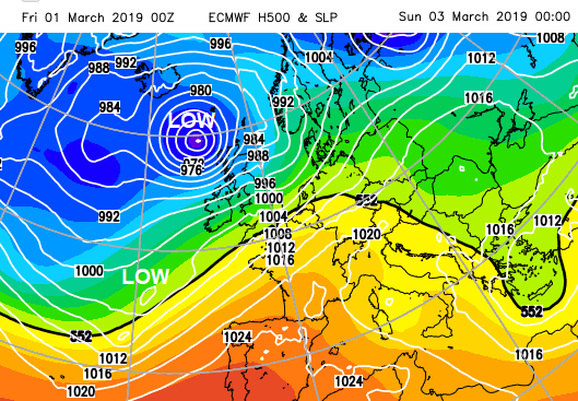
Storm Freya
Meanwhile, a second area of low pressure, just named #StormFreya, develops away to the SW, linking back from the frontal rain over England and Wales. Different models have slight differences in path and developments; how much of northern Britain will still be in the strong winds on Sunday morning and how far north this second low will bring rain and blustery winds.
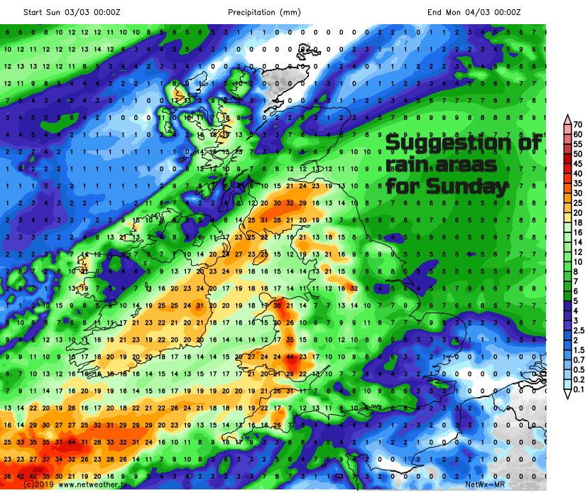
It looks like the low will head in from the SW, bringing heavy rain to Wales and SW England, not much at all for the SE in the day but as it spins potentially up through the Irish Sea later on Sunday the weather will be really quite miserable. Strong winds over England, Wales, into Northern Ireland and persistent rain for Northern Ireland and a swathe of central Britain. This low could then deepen further as it swings across Britain on Sunday night.
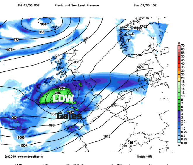
So strongest winds and gales for NW UK Saturday night and potentially more gales Sunday night, clearing into the North Sea early Monday. Rain for Ireland and NW Britain Saturday pm. Rain for central Britain into the SW Saturday night before the second low brings rain over SW England, Wales then northwards.
If you are looking at an app, with one weather symbol per time slot, bear in mind the uncertainty and bigger picture.
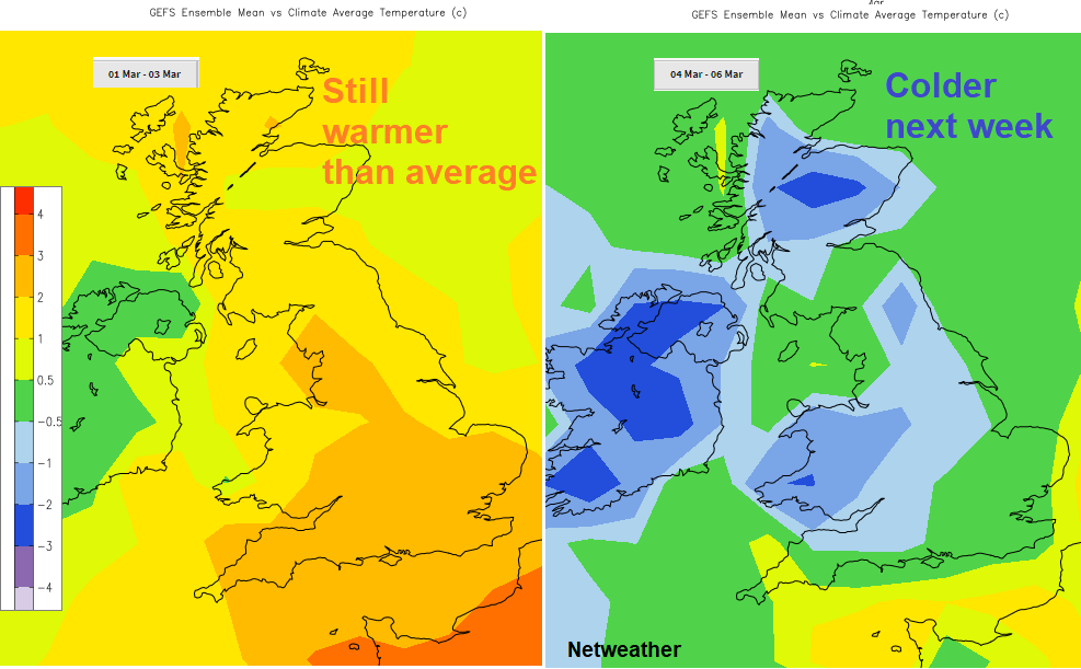
A fair bit of uncertainty about locations and timings but the likelihood of wet and windy even stormy weather this weekend and then turning colder next week.
More about #StormFreya