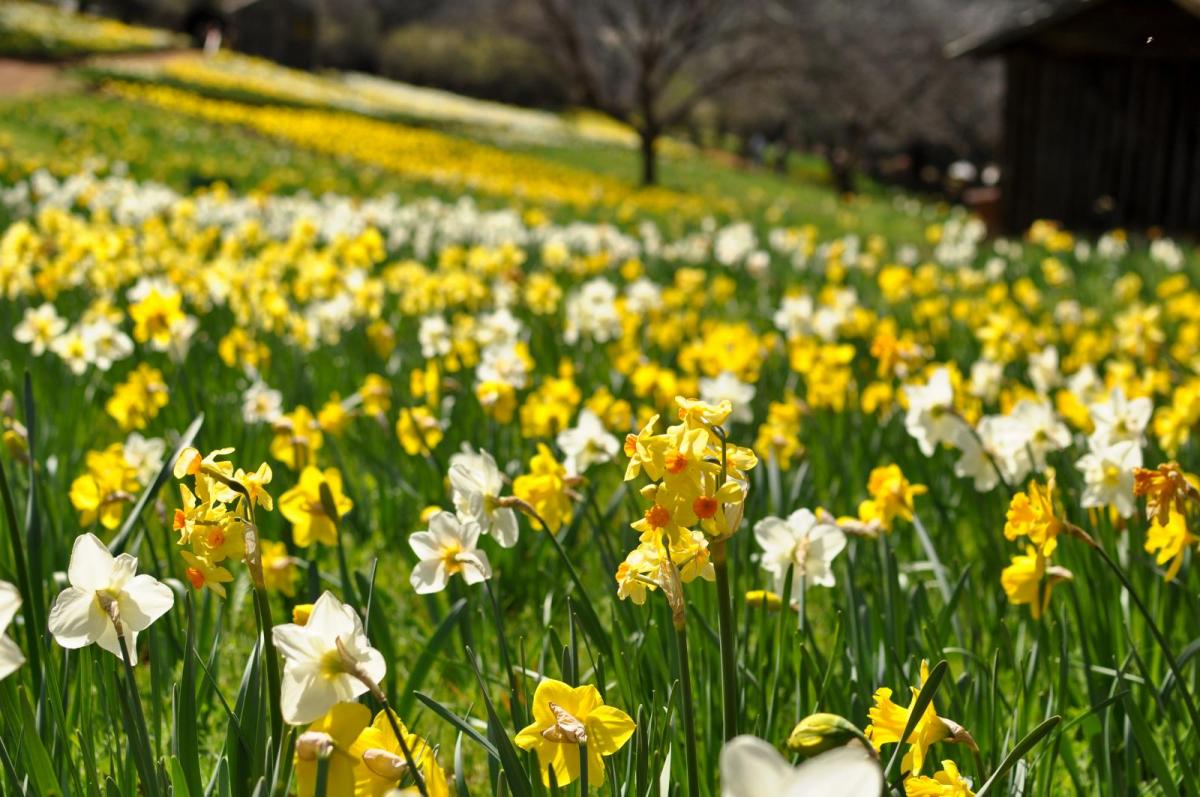
Oh, isn't it mild! Temperatures widely in the teens and there will be sunshine over the next few days, fog and rain for the west too. Scotland's February record of 17.9C is under threat today. Spring has sprung.
Temperatures are still up, well above average in the mid-teens, with some spots up to 17 maybe 18C. The south-westerly flow continues into the weekend with a lot of fine, dry, very mild and often sunny weather. A real taste of spring. It remains windy in the west with more cloud and light rain for Northern Ireland and western Scotland but the warm air stays over the UK into next week.
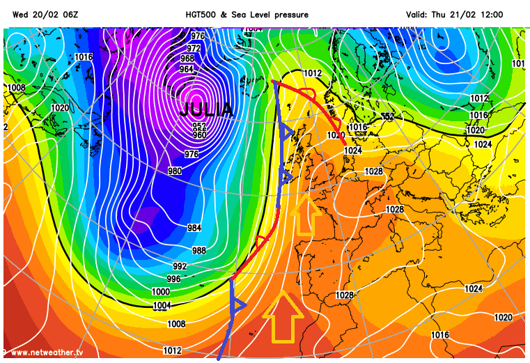
High pressure over western Europe is settling our weather down today. A rapidly deepening immense low pressure has moved up through the Atlantic (Storm Julia named by the Portuguese Met Service), steered away towards southern Greenland by the European anticyclone and the intense jetstream. We have missed out on a severe storm, but the flow in-between the low and the high is allowing very mild air to be pumped up from NW Africa and the Canary Islands.
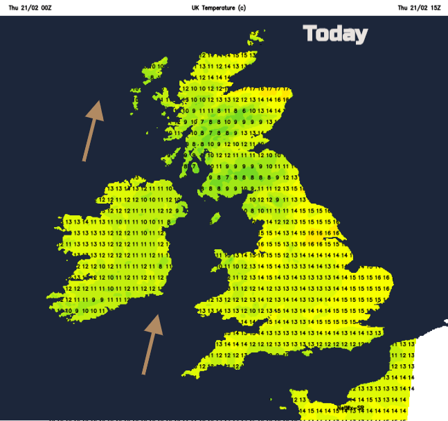
It’s not wholly a fine, sunny picture. This morning there is some low cloud, mist and patchy rain about. NE Scotland had clear skies and temperatures fell widely to +2 or +3C, Fyvie Castle down to -1 overnight an air frost. It is this part of Scotland that could see the highest temperatures today, 17 maybe 18C, which would break the 1897 Scotland record of 17.9C. Quite a jump if it comes off, thanks to the Foehn Effect where air dries out and warms after rising over high ground, such as the Grampian mountains.

Saturday could bring 17 or 18C to parts of England but the February record here is high at 19.7C. Still it will feel very mild for many and quite peculiar consider what February can produce, and what occurred last year.
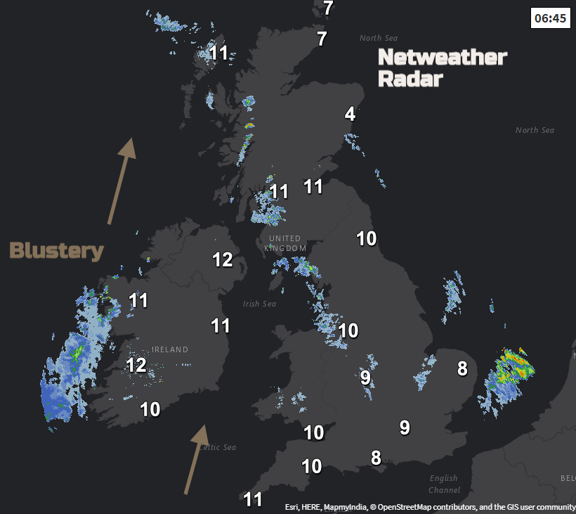
Today there is a south to SW wind, which will be fresh for Ireland and coasts of western Britain. Are which are starting the day cloudy and grey will brighten up and the rain fades. Cumbria and SW Scotland into Strathclyde will take a while to improve with more cloud through the Irish Sea. There will be sunshine for SW Britain and NE Britain with sunny or bright spells in-between.

Rhyl saw 18.2C last Friday, no February records broken yet. Scotland record the one to watch today.
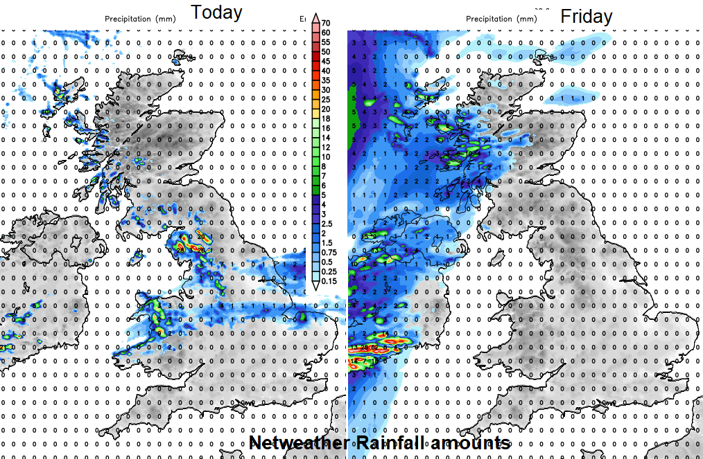
Tonight, the southerly winds pick up for Ireland, through the Irish Sea and for western Scotland with gusts around 60mph with strong winds still over NW Scotland for Friday morning. A completely different picture further east. It will be still with hardly any breeze, especially for SE Britain. There will be fog and low cloud which will mean a murky grey start for some on Friday. This low cloud will disappear through the morning, leaving a sunny afternoon with the mild air. For most of Britain, temperatures will be 12 to 16C
Through the afternoon cloud increases in the west and rain will spread over Northern Ireland later in the day.
The Weekend
Another band of rain heads in for Saturday morning over Northern Ireland then western Scotland with less warm air. Ahead of this frontal band it remains fine, sunny and very mild.
Sunday looks dry everywhere with a colder start in the far north and a light SE breeze. Sunshine for many and still 15 or 16C for many inland parts of England and Wales.