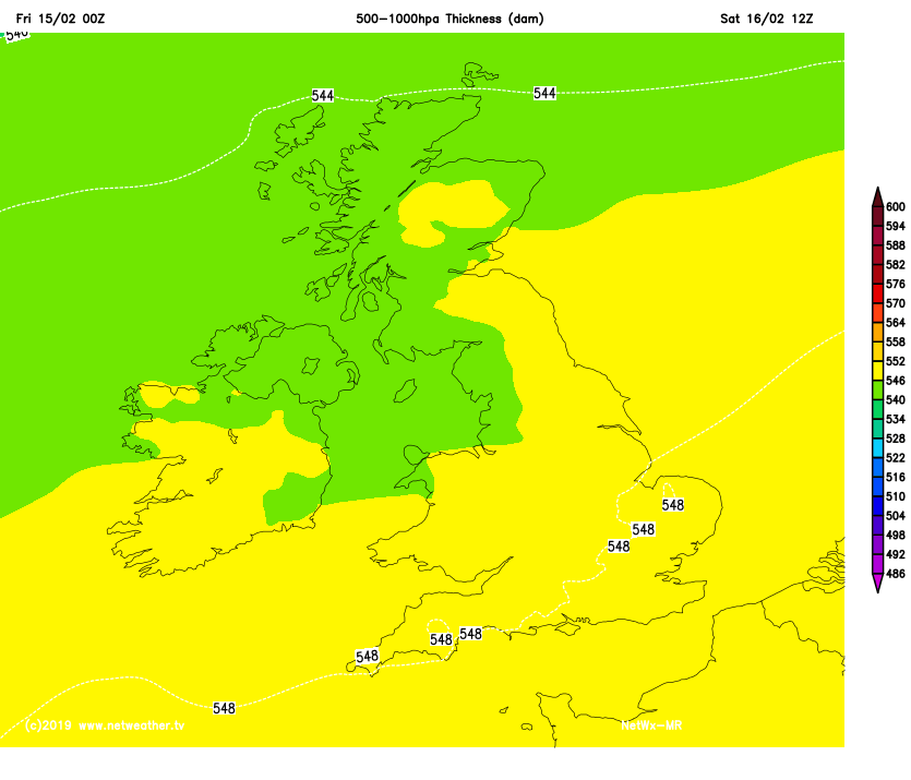
Southerly winds are bringing mild air across the UK. It feels like spring, especially if you have sunshine and are out of the breeze. Bit of a change through the weekend, a westerly flow with rain briefly.
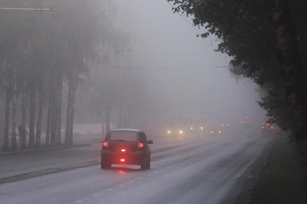
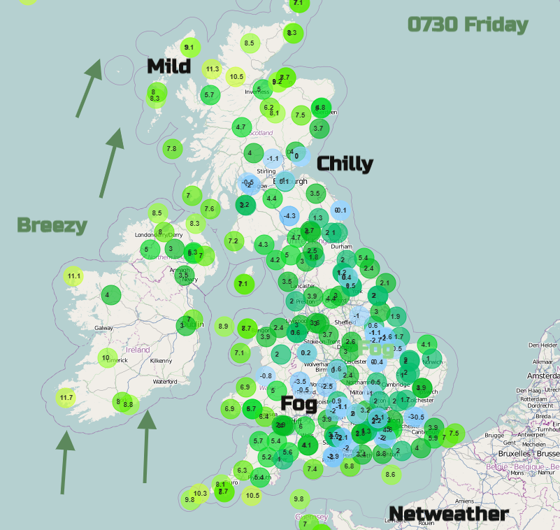
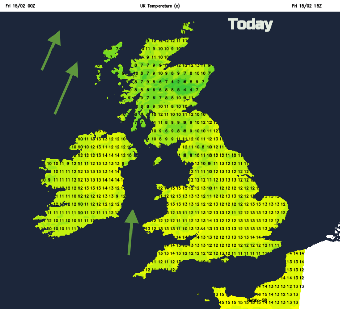
It’s mid-February, still chilly by night where the skies are clear, and the winds are light. There is mist and dense fog in places again this morning. However, by day it is mild. Yesterday Wales, Yorkshire and London were all around 15C, Gwynedd up to 16.1C. Overnight temperatures fell away to -4C in Essex and SW Scotland, the contrasts are large at this time of year. The southerly flow is bringing us this mild air and with high pressure nearby there has been settled fine weather and sunshine. The high over Europe keeps much of SE UK dry and fine but for the north and west there will be more cloud and bands of rain heading in from the Atlantic.
There will be a change during the weekend with a cooler westerly and some rain and temperatures nearer average for the start of the new week. By the middle of next week, we’ll be back in the blustery southerly flow and the mild air.
The fog will clear this morning, taking its time for southern England where conditions are still. There will be a lot of sunshine on another lovely day. There will be a brisk southerly wind for Northern Ireland and western Scotland, affecting more of west coast Britain through the day. Temperatures again will widely be in double figures. And again we could see 15 or 16C, north Wales looks likely, to the lee of the Welsh mountains.
Tonight, a frontal system moves in from the NW bringing more cloud, gusty winds and rain to the NW Highlands and Scottish Islands. Western Britain and Northern Ireland will turn cloudy and damp for a time overnight, which will stop the temperatures from falling too far.
By Saturday morning many places will be more cloudy than on recent days. Another low pressure tries to head in from the west but the high pressure over Europe is doing a great job of warding away incoming frontal systems. It will keep south-eastern Britain settled and dry for most of the week, with perhaps just a little, light rain to end the weekend.
Saturday starts off cool in the SE and also for northern Scotland but not as chilly elsewhere. Greater London could again see 15C but much of the UK will be around 10 to 12C
By Saturday night it will again be blustery with gusty southerly winds, more cloud in the west and a little rain once more for western Scotland and western counties of Northern Ireland.
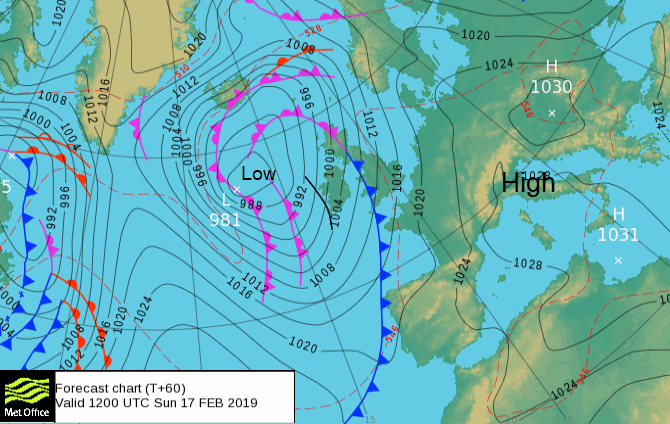
This damp weather will make progress over more of Wales, western England and Scotland during Sunday, so a different day here by then. It will be blustery everywhere, another change for the SE after the recent settled spell.
Behind an occluding cold front, we will lose the mild flow to end the weekend and it will feel cooler on Sunday for most, SE England will notice the change by Monday. The winds will veer to the SW and west with high gusts for NW UK during Sunday night and possible still over northern Scotland on Monday morning.
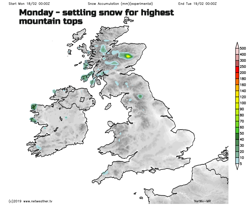
Monday looks cooler with snow for the tops of the mountains and wintry showers for Northern Ireland and Scotland, into the Cumbrian Fells, Pennines, Welsh Mountains and Moors of the SW later in the day. Not much but a blip from this mild theme until the southerlies take hold again on Wednesday.