UK Weather. A frosty and foggy start for Tuesday but breezy and milder conditions are moving in with bands of rain as Atlantic low pressures head our way.
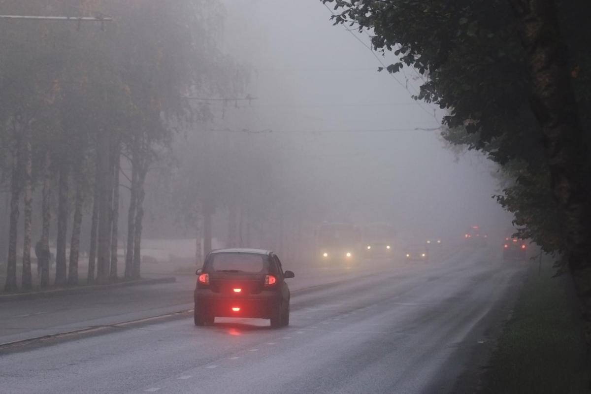
There are frosty, icy conditions this morning with patches of locally dense, even freezing fog in places. This will clear through the morning, as cloud and milder conditions, with drizzle then occasional rain, move in from the South West. Then apart from the odd slight frost, it'll remain mostly mild for at least a week, but with unsettled conditions especially in the North and West where it'll be windy at times.
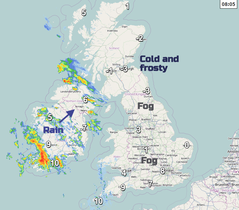
All but the South and Northern Ireland are waking to a frost, with temperatures as low as -3 or -4C first thing in some rural valleys and glens. -5C was the overnight minimum for Co. Down Shropshire and North Yorkshire. There'll be some sunshine this morning, mostly over central and eastern parts of Scotland and the East of England. That'll persist into the early afternoon towards the East coast and across North East Scotland. The South West, South and Northern Ireland are cloudy and milder, with patchy rain and drizzle already over the province and the far South West moving steadily North and East across the country through the day. Later, the rain will become heavier and more persistent across Northern Ireland, the West and South of Wales and In the West, where it'll turn misty with some patches of hill and coastal fog.
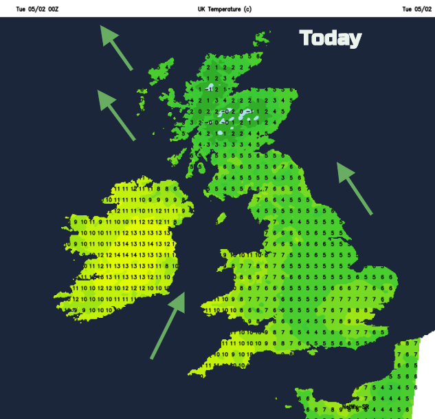
Winds, mostly light at first, will freshen from the South becoming strong in the West, where gales are likely later especially over exposed coasts and hills. After the frosty start, it'll remain chilly over North East England and East Scotland, where temperatures will struggle to reach 6 or 7C. Elsewhere, it'll turn milder, with temperatures eventually reaching 8 to 10C and probably 11 or 12C in the far South West.
Most parts will see some rain in a cloudy, misty evening, that'll be followed overnight by clearer weather from the West. This should have reached all but the South East by morning. With it will come a few showers mostly over Northern Ireland, the North and West of Scotland. A moderate or fresh southerly wind will be strong in exposed areas before 'veering' West or South Westerly and decreasing somewhat with the arrival of the clearer weather. While a touch of ground frost may occur in a few well sheltered eastern rural valleys and glens where skies clear, it'll be a milder night than of late, with minimum temperatures mostly between 2 and 7C.
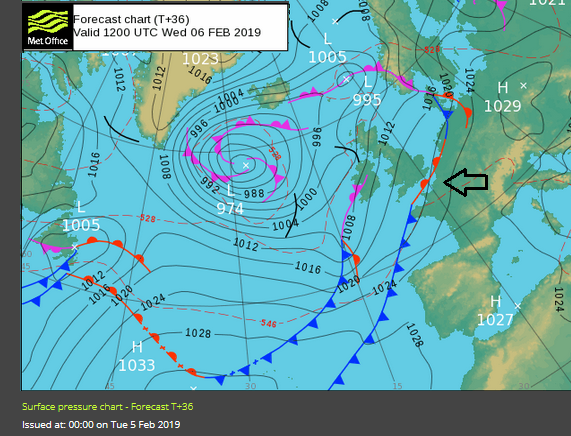
A meandering front on Wednesday will cause a few forecasting headaches over the Channel Islands, East Anglia, the South East. Here where after a bright morning away from Kent it'll cloud over from the South, with probably some rain moving in during or later in the afternoon. Elsewhere, there'll be a mixture of sunny spells and showers these mostly in the West, that'll become heavier and more widespread over Northern Ireland later. Over East Scotland and to the East of the Pennines, you'll see the best of the sunshine and fewer showers, leading to a reasonable day here in most parts.
A mostly light or moderate South Westerly wind will be fresh or strong and quite blustery at times over Northern Ireland and the North and West of Scotland. This'll make it feel rather cold but despite this, temperatures will be well up to normal for early February reaching 6 to 8C in the North and 8 to 10C further South.
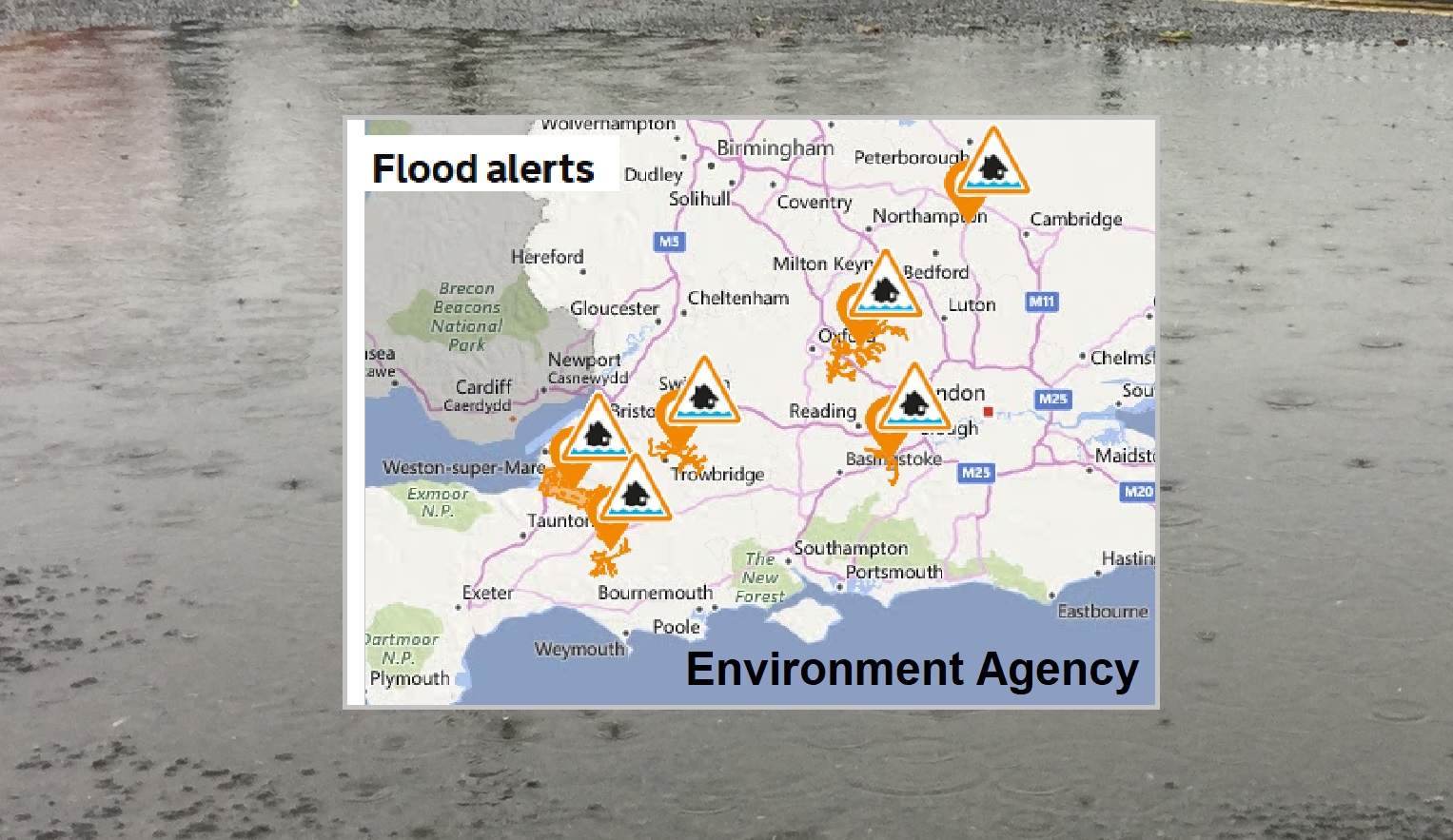
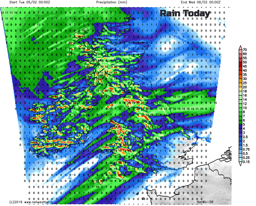
Flood alerts from Environment Agency (England) "as a result of a period of sustained rainfall and snow melt"
The South East, East Anglia and perhaps parts of Lincolnshire and the East Midlands may some rain into the evening, but this'll move away. Most central and eastern areas then see clear intervals, before a band of showers some heavy giving snow on northern hills already over Northern Ireland, moves into most western areas overnight. A light or moderate locally fresh South West wind will be blustery in the vicinity of showers making it feel quite cold, but should prevent temperatures from falling below 3 to 6C.