Snow disruption diminishing this weekend, with most places dry and sunny today, coastal areas seeing wintry showers. After a bright start, rain and hill snow spreading east Sunday.
Friday saw some disruptive snow again, this time over a wider area, starting off to the west of London before affecting parts of the West Country through much of the day, particularly over Wiltshire, parts of Somerset, Gloucestershire and Oxfordshire – including the Cotswolds, where over 20cm fell in places. This persistent and sometimes heavy snow than transferred southeast across Hampshire in the evening, dumping 19cm at RAF Odiham and bringing significant travel disruption for commuters during the rush hour, with major delays to traffic on the M3, A3 and A31 out from the M25 southwest of London towards the Hampshire coast. It was particularly bad around Basingstoke because the M3 was shut for a time, causing gridlock around the area. There were also problems because of heavy snow on the A21 and M2 in Kent.
Snow continued to bring further accumulations overnight across SE England before eventually the troublesome rain, sleet and snow bands that had been plaguing southern England all day cleared away south after midnight. However, wet surfaces or lying snow here and also lying snow further north across parts of northern Scotland and NE England from frequent snow showers coming in from the northeast overnight, means there is a risk of ice on any untreated surfaces. Across the west and much of central and southern Scotland, it’s been a drier and clearer picture overnight and here we’ve seen lower temperatures, lowest across the highlands of Scotland.
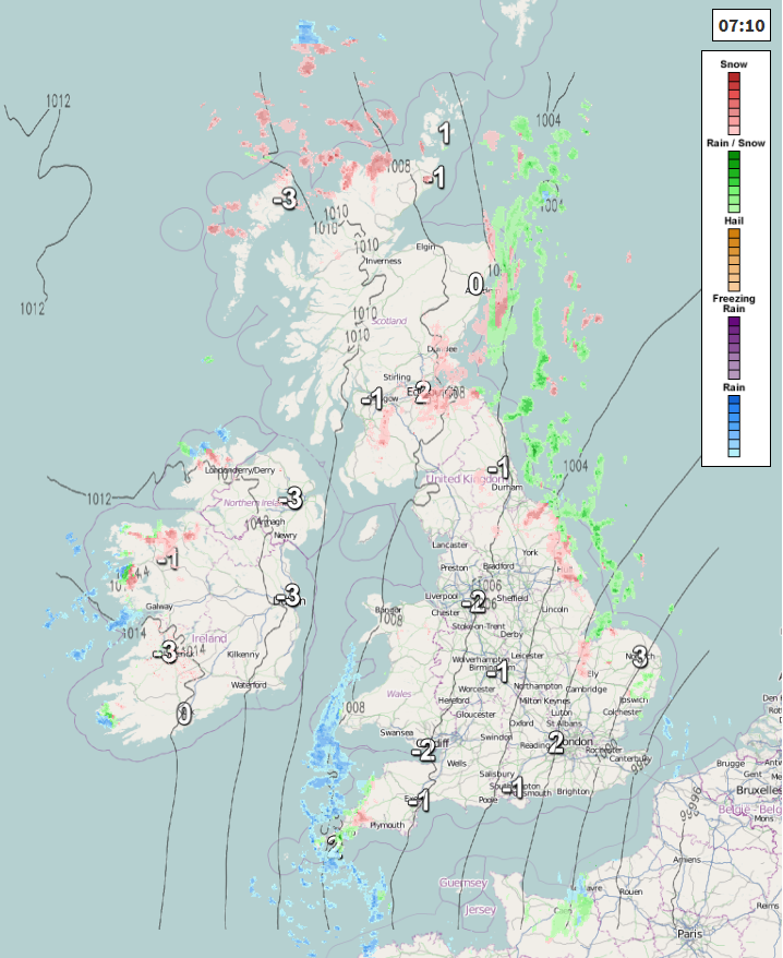
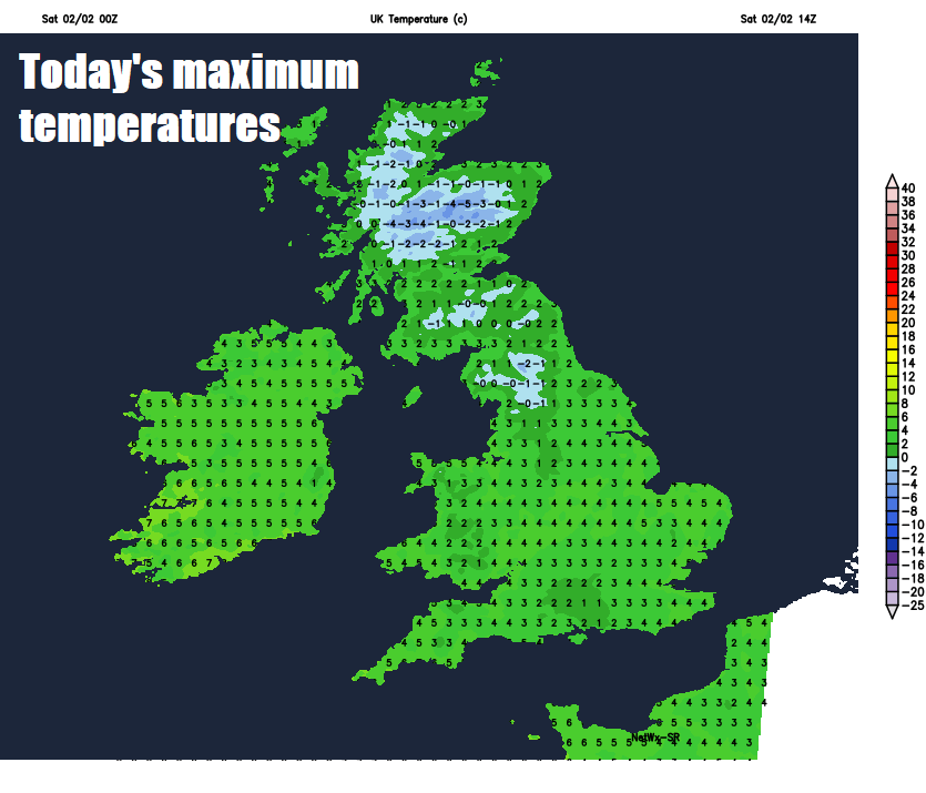
So, a cold start to the weekend, but a much better picture across the south for Saturday and indeed for many areas, with decent spells of wintry sunshine. However, there will be further wintry showers in the east, falling as snow over higher ground, though these becoming increasingly confined to eastern coasts through the afternoon. There will also be some showers, mainly of rain, running down the Irish Sea across Pembrokeshire and Cornwall. Plenty of snow showers piling in across northern Scotland too. Another cold day, temperatures reaching 3-5C, though across the far west reaching 6-7C.
A ridge of high pressure builds in from the west tonight, so clear skies and light winds across many areas, leading to a widespread frost away from the east coast – where we may see a few wintry showers still. A risk of ice across northern and eastern areas where we’ve seen wintry showers through the day.
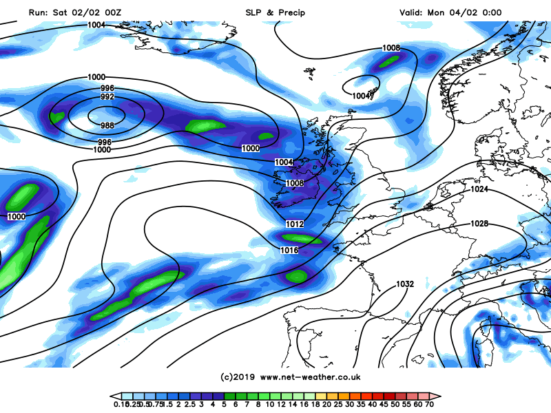
Turning a little less cold than recently on Sunday after a widespread cold and frosty start. A frontal system moving off the Atlantic will bring a band of rain and hill snow initially to the island of Ireland in the morning before moving across Scotland, northern England, Midlands and Wales by lunchtime, with snow over the Scottish hills, Cumbrian Fells, Pennines and Welsh Mountains. It will brighten behind the band of rain and hill snow across Northern Ireland and ahead of it should stay dry across eastern areas of England until after dark. Temperatures reaching 4-6C generally, perhaps as high as 8C in the far southwest.
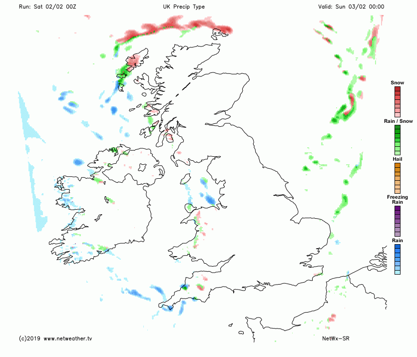
Wet and windy conditions sweeping in from the west Sunday night across northern and western areas, with hill snow across northern areas. An area of low pressure crossing the north on Monday, spreading wind and rain towards the east in the morning, followed by brighter conditions with showers from the west. A ridge of high pressure building in Monday night into Tuesday morning could allow a frost and patchy fog to develop overnight, then after a fine and bright start on Tuesday, further cloud and rain will spread in from the west, while becoming windy.
Staying generally unsettled next week, with further Atlantic systems moving in from the west at times, bringing spells of rain, with hill snow in the north and windy at times too. Turning milder too, especially in the south - where temperatures will likely reach double figures by mid-week. There will still be a risk of overnight frosts though where skies clear.