A cold and frosty start this morning but as frontal rain hits the cold air later today, there will be snow. Again uncertainty about amounts but several cms for hills, and inland Wales.
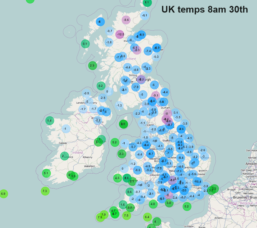
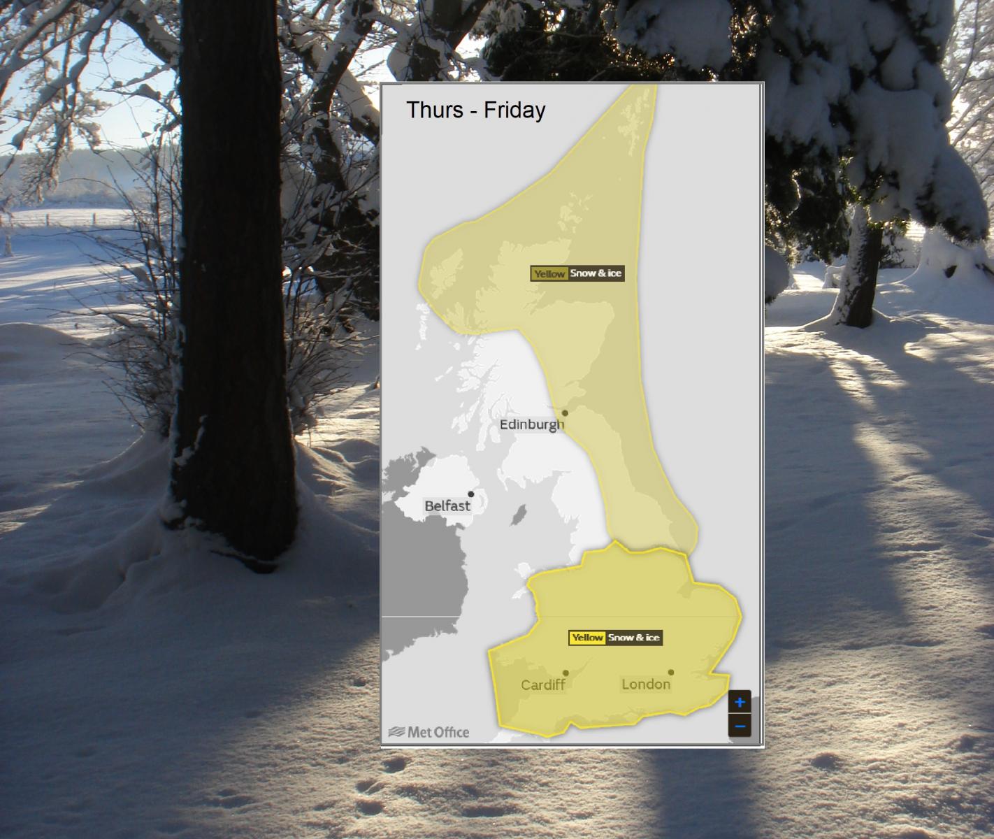
Once again there are warnings for snow. Yellow warnings from the UK Met Office for over southern Britain as a weather system comes in from the SW today. Also, a warning for snow showers over Northern Scotland and NE Britain. Temperatures overnight fell to -14.4C in Aberdeenshire and it was cold and frosty for many with ice and fog.
The ice risk continues into Friday, enhanced in the south as this band of rain, sleet and snow works its way over Wales and southern England, just into the Midlands. Ireland continues with the blanket yellow warning for Snow and Ice until Saturday.
Through today the SE winds will freshen becoming strong around coasts of SW Britain. Temperatures across the UK will reach only 1 to 5C, it stays chilly even if you are in the sunshine. The frontal band, an occluded front, can be seen on the Netweather Radar across Ireland and just into Cornwall. There will be heavy rain for a time in SW England but already there is snow for Ireland, edging into Co Fermanagh. The frontal band should falter along the Irish border, so Northern Ireland escaping the worst of the wet and wintry weather today.
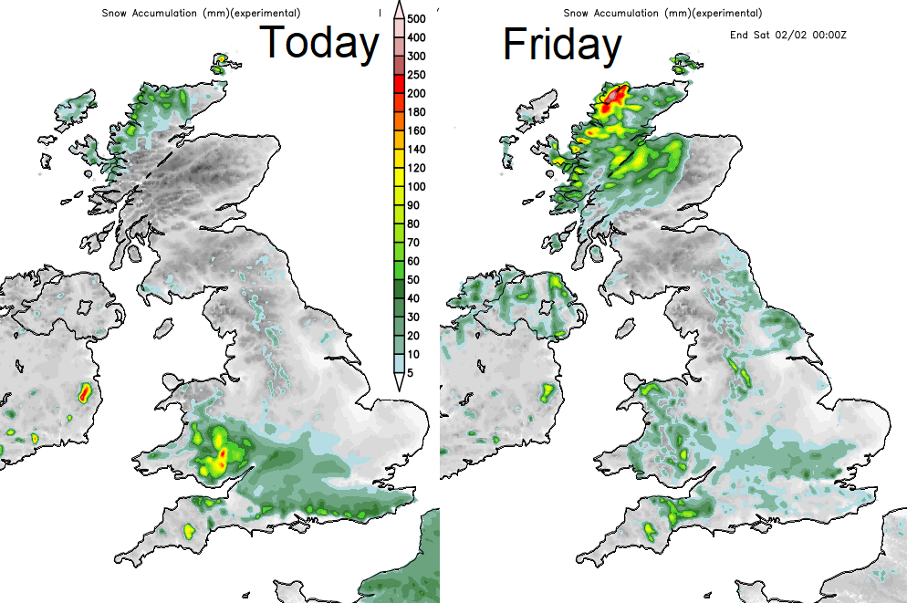
"Areas of rain and snow are expected to move into the UK from the southwest from Thursday and through Friday. Any single period of rain and snow is not expected to last more than 6 to 9 hours but some snow accumulations are likely with 1-3 cm likely in places within the warning area and the potential for 5-10 cm, perhaps particularly over Wales and southwest England. Snow amounts will vary markedly across England and Wales with many places seeing very little accumulating snow".Met Office warning
The band edges over Wales and sort of slides over southern England. The main snow risk looks to be late afternoon into the evening for SW Britain, into central southern England. By tonight, it should be over London. Outbreaks will be patchy and variable. The definite band fades but a cloudy mix will be left over southern Britain with outbreaks of rain, sleet and patchy snow. By Friday there will be a brisk NE wind which will draw in snow showers from the North Sea before lines of showers appear over NW Scotland and western Wales
The Weekend
Later on Friday more rain, sleet and snow pushes into the far NW with a good amount of snow for the Scottish mountains. All good news in the run up to half term. Colder air takes hold once more for Saturday with wintry showers from the north to NW in a chilly wind.
By Sunday the winds will be from the SW with less cold air, but a frontal band could bring rain and snow into NW UK, fine further south.
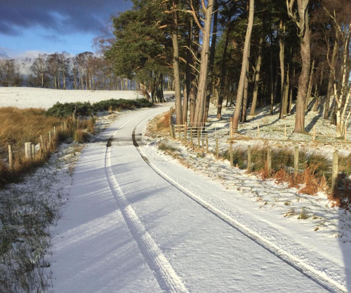
Many places have seen a fine, bright but chilly start this morning. Some of you may have caught sight of two planets and the crescent moon in the SE sky around dawn. Venus and Jupiter either side.