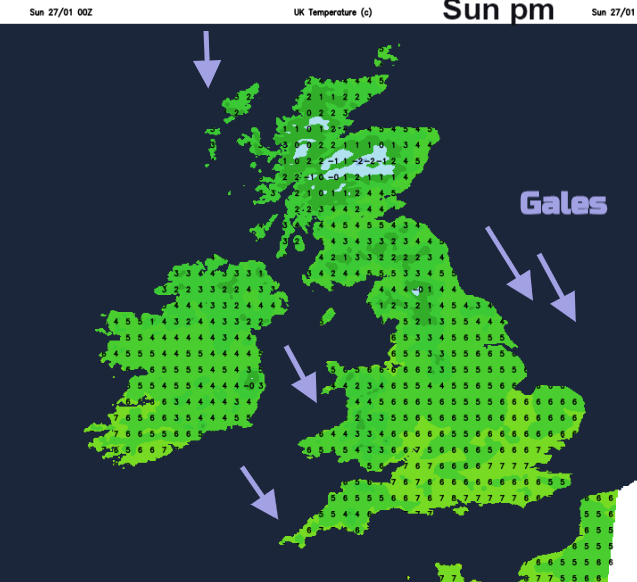
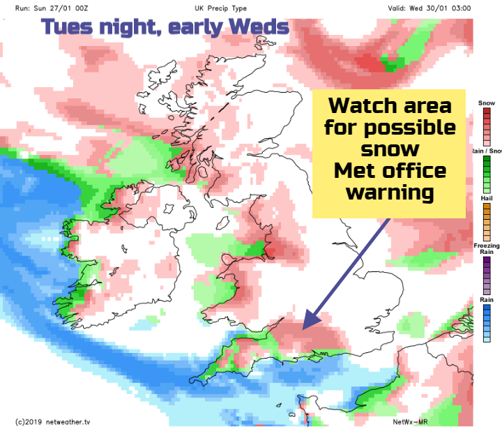
The strong north to northwest wind will make it feel raw today. Wintry showers pepper Scotland, Wales, SW England and Northern Ireland as the worst of the weather transfers to eastern Britain through Sunday.
After the brief milder interval, we are plunged into a cold northerly blast today as air from the Arctic returns, with warnings of icy conditions this morning mostly over Scotland and in the North and West. Fortunately, the Arctic air has been modified by the seas and ocean to the North of Scotland, so although still feeling very raw, it's not as cold as it would have been, had the air come off the nearby continent. Nevertheless, it'll still be cold enough for snow over Scotland, parts of Northern Ireland and northern England mostly on hills, but not exclusively so with blizzards likely over the Scottish mountains in strong to gale force winds.

Rain soon clears from East Anglia and the South East, leaving all parts in cold, very windy conditions. There are already blustery wintry showers over Scotland, Northern Ireland, Wales and the South West, falling as snow mostly on hills and in the North. These will affect other parts later in a day of sunny spells and showers, although not everywhere will see them with the best of the sunshine across sheltered central and southern areas. Some of the showers will be heavy, falling as hail, sleet or snow, but any snow at lower levels will be wet and shouldn't settle before the showers tend to fade towards dusk in western and central areas. In the East though and particularly towards the coast, you can expect longer spells of rain or sleet and hill snow spreading from the North through the afternoon.
A fresh or strong North or North Westerly wind will add to the chill making it feel very raw, with gusts to gale force quite widely. Along exposed coasts of Wales and the South West at first and towards the East coast gusts of up to 70mph are likely for a time, before winds begin to moderate a little towards dusk. Temperatures of 3 to 5C in the North and 6 to 8C in the South won't change much through the day, but it'll feel more like 0 to 2C out in the very blustery conditions.
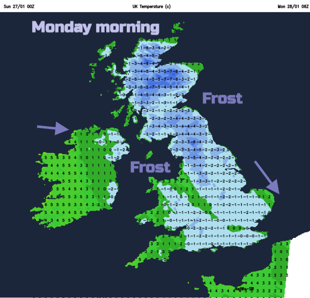
Districts towards the East coast see further outbreaks of rain, sleet and hill snow into the evening, but this'll move away overnight, as winds continue to decrease and turn into the North West or West. Elsewhere, wintry showers become largely confined to exposed coasts and hills, with some coming through 'The Cheshire Gap' into parts of the West Midlands. As skies begin to clear, this'll allow a fairly widespread frost to develop, with temperatures falling as low as -3 or -4C in sheltered rural areas of Dumfries, across parts of North West England and around the Welsh marshes. Towards the East coast and across Norfolk however, temperatures will probably remain just above freezing.
Monday should see the new working week beginning somewhat quieter, although still with a noticeable quite raw North West or Westerly breeze. After a widespread frost, there'll be some sunshine particularly at first, with many eastern areas having a dry, bright day apart from isolated wintry showers mostly towards the coast at first. Cloud amounts will tend to increase though especially in the West and over Northern Ireland, where there'll be some wintry showers from the word go that'll spread to other western areas through the day. These should fall mostly as rain, sleet or hail at lower levels, but as snow on hills in a raw day. As a result, temperatures generally will get no higher than 2 to 5C in the North and 6 or 7C further South.
In a mixed evening and night, there'll be variable amounts of cloud, that'll break at times to give clear intervals particularly in the East. There'll be a further scattering of showers wintry in places these mostly in the West, with the South West perhaps turning more generally cloudy later in the night bringing the threat of rain and some hill snow towards morning. Where skies clear there'll be another slight frost in a mostly light Westerly breeze, with lowest temperatures mostly in the range -2 to +2C.