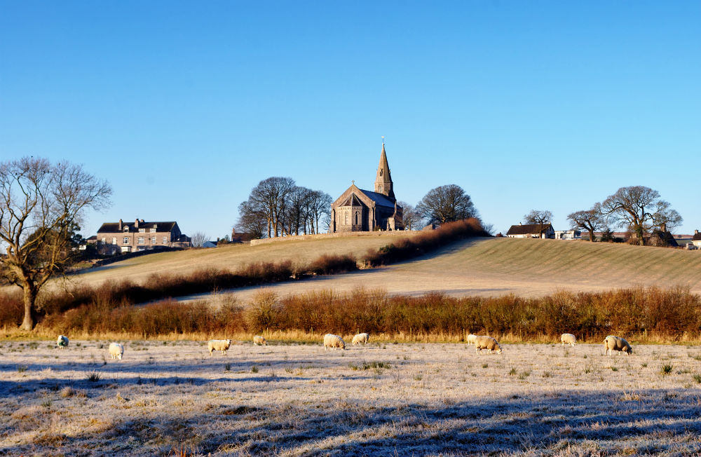
UK Weather - a frosty start this morning for many with a few sleet and hill snow showers in the east. More cloud for the rest of this week as it turns milder briefly.
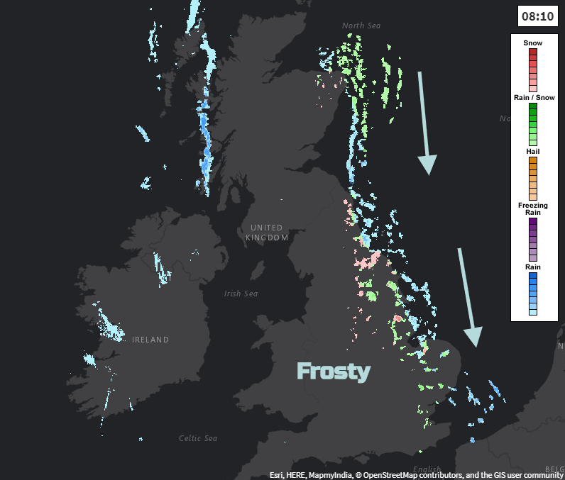
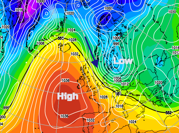
We are slipping towards high pressure again which is bringing lighter winds, clear skies and there is a chill this morning accompanied by frost. However, for eastern England, there is still a fresh north wind making it feel even colder. That’s linked to the low pressure which moved near to Scotland on Monday. This northerly flow is bringing a scattering of showers from Northumberland down to Essex and also clipping Aberdeenshire and Angus. These are of rain, sleet and hill snow. To the far NW of the UK is a band of rain from a warm front which will bring a change to a westerly flow as the working week continues.
It’s not as windy as earlier in the week but for East Anglia and southeast England, there is this brisk north wind which will only ease off this evening. The winds are very light for NW UK but gradually turning to a westerly as milder air arrives behind the warm front. This is bringing more cloud from the west, over Northern Ireland and the west coast of Scotland and some rain. Northern Ireland will become grey and damp especially in the west with hardly any breeze and temperatures of 7C. Wales will be bright or sunny with light north winds and temperatures around 6C. Scotland start off fine and bright but high cloud will increase with dampness from the west later today. The wintry showers in the northeast will move offshore as the winds back.
Much of England has a bright, sunny but frosty start for Wednesday. The showers will continue to feed into eastern England today, tilting away from NE England but driven downwards on the chilly wind. You might see a flurry today, a white covering over the North York Moors and by tonight there will just be a few showers for Lincolnshire, East Anglia and Kent so perhaps a dusting for the Downs by early Thursday.
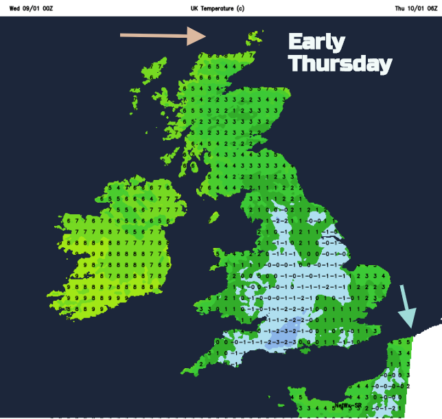
By Thursday there will still be cold air over SE Britain and mild conditions elsewhere as the high reaches over the UK and winds fall light everywhere. There will be more cloud about and some murky conditions, but a clearance will appear for eastern Scotland and later northern England in a light NW wind. Temperatures will be around 7 or 8C on a quiet day.
By Friday there will be a NW breeze with more cloud on a mostly dry day. There will be some dampness in the NW around coasts and over the hills but it’s still fairly settled and mild with temperatures of 7 to 10C. Another warm front will bring rain to NW Britain on Friday night and Northern Ireland. This will reach northern England and Wales by Saturday morning.
The Weekend will be windy. The air is still mild with temperatures staying around 8 to 10C but the brisk NW to west winds will make it feel cooler. There will still be a lot of dry and cloudy weather through the weekend, but eastern and southern areas will fair best as patchy rain will come and go for NW exposed coastal counties. Another frontal band will pass over northern Scotland on Saturday night. There will be heavy showers from the north on Sunday with snow for the highest peaks of northern Britain. Westerly severe gales are showing on the forecast wind maps for Sunday in the far north of Scotland, so something to keep an eye on.
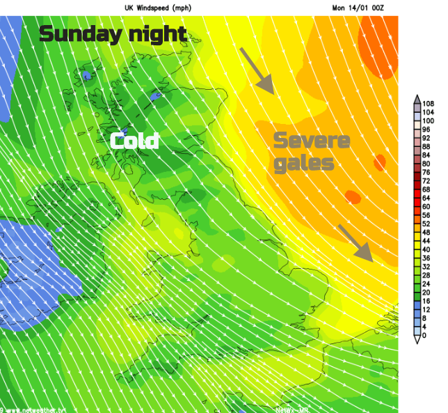
These stronger winds across the UK link to a low pressure skirting to the north on Saturday night which will start to pull down colder air for Sunday. There will be storm out in the North Sea on Sunday night and it will be noticeably colder for the UK by Monday morning.