UK Weather - Quite a chill for midweek with frost. There will be a few rain, sleet and snow showers in the northerly flow but overall quiet and settled.
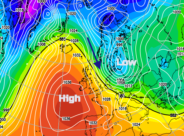
After a bit of a shakeup on Monday, our UK weather will be settling down once more as high pressure builds back in this week. The frosts will return tonight and for Wednesday night. The winds are already easing down. Northern Scotland saw gusts of 74mph yesterday as a low pressure moved by. This low is heading towards Poland but drawing down colder air over Britain today, more noticeable for the east coast, and also creating a push on the waters of the North Sea.
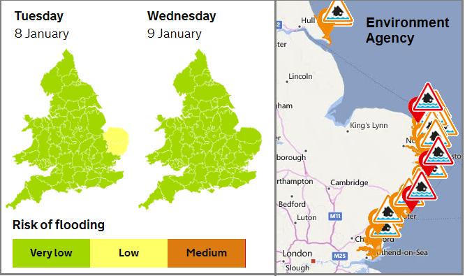
This happens occasionally and can cause devastating floods for eastern England if the conditions are right, it’s one of the reasons that the Thames Barrier was built. No major worries today but the Environment Agency do have Flood warnings in place for coastal flooding in Norfolk and Suffolk.
“Strong winds and spring tides may cause large waves and spray overtopping on the coast”
Temperatures today will reach 6 to 9C across the UK, yesterday Boulmer in NE England saw 13.1C so quite a change on the way. The strong winds for eastern Britain will make it feel cold with coastal gales.

Overall it is a dry picture with varying amounts of cloud, so fine and bright for some, more greyness and gloom for others. There are a few showers in the NW flow, some clipping north and northeast Scotland, a few more along the North Sea which will drift onto eastern England as the winds veer more to the north.
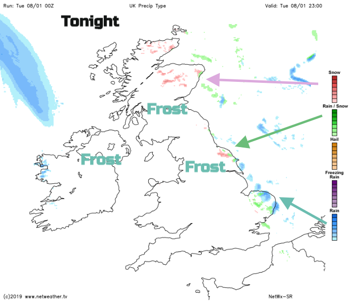
Inland the winds will have eased although it will still be blustery for eastern England. There will be a widespread frost. There will be a few more showers coming down in the northerly flow, a mix of rain, sleet and hill snow.
So by Wednesday morning, there will be the white of the frost and for a few spots a light covering of snow from the showers off the North Sea.
Midweek
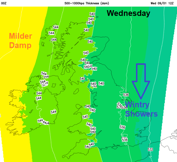
A cold start but it will turn milder from the west. The wintry showers will continue for a time for eastern England but still very scattered. The brisk cold north wind will also keep going, not as strong as today but still chilly. There will be plenty of sunny weather for Britain but high cloud over Ireland. A warm front will be toppling in from the Atlantic. This will bring milder air eventually but there will be light rain for Co. Fermanagh and Co. Tyrone and then more showery rain into NW Scotland to end the day. With the clear skies and light winds over Britain, there will be an early frost and still a few lingering showers for SE Britain giving the odd flurry.
The warm front will bring cloud and damp weather to Northern Ireland and western Scotland on Wednesday night, this will move over northern England and north Wales for Thursday. It will be a chilly start for England and Wales with light winds and sunshine ahead of the frontal band.
By Friday the high will have settled over the UK but with a fair amount of cloud and some dampness in the NW flow. The NW to westerly flow remains at the weekend, it looks rather windy.