Some heavy rain for parts of England, Wales and Ireland today which may make for some tricky travel conditions. Settling down by tomorrow though, and staying that way for most through Christmas week.
It's Christmas Eve, Eve! The weather isn't going to be delivering anything seasonal though, in fact, if you're on the road today, there's some heavy rain affecting parts of England and Wales, which may cause a few delays.
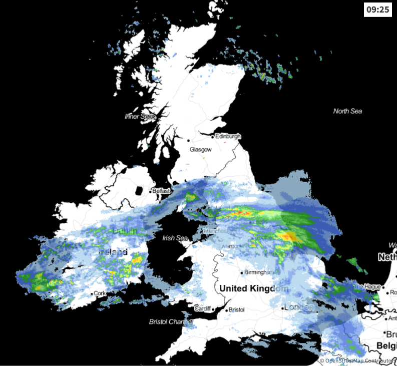 Keep track of the latest rain radar here.
The first batch of wet weather will clear east through the day, but once that has started to move away, the next spell of rain will be moving into southwest England and across other southern regions beyond that.
Much of Scotland will avoid the rain though, here it'll be calmer, colder and clearer with some sunny spells breaking through once any fog clears. Through the day, as this morning's rain clears, that colder air sinks further south to all parts but the south of England. So, while the south gets wet this evening and into the first part of the night, north of that will be some clear spells allowing patches of frost and fog to develop.
The rain in the south will start to tilt through the night, so by Christmas Eve morning, it's mostly the southwest seeing any further showery outbreaks. Elsewhere, as pressure builds, it'll be a calm, cool, quiet day with some of that early fog taking some time to clear. The rain and cloud will mark the dividing line between the milder and colder air, and that feature will continue into Christmas day.
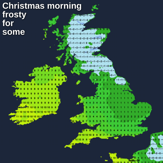
The tilting of the rain and cloud will continue too, so by the big day; it'll have moved right up across the whole western half of the country.
To the east of it, a seasonal start with some frost at least giving the impression of a white Christmas.
As the day wears on, the cloud and drizzly patches of rain will tend to spread further east with some more general rain turning up into the far northwest later on. That leads us into a mostly cloudy, mild Boxing Day, with a few bits and pieces of rain here and there - especially in the north and west. The best chance of some sunshine will be in eastern parts.
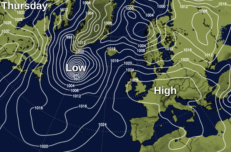
The rest of the week follows along similar lines, with high pressure in charge, centred close to or just away from the southeast of the country.
Where skies clear at night there'll be some frost patches, with temperatures by day not too far from average. Cloud will be drifting around under the high, sometimes thick enough to bring some drizzle but there'll also be some sunny spells at times. By the end of the week and into the weekend, a front may make a move down from the northwest into Scotland bringing some wet weather, but this is uncertain for now.