Overall the weather seems to be okay in the run up to Christmas just not at all Christmassy. Nothing severe although there could be fog next week as the weather quietens down even more.
The least amount of daylight today, the Winter Solstice. Only four more sleeps til Christmas. But it just doesn’t; quite feel right. It will be mild again in the south, staying colder in the north. School are breaking up, many people finishing work. Get home safely tonight people after any festive drinks. The weekends available for shopping just keep on going, are you finished yet. I just did my last bit of wrapping last night so I’m feeling smug.
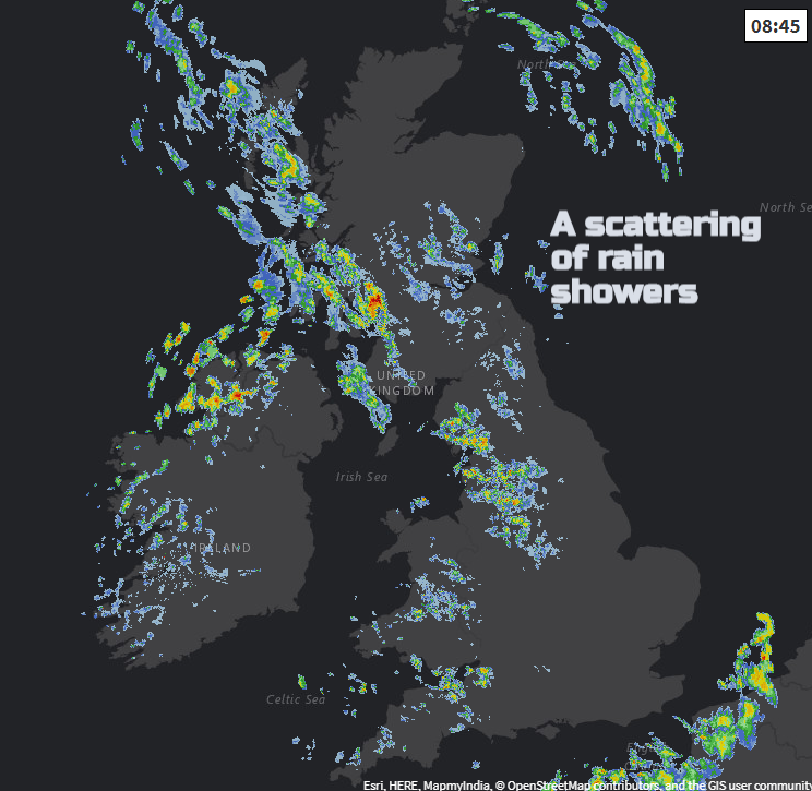
For anyone travelling over the next few days there aren’t any major issues forecast with our UK weather. As the weather quietens down early next week there could be mist and fog, so just be aware of that if you are travelling by road or air.
Today
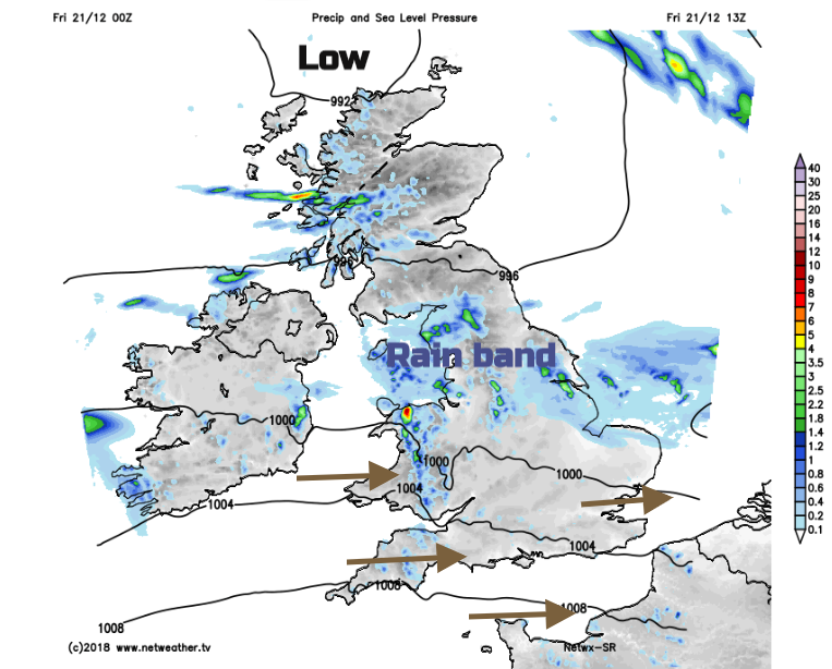
There is a frontal band across the UK with mild air to the south, temperatures of 11 to 14C today and to the north colder air. Temperatures dipped down to -3C in the Highlands overnight with frost in places. Daytime temperatures will be around 7 or 8C so not bad for late December.
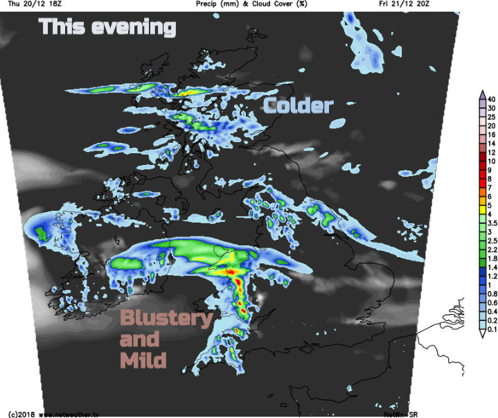
The band of rain becomes more patchy and the rain less heavy by the afternoon. Still, across a central swathe of Britain, it will stay cloudy here. To the south, the cloud will break up and sunny spells appear, adding to the fine day. Further north, clusters of showers will work in from the west so more unsettled here.
Low pressure sits to the north of Scotland with weather fronts wavering along on a more southerly track than usual. Another little low will bring rain this evening from the SW with blustery winds and more mild air. At the other end of the UK Grampian turns chilly under clear skies even a little ice about.
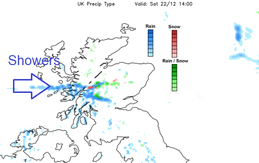
The overnight rain moves through Wales, the Midlands and Yorkshire then off into the North Sea. Showery rain continues to affect NW England, Northern Ireland and western Scotland
Saturday brings a lot of fair weather but still showers for western areas especially western Scotland. Many people will have a bright day with a moderate to fresh west wind and again it will be mild for southern Britain. That Christmas feeling is still going to need some work with temperatures of 11 or 12C and no snow. Well, maybe a little on the top of Nevis Range and Cairngorm if you are mountain climbing or skiing.
Through the afternoon the wet weather could sink southwards to Strathclyde with more cloud still over western Scotland and NW England but elsewhere the fair weather continues.
During Saturday night a different lo pressure develops out in the Atlantic and begins to throw rain over Ireland. However, pressure will be rising over western Europe and looks to keep this low centre at bay. The fronts will sway over the UK, but our weather will be settling down with lighter winds. Some uncertainty about the rain on Sunday but it could turn wet but mild over England, Wales and Northern Ireland with colder clearer conditions to the north.
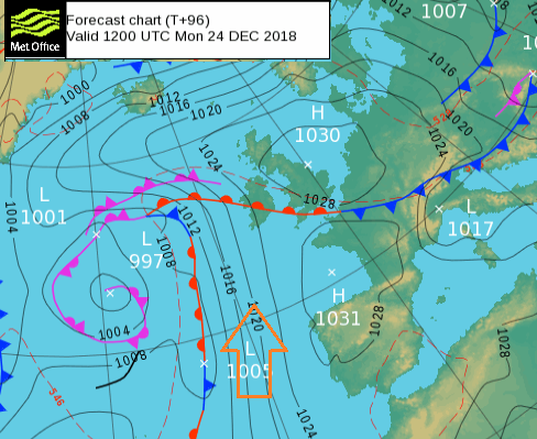
That rain could still be around on Monday for southern Britain, taking its time to clear SE England. Cold and frosty for Scotland on Christmas Eve, to start and end the day.
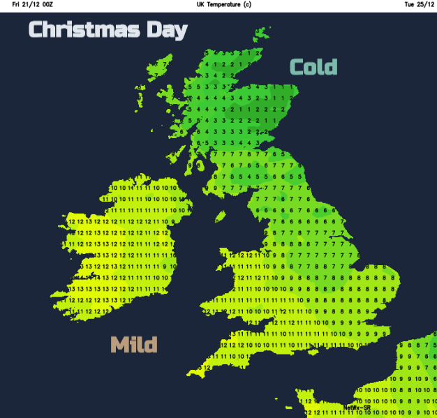
Christmas Day looks mild for many, still cold in the far north. Overall quiet, settled and dry. More cloud from the west later. No signs of a Christmas card like white snowy scene.
Maybe something colder and snowy by the end of December or start of 2019. The stratosphere has some very cold air above us at the moment. Further discussions here. Also, special Nacreous Clouds can form when this very cold air is present. Worth keeping an eye out at sunrise, when that finally comes. More daylight tomorrow, hoorah.