No severe weather in the forecast for the next few days, good news if you have travel plans, or just Christmas shopping still to do. May have to watch for fog as things quieten down early next week.
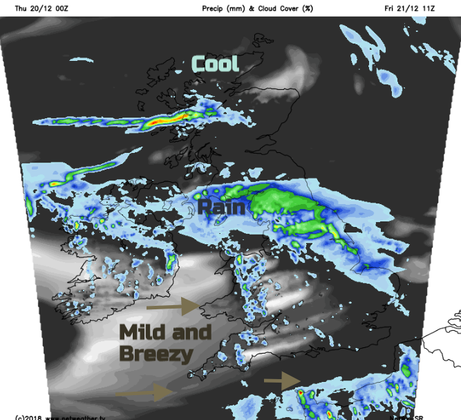
Low pressure continues to rule our UK weather with showers feeding in from the south and the west. It’s not that cold considering we are nearing the winter solstice. Frontal bands float across the southern half of the UK during the next few days but by Christmas Eve, high pressure is building. That could result in a dry, settled even fine Christmas Day. For those travelling in the next week, this will all be good news. As seen at Gatwick this morning, it may not be the weather that disrupts transportation.
Today
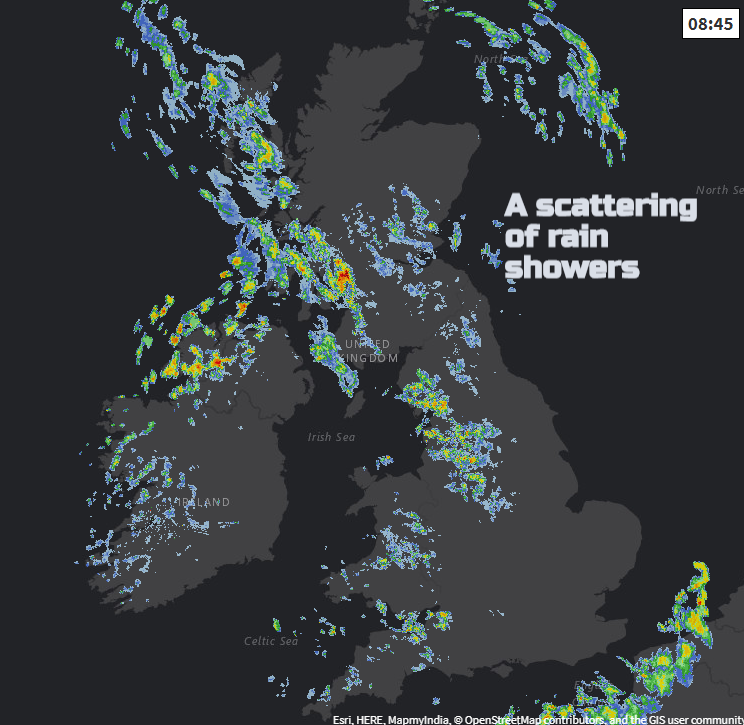
We have a mixture of showers and bright spells, blustery winds for England, Wales and Northern Ireland. A line of heavier showers pushes in this morning clipping Northern Ireland heading for western Scotland and Cumbria. Other pockets of showers appear driven eastwards but always with the wetter weather in the west and drier even brighter conditions to the east.
Keep an eye on the radar for the progress of the rain today. The showers ease off for southern Britain for a time this evening before the next low pressure edges into the SW. This area of rain has changed quite a lot in the forecast this week, gradually becoming a flatter wave with the rain not reaching so far north.
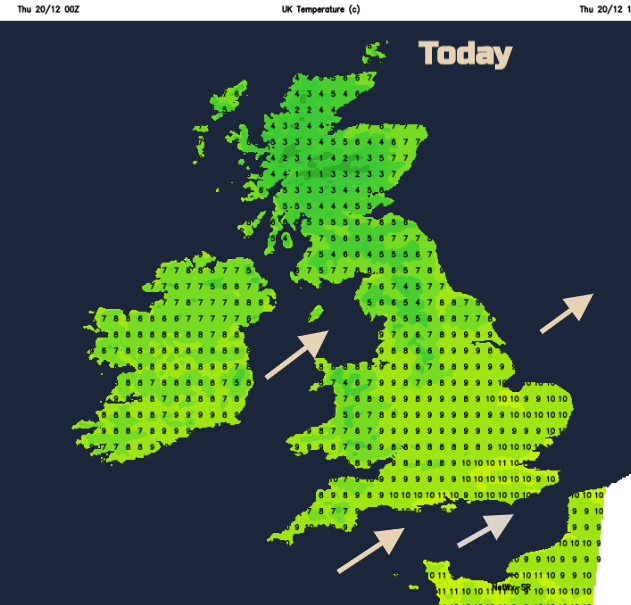
It turns cool overnight with just northern Scotland seeing a frost under clearer skies. The occlusion brings rain and milder air over much of England and Wales, into Northern Ireland but maybe not NE England by Friday rush hour. As the rain band settles over Northern Ireland and more of northern England, even the far south of Scotland during Friday, there will be brighter skies to the south and temperatures into double figures. However, a brisk west wind will temper this, with strong winds through the English Channel. To the north of the rain band it will be cool and calm with bright spells in the northeast, still showery for Shetland.
For the weekend, Saturday looks more settled if you are preparing to head to the shops. There will still be showers bought in on the westerly breeze. Mild in the south, chilly in the far north. Rain heads in from the SW on Sunday, again with milder air. It stays colder in the north with lighter winds across the UK. No major concerns about severe weather at the moment, as school end and people start to travel for the holidays. Fog may be an issue early next week.
Christmas Day
Looks quiet. High pressure, a fair amount of cloud. You may have to check the small print if you have a bet on a White Christmas. This kind of set up and stratiform low cloud could give snow grains- frozen drizzle. That looks about it, at the moment, for the white stuff.
What kind of Frozen precipitation counts for a White Christmas?