The east-west battle continues, the eventual winner will be the wet and windy weather from the west though, as it breaks through by the weekend.
The start of this week has seen a lull in proceedings after a busy, often wet and windy start to December. Despite the quiet weather on the ground though, quite the battle is ongoing in the atmosphere at the moment, with high pressure, which is trying to build into Scandinavia doing what it can to repel Atlantic weather systems trying to push in from in from the west.
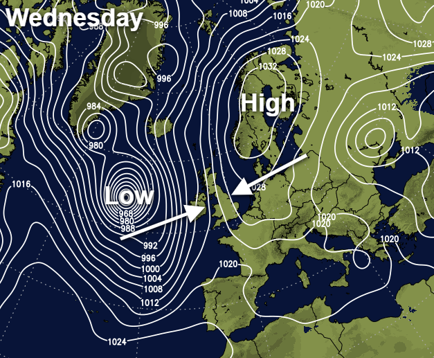
By Wednesday, the high will be in situ, and the fight will be on. Initially, the blocking high will win out - but some rain will make it into Ireland and the far west of Britain. By the weekend though, the Atlantic looks set to break through and take us back into a spell of very unsettled weather.
For today, we're set mostly fair. There's a lot of cloud in central and western parts, but further east there will be some sunny spells breaking through. Rain will be edging into the west of Ireland as the day wears on though, some of it on the heavy side, as the first, ultimately unsuccessful attempt from the Atlantic moves in. Temperatures will be quite chilly in eastern regions, with highs of 6-8c, milder further west though at 9-11c. There'll be a fresh, southeast wind everywhere, becoming quite gusty as the day wears on.
Overnight, the west-east split continues with the band of rain continuing to edge further east. The cloud from that will keep temperatures up in western and central regions, but further east with clearer skies there will be some frost and fog about by dawn.
Wednesday will see the rain stall and slowly fizzle out across western parts. There'll still be some heavier bursts at times though, especially during the first half of the day. Further east, it's a case of as you were, with sunny periods developing once any early mist and fog clear away.
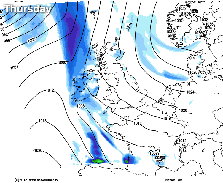
Thursday sees the east-west squeeze continue, with the easterly flow perhaps bringing a few showers in across the northern half of the country; these could be wintry at times, especially over the hills. To the west, there'll be another band of rain doing what it can to move in from the Atlantic, joining what's left of Wednesday's attempt over Ireland and perhaps bringing a few showers into western Britain.
A bigger thrust from the west arrives later Friday though, and this is the one which is currently expected to break down the eastern blockade. The colder air is unlikely to give up without a bit of a fight though, and some snow is possible, especially up over the higher ground of northern Britain as the rain bumps up against the colder air. It could also turn windy for a time in the north, with gales or severe gales possible.
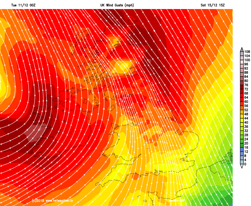
Then, into the weekend as low pressure takes charge, more wet, potentially very windy is likely but still with the risk of some wintriness over the high ground.