Fair and bright for many today and tomorrow before rain and more of a breeze edge in from the west. As that hits the cold air further east, there will be snow on northern hills. It is December after all.
Last week was really unsettled as wind and rain barrelled in from the Atlantic. This week high pressure tries to steady the UK weather but can’t hold on properly. So, there will be spells of dry weather with lighter winds but still a few rain bands managing to work their way in from the west. Later this week, a colder tuck of air will reach in from the North Sea.
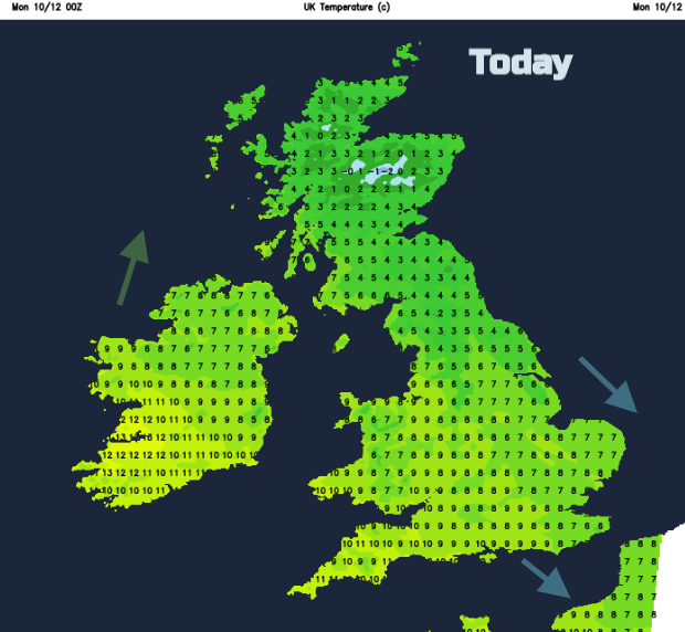
This morning the north-eastern half of Britain has a chilly start with frost with inland temperatures around zero. Northumberland and Perthshire have been down to -3C overnight. There is a central band around 4C as is Northern Ireland and then for SW Britain it is still mild enough at 7 or 8C
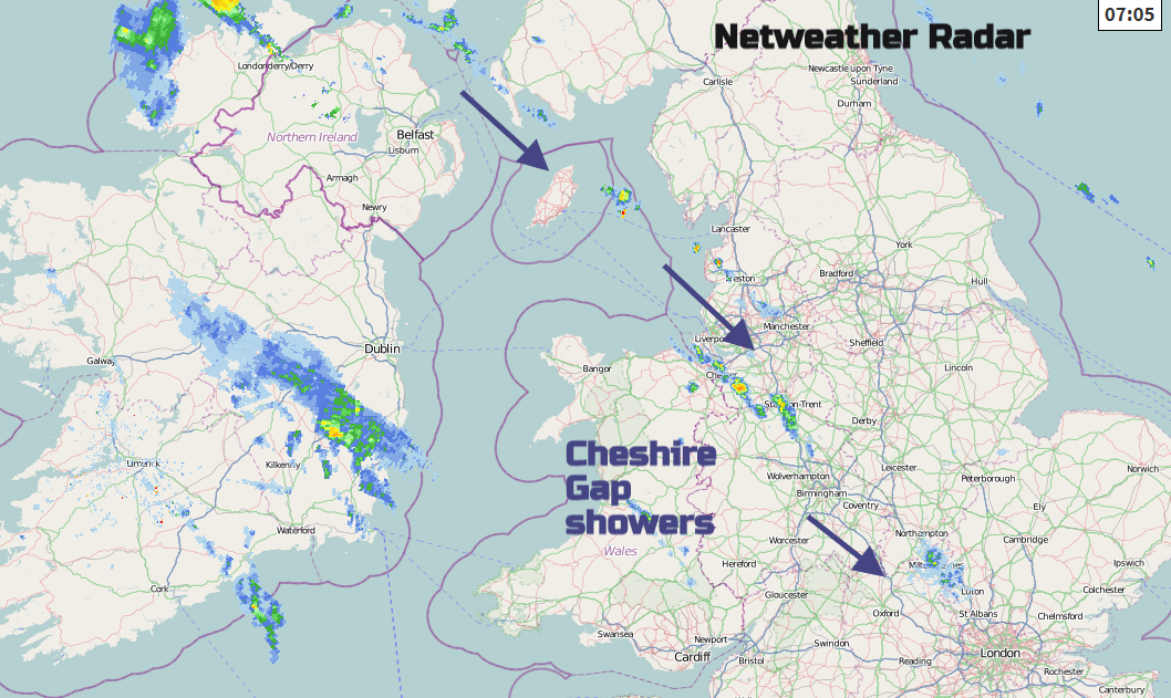
Today looks dry for most of the UK. There are just a few showers showing on the radar, lining up tthroughthe Cheshire Gap in the NW wind and reaching down to north London. Northern Ireland will also see a few showers today, but most places will be dry and fine with increasing cloud. For Britain, there is plenty of sunshine to start the working week with more cloud along the shower line.
So, a quiet fine start to the week with mostly light winds. A light to moderate NW wind for Kent, Essex, Norfolk and Suffolk. Temperatures will reach 7 to 10C for England, Wales and Northern Ireland, maybe 11C for the south coast of England and around 4C for much of Scotland.
Cloud moves in from the west for tonight with more of a breeze from the south around Ireland and western Wales, SW England so still mild here. Scotland will have a frost again extending into eastern England where the winds will be very light.
Tuesday
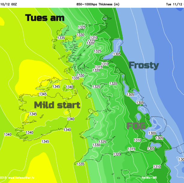
Eastern England and the Midlands will have fog for tomorrow morning with another dry day to come. It won’t be as sunny tomorrow and there will be low cloud and murk for western Britain and Northern Ireland from a weak warm front. By Tuesday evening rain from the cold front will be slowly edging in. Northern Ireland and SW Britain will be mild enough at 9 or 10C and breezy. The rest of the UK will be around 4 to 7C with light winds, except northern and west Scotland where it will be blustery too.
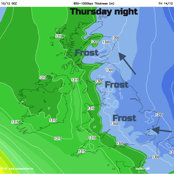
Later in the week looks colder, with blustery winds in the north and west. Rain for SW Britain and possibly strong wind and rain by next weekend.
Snow
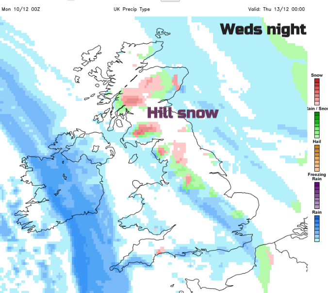
The tabloids were screaming about SNOW for this week. Depending on the progress of the Atlantic weather fronts coming in from the west up against the cold air, there will be snow on northern hills, Wednesday night onwards and possibly sleet and snow to lower levels on Thursday morning for Northern Britain only. There will be ice and frost with gales for NW Scotland and we’ll await the very end of the week to see if an Atlantic low does bring a miserable Saturday 15th, if that is your Christmas party or outing, or just heading to the shops.