


High pressure brings a dry start to the week, chilly in the east. Atlantic fronts making erratic eastward progress from mid-week, perhaps bringing snow, mainly hills, as fronts bump into cold air.
It’s been often wet and windy over the past week, thanks to a strong Atlantic jet stream aimed at the UK, bringing a succession of low pressure systems. However, we will see a change in the jet stream which see it buckle north across the UK as we start the new week, allowing a ridge of high pressure to build north bringing calmer and more settled conditions that will last until mid-week, when we will start to see Atlantic fronts push in from the west. However, there is increasing uncertainty how far east the fronts will get as high pressure builds close to the northeast over Scandinavia, which will try and introduce cold air across the east too.
For now, we still have some showers this morning moving down across England and Wales on a strong northwesterly wind, though northern England is turning drier and brighter. Across southern coasts and particularly southwest England the westerly wind is reaching gale force with 45-55 mph gusts. Scotland mostly dry and bright this morning, though a few showers affecting the north that will fall as snow over higher ground. With lighter winds here, it’s a cold start too, with temperatures not far off freezing to start, so a risk of some icy patches to watch out for.
Morning showers clearing the south to brighter conditions, but chilly in the northwesterly wind
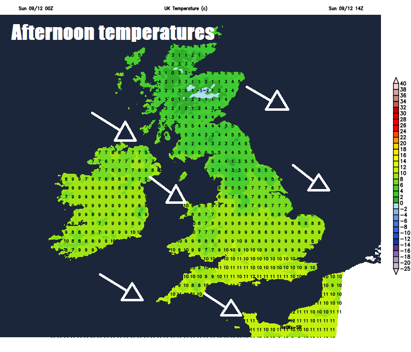
The north to northwesterly wind will bring down colder and drier air from the north, which will chase away south the morning showers to bring a drier and sunnier afternoon for many, though some isolated showers will affect northern and western coastal areas at times. A noticeably cooler day given the change in wind direction, particularly in the north, temperatures reaching 6-9C in the north, 9-11C in the south.
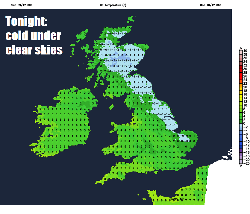
Generally clear skies and light winds tonight away from western coasts, where there’ll be isolated showers, will mean temperatures fall away in the cold polar airmass, temperatures dropping to low single figures in the south, perhaps locally close to freezing, but it’s across Scotland and northeast England where the lowest temperatures will be, falling one or two degrees below freezing in some spots. So a risk of icy patches forming where wet surfaces linger.
So, a cold but sunny start on Monday morning for the commute or school run, perhaps locally frosty and icy in the north and east. Generally, it will stay dry and sunny or bright throughout the day, sunshine turning hazy in the west, thicker cloud spreading in across Northern Ireland and western Scotland bringing some patchy drizzle through the afternoon. Temperatures reaching a chilly 4-7C in the east, a milder 8-12C in the west.
The rest of the week will see a battle between milder Atlantic air from the southwest trying to push east and colder and drier continental air trying to push west over the North Sea. Where the boundary between these two different airmasses ends up through the week remains a little uncertain.
Tuesday is likely to be rather cloudy and murky across many areas, though mainly dry in the east. Low cloud and patchy drizzle will affect western hills, before a band of more general rain spreads in from the west across the far west in the evening. Chilly across the east – where temperatures will reach 4-7C at best.
Possible frontal battleground snow later in the week? (Not to be taken literally, as probably will change)
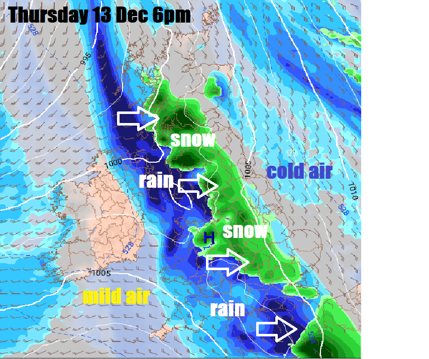
Wednesday likely cloudy again in the east, with a band of patchy rain reaching eastern areas in the morning before fizzling out. Brighter and drier conditions spreading in across the west. Some uncertainty on detail thereafter, but another Atlantic front with a band of rain tries to push east on Thursday, uncertain how far east, but may turn to snow, more particularly higher ground in the north, as it bumps into colder air across the east. Atlantic frontal systems eventually winning out by Saturday, spreading rain across all parts, perhaps preceded by a little snow before turning to rain, followed by milder air from the southwest.


