Deep low will bring gales or severe gales to the north, western showers once morning rain clears. Showery over the weekend, colder on Sunday as winds turn northerly.
A deepening area of low pressure crossing the far north today will bring severe gales to Scotland and the north of Northern Ireland today, leading to some disruption to travel. Saturday staying blustery, with showers spreading from the west. However, as we end the weekend, the weather looks to quieten down, as winds turn northerly on Sunday, bringing chilly air and some wintry showers. High pressure builds early next week, bringing mostly dry and chilly conditions with risk of overnight frost. However, from mid-week, it looks like unsettled conditions will return from the Atlantic.
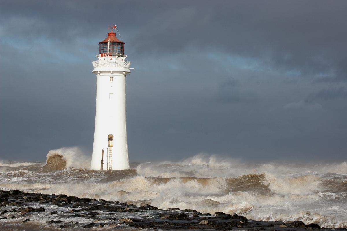
The morning commute may take longer than normal today, with strong winds in the north bringing disruption to road, rail and ferry journeys through the morning – while in the south heavy rain is bringing a lot of spray on the roads and some localised flooding too to watch out for.
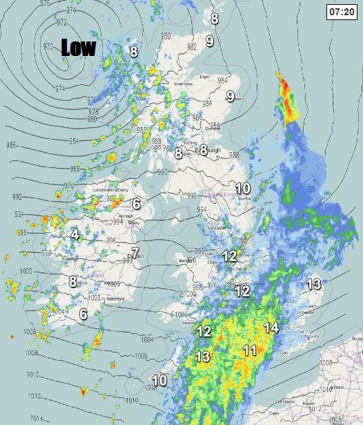
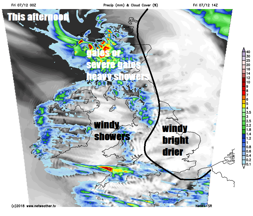
Starting across Scotland and Northern Ireland and the strong southwesterly wind will increase to gale or severe gale force though the morning, already gusting to 50-60mph across the northwest, locally up to 70mph with exposure. Gust of 55-65 mph developing more widely through the morning and probably peaking this afternoon, across more exposed western coasts and hills gusts of 65-80mph are likely. Blustery showers will pack in across western areas of Scotland and across Northern Ireland through the rest of the day, merging into longer spells in the northwest, eastern Scotland drier and sunnier.
Further south across England and Wales windy today too, with gales around coasts, but not as windy as further north, overnight rain will clear western areas to brighter conditions with showers this morning. A band of heavy rain will affect central, southern and eastern areas for the next few hours before clearing away east by late morning. Following across all parts will be sunshine and showers for the afternoon.
Cooler than recent days, accentuated by the strong westerly wind, temperatures reaching 7-8C in the north, 9-10C in the south.
Today’s deep low moving across the north of Scotland will move on across the North Sea, following will be a brief ridge of high pressure, allowing showers to ease with clear spells away from western coastal, but staying windy overnight, especially in the north.
After a dry and sunny start away from western coasts, a blustery day in store on Saturday, with showers becoming increasingly frequent from the west across most areas during the day, merging into longer spells of rain at times in the west. Isobars tightening again and becoming quite windy with gales across the south and southwest in the evening. Highs reaching 8-11C in the north, 11-13C in the south.
Wind turning northerly on Sunday, so as a result, temperatures falling. Perhaps some rain at first across the far south, then sunny spells and scattered showers spreading down from the north, most of which will be in the north, where they will be wintry in nature, falling as snow over higher ground.
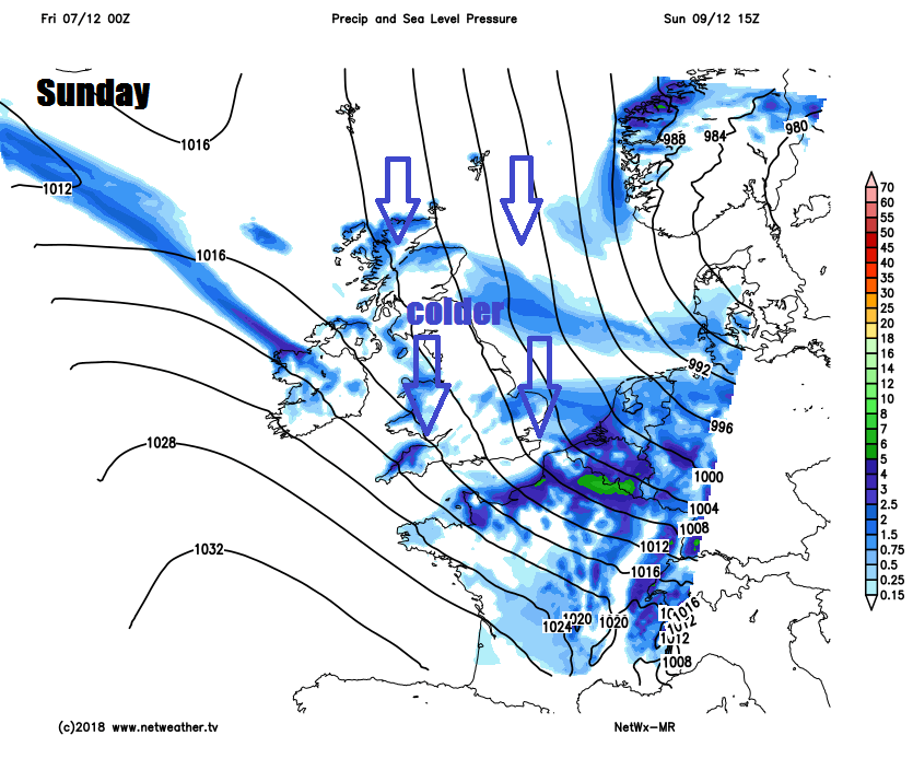
Showers and the northerly wind easing on Monday, as high pressure builds, so becoming a mostly dry and bright but cold day. Tuesday is looking largely dry and settled but cold. Atlantic fronts bringing rain trying to push east on Wednesday, though some uncertainty how far east, perhaps a more asserted effort by the Atlantic low pressure to push wind and rain eastward on Thursday and Friday, bringing with it milder air.