Quite a divide through the UK with temperatures up into double figures in the south but a frost and ice furhter north. As rain hits the colder air there will be a bit of snow on the hills, Wales, N.England and Scotland
it's winter now, December, January and February but the UK weather has gone all autumnal, with a further set of low pressures racing in from the Atlantic.
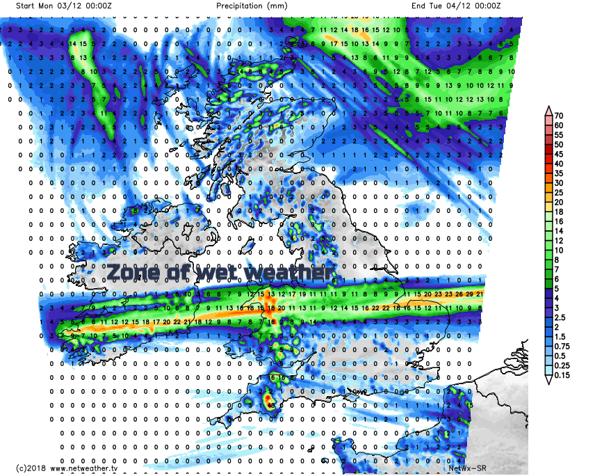
Often this week it will be cool in the north and mild in the south. This morning we have 11 or 12C for southern England and 2 to 5C for Scotland and Northern Ireland. Wales looks wet over the next few days with more rain everywhere on Wednesday and Friday looks windy with more showers.
The colder conditions in the north mean that there is some fog and frost about this morning with temperatures down near to freezing. The Met Office have an ice warning for parts of Scotland. This is due to clearer skies with just a few showers in the far north, so a bright and sunny morning to come. Further south there is more cloud with showery rain already over Wales and moving into NW England. This is a little low pressure which nips across Wales and England today.
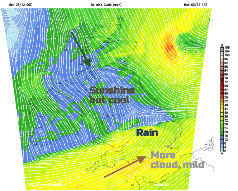
This divides the UK with milder air over southern Britain and temperatures into double figures with a SW wind, and the cooler NW breeze accompanying the brighter conditions. The rain will be heavy, thundery and blustery but will zip eastwards quite quickly across to East Anglia this afternoon. The model doesn’t quite have a handle on this little low’s development today. Showing as only a strip of Britain.
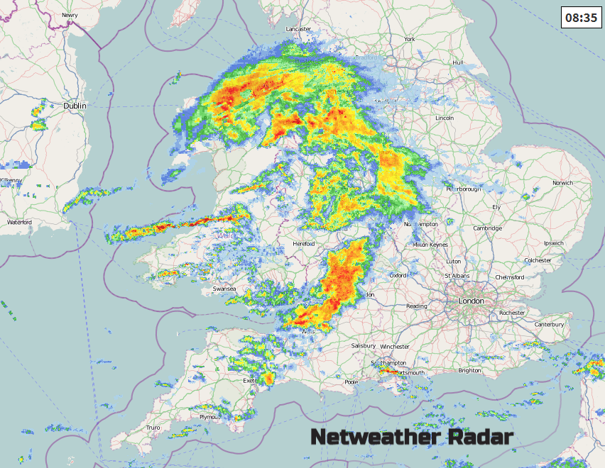
That’s the model representation of the warm then cold fronts moving across the UK, but from the earlier radar picture of the actual rain you can see there will be more rain to the south from the cold front, with more of a low centre. It will be worth considering this in the hourly symbol forecast. Along the M4 and south Midlands into more of SE Britain rain looks likely. This low pressure isn’t quite the flat wave that seems to be present on the model charts. That’s why you can’t just look at an app on its own and why they can all say different things.
As the showery rain and cloud pull away from the SE this afternoon, we are back to clear skies and the NW wind, so it will feel noticeably cooler throughout the UK by this evening. There will be more showers heading into the far NW with a wintry mix over the hills. It will be clear and cold for most.
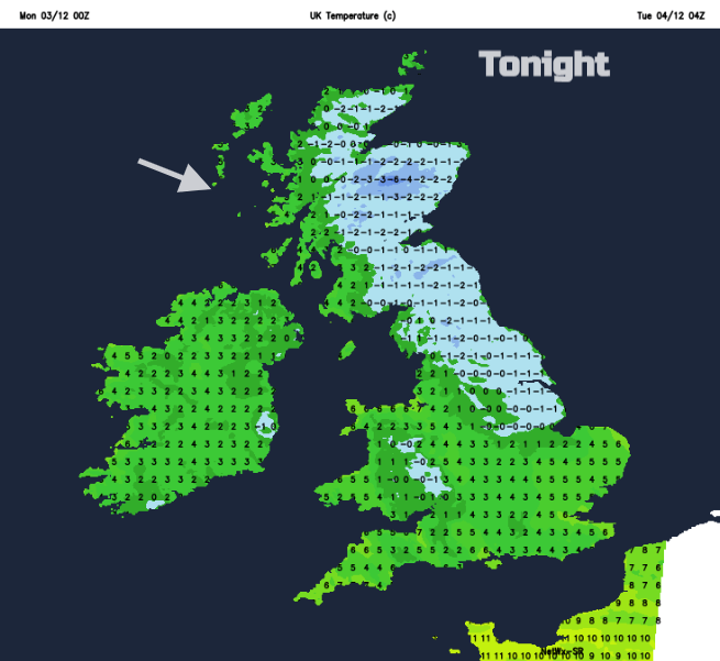
There will be a widespread frost, some fog and an ice risk as temperatures fall below freezing.
Another low pressure then begins to wind up out in the Atlantic. Tuesday starts off chilly but sunny and will be a fine day for many. High cloud appears from the SW with a SW wind picking up for Cornwall and Devon. The warm front rain then pushes into SW England, Wales and southern Ireland during Tuesday evening with snow over the tops of the Welsh mountains and even sleet on the leading edge as it heads over the Midlands of England. There could be some snow for the Peak District overnight too and then for the hills of northern England into southern Scotland by Wednesday morning. The far north of Scotland stays fine but cold as wet weather spreads over most of the UK.
It will be very wet for a time, with snow for the Scottish mountains but within the warm sector, there will be mild air once more for southern Britain. That low then moves off into the North Sea by the end of the day. It stays unsettled with stronger winds and more rain for the rest of the week.