Rain at times this weekend, Monday and Tuesday colder, drier and brighter before more rain arrives by Wednesday, with further rain Thursday and Friday.
A rinse and repeat changeable but unsettled pattern over the weekend and through next week. Rain across much of the UK clearing this morning to brighter spells this afternoon, but a dry evening will be followed by another area of rain moving east to affect many parts overnight. Rain clearing northeast Sunday morning followed by brighter weather across the south on Sunday, rain lingering across the north. Monday’s looking drier, brighter but colder. However, a deep low looks to move off the Atlantic to bring wet and windy weather later on Tuesday and into Wednesday, then perhaps more rain and strong winds for Thursday. All-in-all, a lot of rain on the way over the coming week, with brief drier respites between these spells of rain.
For now, heavy rain affecting N. Ireland, SW Scotland, northern, central and eastern England for the next few hours. Dry and clearer across much of Scotland away from west coast showers and the rain in the southwest, chilly too towards the east, with temperatures close to freezing at dawn in the eastern Highlands.
Rain easing to drizzle across Wales and SW England before slowly drying up and brightening up here through the morning. These drier and brighter conditions reaching the Midlands by lunchtime, then eastern areas of England this afternoon as the morning rain slowly clears here. Turning drier and brighter across N. Ireland and southern Scotland too after morning rain, but tending to stay grey with further drizzle or patchy rain across north Wales and northern England. Northern Scotland mostly dry and bright, though showers, wintry over hills, towards western coasts.
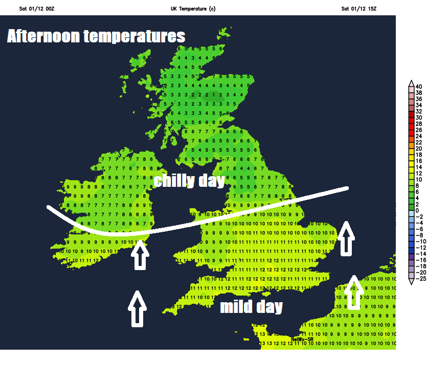
Quite chilly across Scotland, N. Ireland and northern England, temperatures reaching 6-8C here, further south a milder day, with highs of 10-13C.
A dry evening for many, just a few showers for western Scotland and northern England. However, the next frontal system arriving off the Atlantic will introduce outbreaks of rain across SW England, south Wales and the island of Ireland by midnight, before steadily pushing east across much of the UK by dawn, rain locally heavy and winds strengthening in the south, with coastal gales possible. Rain easing but staying cloudy and drizzly across SW England and Wales.
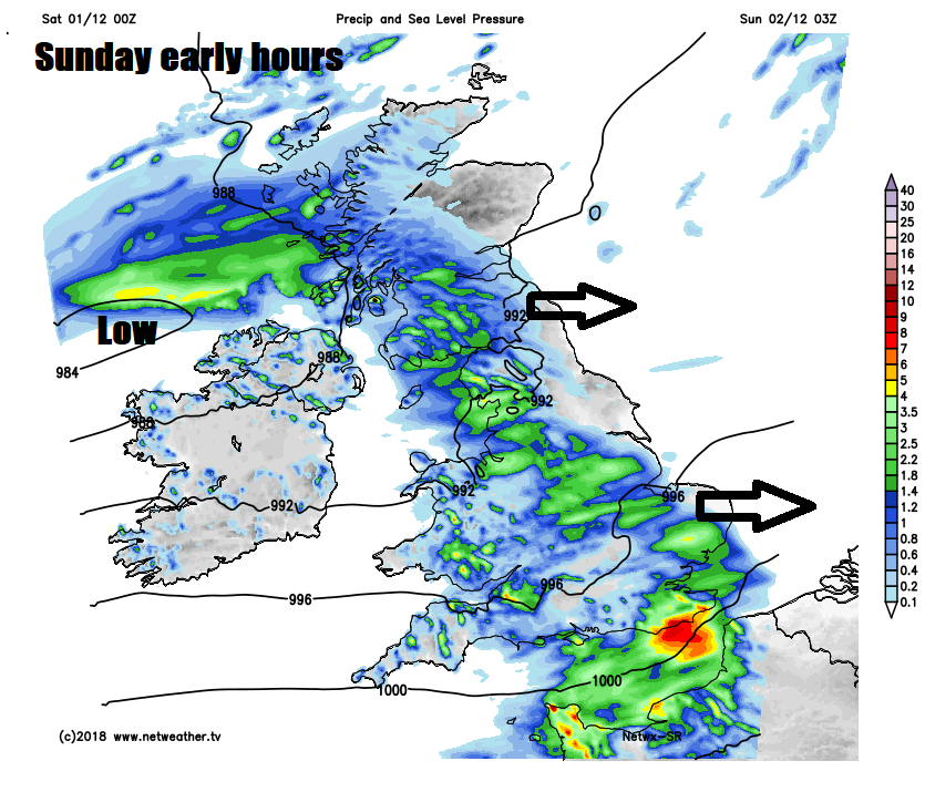
A grey and damp start to Sunday across much of the UK, heaviest of the rain clearing the east coast of England first thing but remaining cloudy and drizzly through the morning, a strong southwesterly wind across the south too. Rain lingering across southern Scotland and northern England through much of the day, thanks to low pressure moving through and associated slow-moving wrap around front. Brightening up across southern England and Wales in the afternoon – with scattered heavy showers in the west and southern coasts, brighter for northern Scotland too. Temperatures reaching a mild 12-15C across the south and west, a colder 6-9C for Scotland and northeast England. A windy day generally, away from northern Scotland - where winds will be lighter.
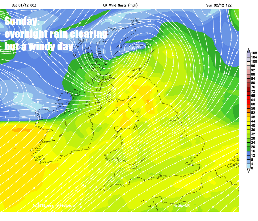
Further rain spreading from the west across N. Ireland and Scotland Sunday evening and night, drier further south away from western coasts where heavy showers are likely. Rain clearing to showers across northern Scotland on Monday, otherwise a brighter but colder day for many in a brisk westerly or northwesterly wind, some scattered showers are possible though across England and Wales, but some will miss these. Showers moving in across northern and western Scotland Monday night could bring snow over higher ground.
Staying unsettled for the rest of the week, cold at times across Scotland – especially Tuesday and Wednesday. Mostly dry and bright on Tuesday during daylight, but wet and windy weather will spread in from the southwest across the west by late afternoon, before sweeping across all parts Tuesday night. A wet and windy morning on Wednesday before the rain clears into the North Sea and winds ease during the afternoon, a cold northwesterly wind following the low moving east. Brief ridge of high pressure Wednesday night before more wet and windy weather spreads east on Thursday and Friday.