Still showery for NE Britain and the SW too but in between, fair and cloudy today. Uneventful Saturday weather could be ideal for Christmas shopping but chilly by Sunday in the north.
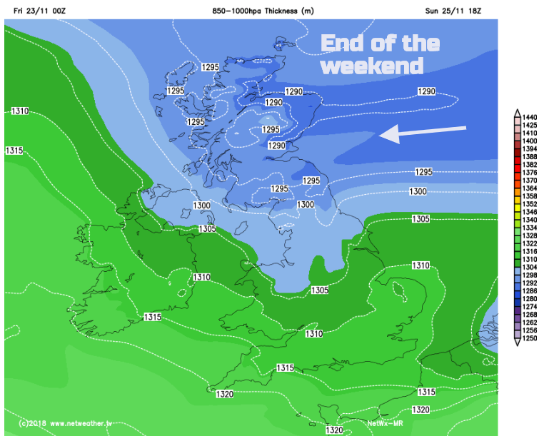
We are still in the cool easterly flow, although it’s not as cold as it was. There are showers caught up in this and a fair amount of cloud. A stalemate persists throughout the weekend with cold air out to the east, managing to topple over into Scotland and milder air well away to the west. Next week things seem to shift with a change on the way.
There is a low pressure to the SW of the UK throwing heavy and thundery showers over southern Ireland, Wales and the West Country. High pressure extends from Iceland over Sweden and Norway into the Baltic States with enough of an influence to feed more showers off the North Sea for Scotland and NE England. In-between it is dry but cloudy today.

The Met Office have a yellow warning for heavy and thundery rain from those showers in the SW. It isn’t as cold this morning although temperatures in Lincolnshire have dipped down near to freezing inland. Though the day, temperatures will reach 6 to 11C with East Anglia and southern England reaching into double figures. The easterly winds continue, light for many but making it still feel cool and fresh around the Bristol Channel and western English Channel.

Tonight, there could be a frost for parts of Cumbria and western Scotland and patchy fog with a murky and misty night further south too. Overnight more showers appear in the SW and for Channel coasts, with a scattering for southern England by Saturday morning.
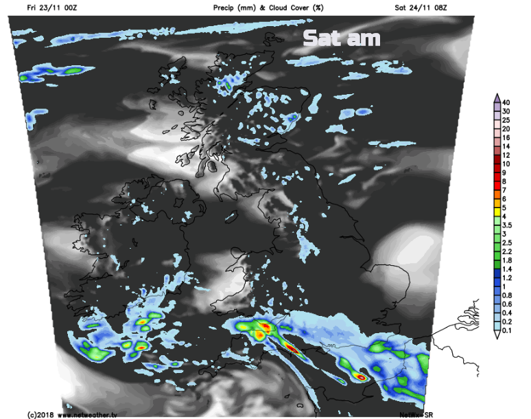
During the weekend southern Britain will have temperatures around 10 or 11C and feel okay whereas further north and for Northern Ireland it will still be cool with temperatures around 7 or 8C. The damp weather coming into the NE will be less lively after some sharp showers in the week. The showers in the far south continue by day, not troubling greater London too much, but scattered across central southern England and the SW. For most of the UK it will be a fair Saturday, rather cloudy, a few brighter spells and a rather bland November day. Perhaps ideal for Christmas shopping?
Sunday
Colder air begins to arrive from the NE on Sunday so, any showery bits will turn wintry over the Grampians, Southern Uplands even the Cheviots, not much but an icy tinge with a light covering of snow on the tops. Just cold and damp at lower levels but sunny for the west coast. There will be more showery rain lurking in the English Channel on Sunday as the low pressure centre tucks into western France. With more of a wind from the east or NE, it will feel colder everywhere on Sunday with temperatures of 4 to 9C and chill in the wind.
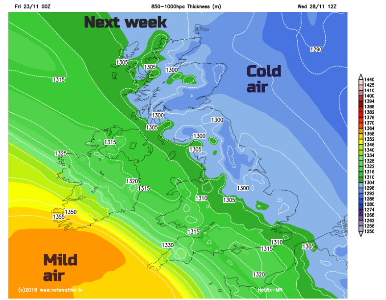
Next week, after a lot of uncertainty it looks like the westerly flow will take over and our UK weather will turn more unsettled, wet and windy but milder. So, less risk of frost but more chance of strong winds, even gales.
Nick Finnis's Convective forecast for thundery showers in SW Britain today