


Further showers today away from the far east, showers easing into Tuesday before rain arrives for the north and west into Wednesday. All parts becoming dry and settled by Friday.
Low pressure remains in control to start the week, so Monday will continue the weather theme of the weekend of sunshine and showers, which will today be heaviest and most frequent in the west, fewer in the northeast. The rest of the week is looking increasingly settled away from the northwest, thanks to the increasing influence of high pressure over continental Europe, but remaining very mild. Tuesday will bring dry and bright conditions after early showers fade, before rain moves in across the north and west Tuesday night and continuing here through Wednesday, the south staying dry. Further rain in the far northwest on Thursday, dry and rather mild elsewhere. Then a dry end to the week for most, as high pressure gains more influence across all parts.
For now, western areas and southern counties of England have seen showers from the word go this morning, bringing a rather grey and damp start to the day here. Much of central and eastern England along with eastern and far north of Scotland off to a dry and bright start though, chilly in the far north and northeast too. Generally mild and breezy elsewhere though, gales along western coasts.
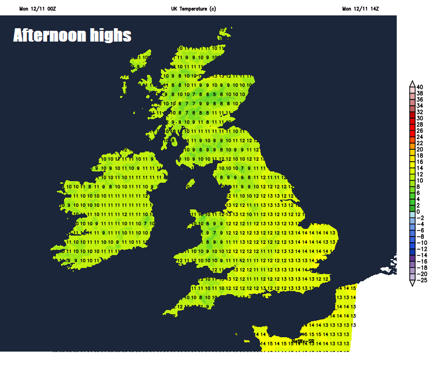
A brisk south to southwesterly wind will blow showers further inland at times across many parts through today, always heaviest and most frequent across the west and along southern-most counties of England – where they may produce hail, gusty winds and even the odd rumble of thunder. Eastern areas of England and far north of Scotland sunniest and most likely to escape most the showers. Highs today ranging from 10-12C in the north to 12-14C in the south, above average for the time of year.
Blustery showers continuing through the evening and overnight away from eastern England and far north of Scotland, before showers tend to ease and become increasingly confined to western and southern coastal areas by the end of the night, allowing increasing clear spells to develop.
Perhaps some showers across the west and south at first, before they fade through the morning, to leave most areas with a drier and brighter afternoon, though a few showers could continue across western coastal areas. A mild day and with lighter winds feeling pleasant in the sun, temperatures reaching 11-12C in the north, 12-15C in the south. Wet and windy conditions spreading in off the Atlantic across Ireland, Northern Ireland and far northwest through the evening.
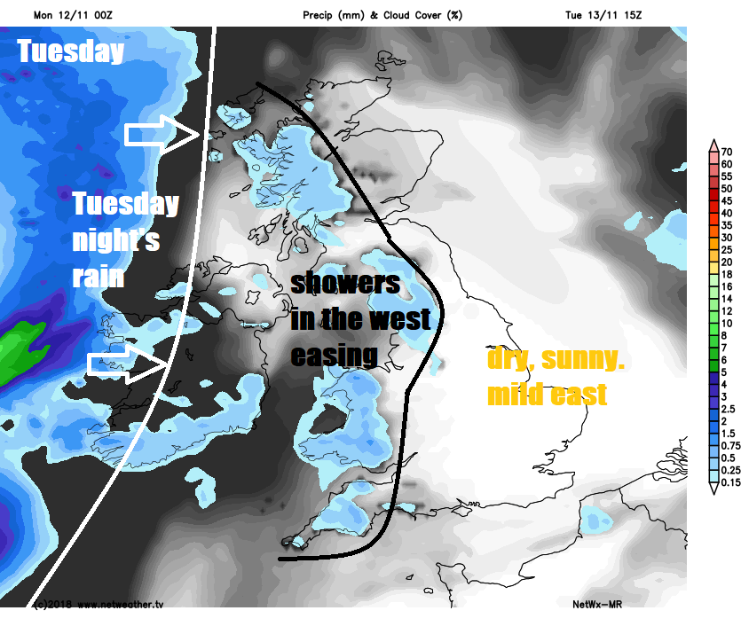
A wet and windy Tuesday night across Scotland, Northern Ireland, northern England, north and west Wales. Heavy rain clearing away from the north in the morning, though remaining wet across northern and western Scotland along with perhaps N. Ireland and Cumbria and generally a cloudy day across the north and west even where the rain eases. Central, southern and eastern England along with east Wales will enjoy a mostly dry and bright or sunny day. Very mild in southerly winds, temperatures widely reaching 13-15C, perhaps 16-17C in a few spots.
High pressure over continental Europe becoming increasingly dominant across the UK as we head towards the end of the week, keeping Atlantic fronts at bay to the northwest. Thursday will see further rain across western Scotland and N. Ireland, but elsewhere it will remain mostly dry and settled with sunny spells, the southerly flow keeping it mild for all. High pressure in control to end the week, so Friday will be generally dry and bright or sunny, though with lighter winds there could be overnight mist and fog to clear in the morning.
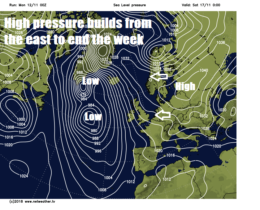
With a large area of high pressure becoming centred towards Scandinavia next weekend and extending over the UK, both Saturday and Sunday are looking dry and settled for all. With a dry and chillier continental feed developing, it will become cooler by day, with nights turning chilly too.


