Low pressure close by will bring further heavy and persistent rain to western areas this week, bringing risk of flooding. Friday looks very windy too, as a deep low arrives west of Ireland.
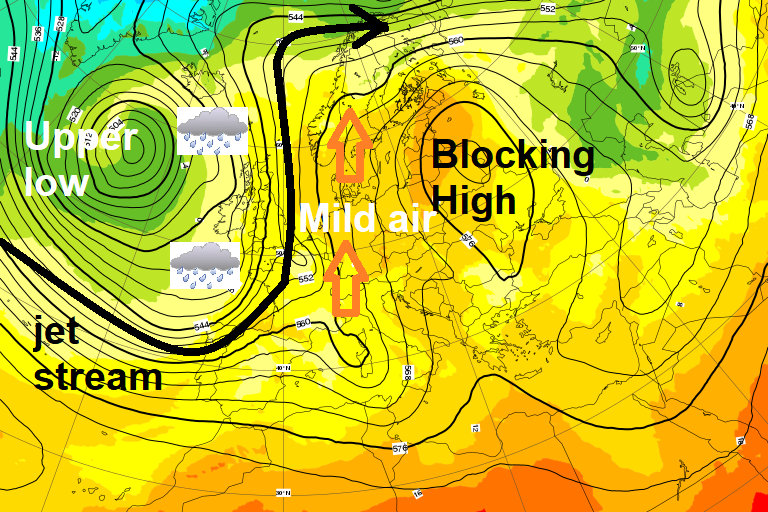
The synoptic pattern will be stuck in a rut across Europe over the coming days, with a persistent block of high pressure over western Russia and slow-moving upper low sat west of the UK blocked to eastward progress but sufficiently close to bring unsettled conditions to NW Europe including the UK. Secondary lows and frontal systems spiralling around the upper low and ‘parent’ surface low to the west and moving northeast towards or over the UK over the coming days will bring a lot of rain in west, where the fronts will tend to be slow-moving at times. Hence the yellow warnings issued by the Met Office for western areas today and Friday.
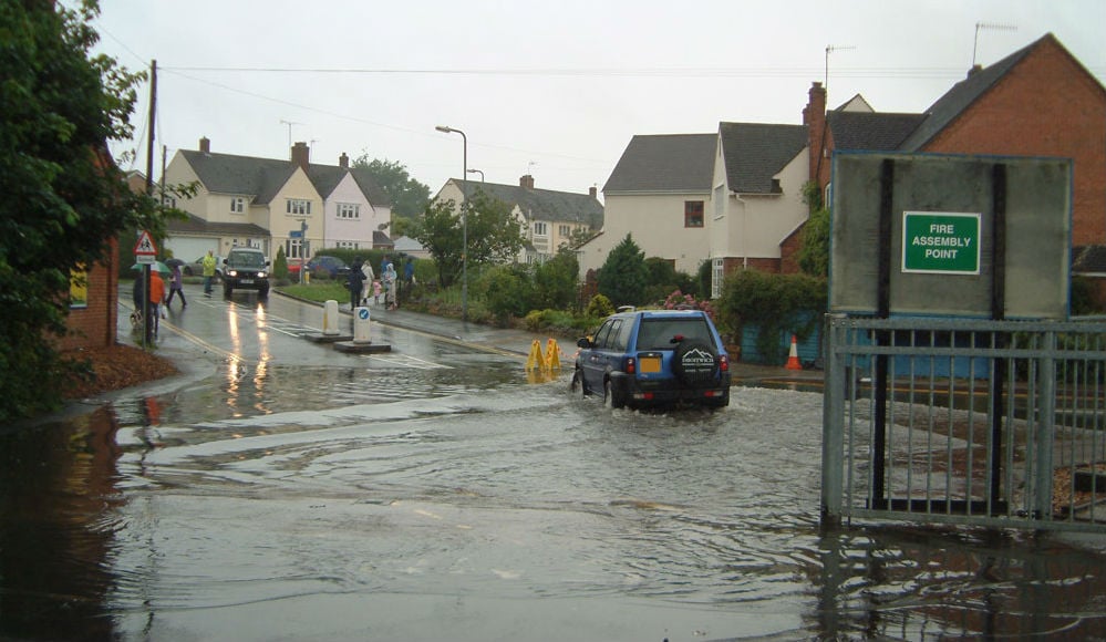
Parts of Northern Ireland have experienced flooding this morning, with Met Office yellow warnings for rain recently updated and extended until 3pm - covering Northern Ireland and also Strathclyde on the western side of Scotland.
Commuters into Belfast faced long delays this morning, due to some roads being flooded and even impassable, with the city’s Translink bus service experiencing long delays.
The heavy rain across the northwest this morning and into the afternoon is tied in with a wriggling frontal boundary which will take its time to clear away north.
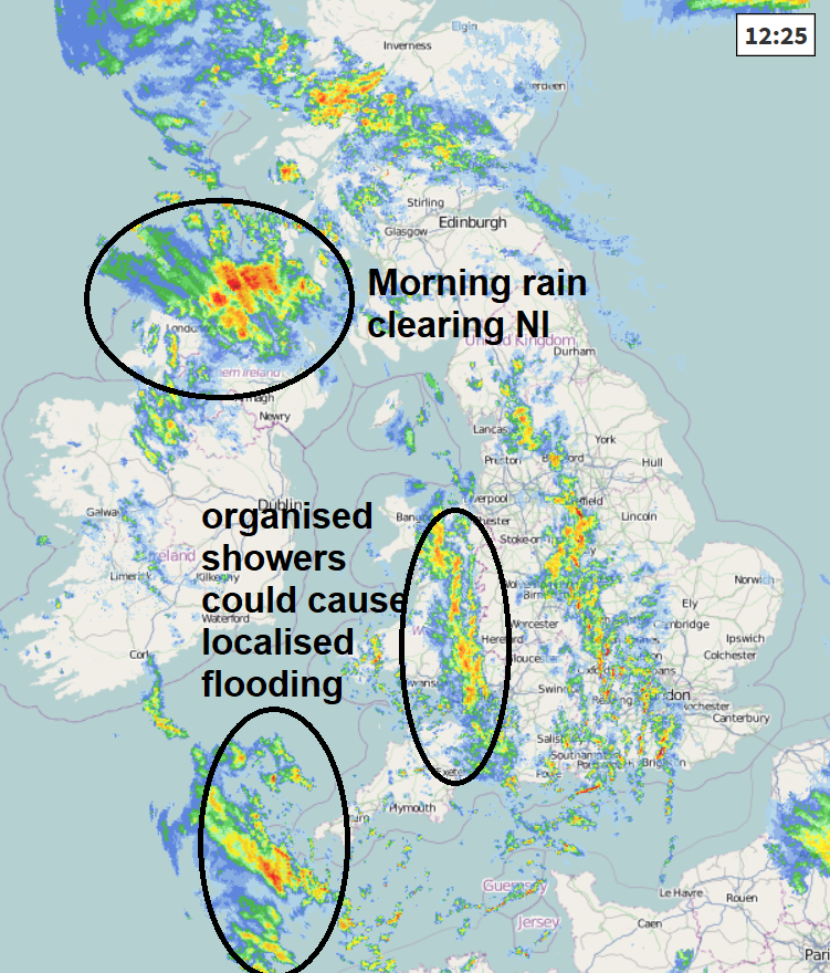
SW England and Wales saw heavy rain from this frontal system overnight but has now cleared away, the yellow warnings for rain issued for these areas expired at midday, but there is a rash of heavy thundery showers merging into longer spells of rain that may still cause some localised flooding through the afternoon.
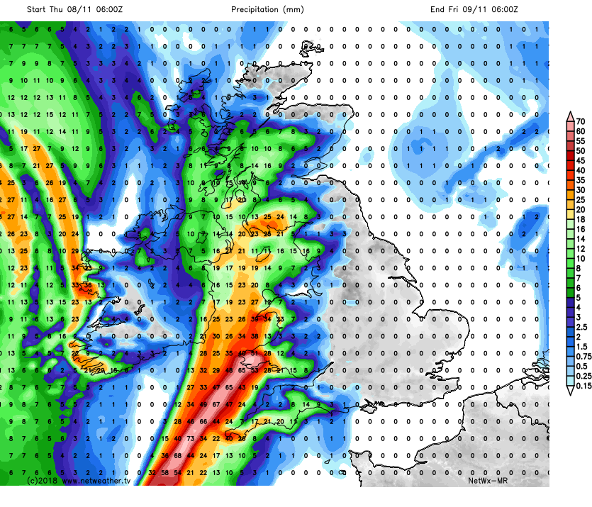
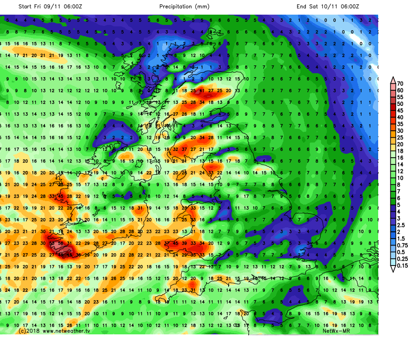
Thursday sees another round of wet weather spread in across western areas, thanks to a new occluded frontal wave moving in across the west and becoming slow moving as it wriggles around. The Met Office has yet to issue any yellow warnings for rain, but recent model runs indicate enough rain falling across parts of Wales and far SW England to cause some flooding issues. Netweather’s Medium Range Model indicates another 40-60mm could fall across parts of west Wales and Cornwall by the end of the day.
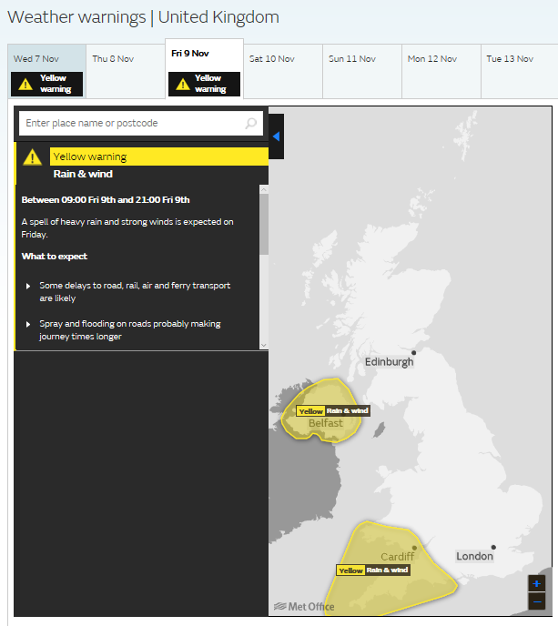
Later this week sees a risk of stormy weather sweeping across the UK, with another round of Met Office weather warnings issued for Friday across the west, not just for heavy rain this time, but also for strong winds.
The culprit will be a secondary low crossing the Atlantic tomorrow after leaving Canada tonight, which will then deepen on its journey over the Atlantic before it arrives to the west of Ireland on Friday.
Watch the low coming off NE Canada deepen on the nose of strong jet as it moves east over Atlantic and towards Ireland
The depression will hitch a ride on the nose of a strong Atlantic jet streak coming out of eastern Canada / New England and east over the North Atlantic. Because the depression will sit in the ‘left exit’ region of the jet maximum, a developmental area where winds diverging aloft cause winds toward the surface to converge and lift to fill the void, it will deepen rapidly as a result, more particularly as it moves over into the cold conveyor on the polar side of the jet stream as it approaches the west of Ireland on Friday.
There is potential this deep low may be named Storm Deirdre by Met Eireann or Met Office if it meets their criteria, the next on the official list of storm names for this season. The Met Office currently have yellow warnings out for rain and wind for SW England, Wales and Northern Ireland.
Forecast models suggesting gusts of 50-60mph around coasts and 50mph inland across the west, 60-70mph with exposure around southern and western coasts. Heavy and persistent rain could again be an issue across the west, with models indicating another 30-40mm or more over western hills.
The unsettled conditions continue through the weekend, as a parent low continues to rotate to the NW of the UK, sending troughs or frontal systems northeast across the UK and Ireland, bringing showers, organised showers or longer spells of rain.