Lots of rain and blustery winds in the forecast for Ireland and western Britain, today tomorrow and then another low pressure for Friday bringing gales. Hold onto your hats.
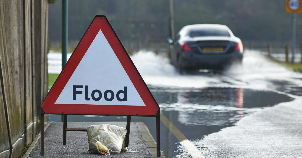
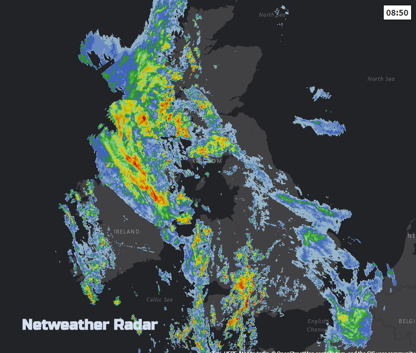
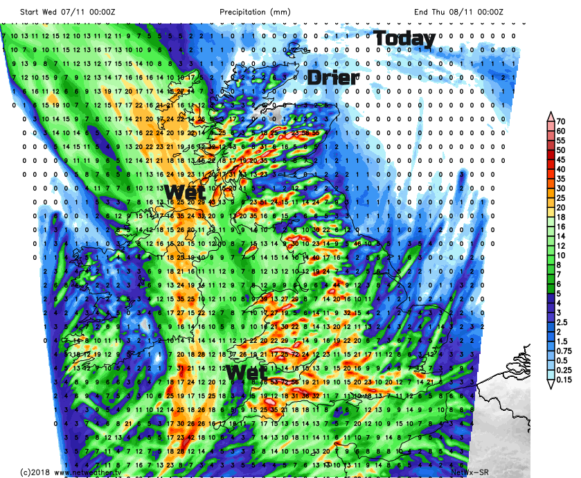
There is plenty of rain about this morning, particularly for Northern Ireland, western Britain and in the south. A collection of fronts has edged in from the west, followed by heavy and thundery showers. There are warnings from the Met Office for heavy rain, highlighting impacts for SW England and Wales this morning and Northern Ireland and SW Scotland for much of today.
This morning’s commute won’t be very nice in the rain and blustery winds. After this spell of unsettled weather, we are looking at the forecast for Friday as a deepening area of low pressure heads in from the Atlantic bringing even windier conditions and more rain.
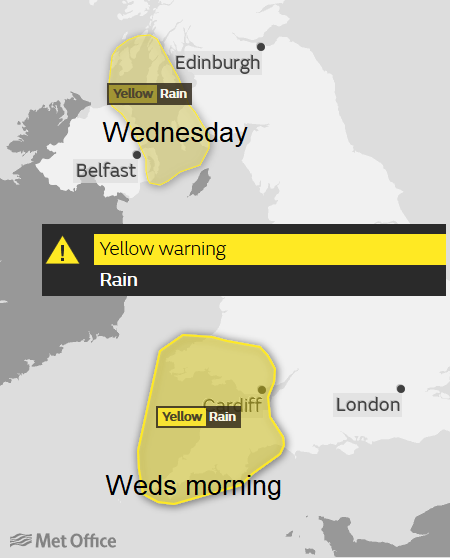
Today’s weather system is linked to a large area of low pressure in the northern Atlantic, spinning about but throwing lots of fronts over the UK as a secondary low pressure develops and heads northwards, feeding more and more rain over parts of the UK. Northern Ireland has already seen flooding this morning and difficult conditions for the morning commute. The persistent rain heads northwards around 9am but there will be more rain today, off and on, until about 5pm. The warnings for SW England and southern Wales are for this morning as the occlusion works through heading NE but there will still be clusters of heavy and thundery showers to follow.
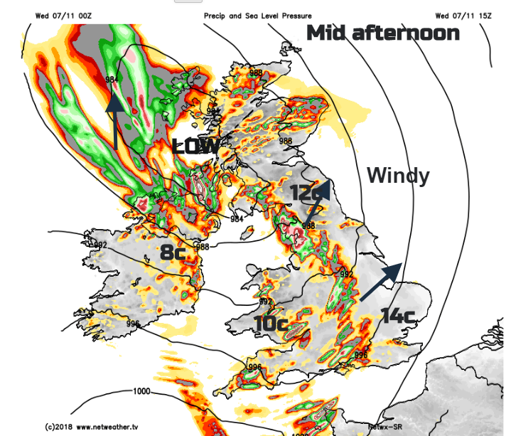
It will be a blustery day (away from the NW Scotland and Northern Ireland) Fresh SE winds will make it feel cooler, even with temperatures up to 13 or 14C. The air isn’t as mild as it was at the start of the week and the wind won’t help. Gradually the winds veer to the west and it will feel even cooler.
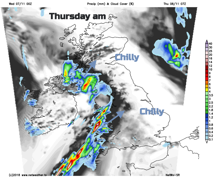
BY this evening heavy showers will have worked their way across to eastern England with still more rain for western and southern Scotland. Overnight it all begins to fade as the bands of showers move NE and pressure starts to rise, settling things down briefly. It turns colder and drier with clear skies. Temperatures will dip down close to zero inland with a touch of frost possible.
Lines of showers from the original Atlantic low pressure head in from the SW, so there will be a spell of hefty downpours across Wales, SW and NW England, Isle of Man and Northern Ireland with gusty winds.
Elsewhere fine, bright but cool as the showery line fades a bit and heads to the Pennines and into Scotland. However further hefty showers continue to feed into western Wales, Cornwall and western Devon, later Cumbria and Dumfries & Galloway. Away from the showery bits, it will be a fine, sunny day but blustery again.
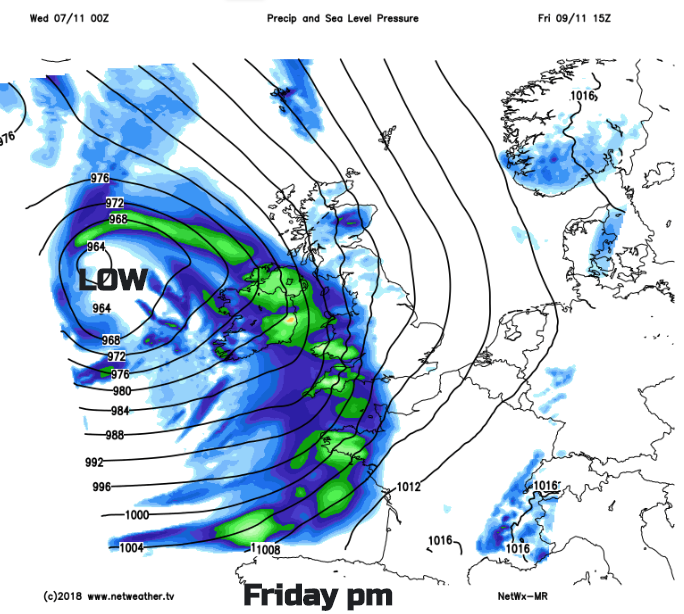
This line of showery rain is still lurking up through the Irish Sea by Thursday night bringing a damp start to western Britain for Friday. However, it is a deepening area of low pressure whizzing in from the Atlantic which will be the one to watch for Friday. There are already weather warnings from the UK Met Office for rain and wind.
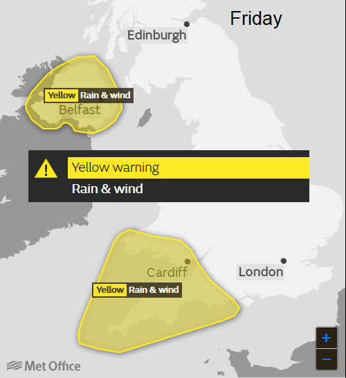
By lunchtime, on Friday more rain will be over Ireland and SW Britain with strong SE or S winds, and coastal gales. Through the afternoon gusts over 60mph and land gales could affect Northern Ireland, Irish Sea coasts and the Bristol Channel and western end of the English Channel. Conditions on the roads, rail and ferry services are likely to be affected, power supplies in Ireland too.
The next name on the Storm list is Deirdre. PRONUNCIATION: deer + dre" or “dare + dreh" from the most beautiful woman in ancient Ireland, not like Deirdre Barlow off Corrie.
Not named yet 9am Weds 7th.
The Friday evening rush hour will be windy and wet with further gales and high gusts. Do bear this in mind if you have travel plans for the end of this week.
Nick Finnis's convective forecast for today's thundery showers