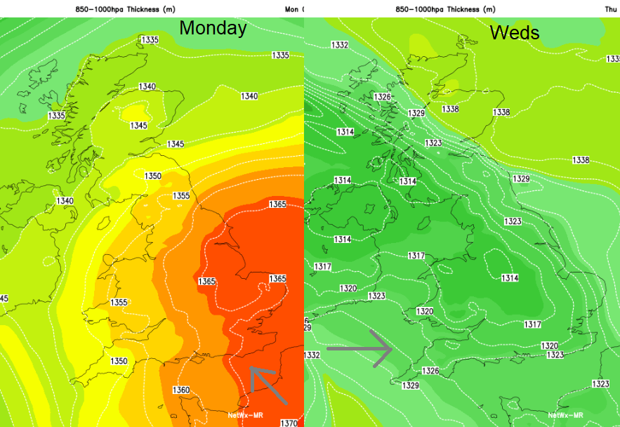
Mild today and tomorrow with temperatures up to 17 or 18C. Then a bit cooler as bands of rain arrive from the west and the winds pick up, blowing all those autumn leaves about.
This morning there is rain and fog, a lot of cloud and murk but it’s not cold. It’s looking fine and mild for Bonfire Night. This week it cools off a bit for the middle of the week as weather fronts try to push in from the Atlantic. They don’t manage to move right across the UK until later Wednesday so before that most of the rain will be in the west, with blustery winds.
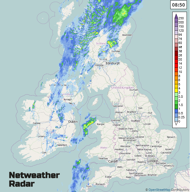
Today’s rain band is from a warm front which will move NW, so away from Welsh coasts and the Irish Sea. The rain band fades during the day so by this evening if you have Bonfire plans, then it should be dry and mild with light winds.
Everywhere should be in double figures today with London up to 17 maybe 18C. With light winds and sunshine, it will be a pleasant Monday across much of England and Wales and this afternoon southern Scotland. For the NW half of Scotland and particularly western counties of Northern Ireland, there will be grey skies and patchy rain in the air, lingering this afternoon with temperatures around 10 to 12C.
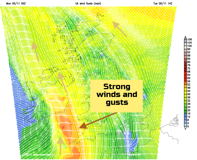
A mild start again tomorrow but with a fresh southerly breeze for Ireland and western Britain. There will be a fair amount of cloud, mostly dry with bright spells. The wind picks up everywhere through the day, so blustery but with temperatures in eastern England up to 17 or 18C.
By the afternoon frontal rain will be moving over Ireland and into Pembrokeshire, Cornwall and Devon. So cooler here and becoming wet and windy with strong southerly winds.
The wet weather will really set in for SW Britain later Tuesday into Wednesday with the risk of localised flooding, surface water, river and coastal. Even as the rain bands begin to shift NE, there will be heavy, thundery showers to follow as the SE winds veer to a cooler westerly
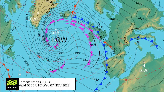
So, a blustery, unsettled day, not as mild with plenty of rain for some parts of the UK. Northern Ireland will be drier and eastern Britain should miss most of the midweek rain. SW Scotland looks wet and there will be even more rain on Thursday heading into SW Britain after a cooler Wednesday night. It will be windy as another low moves in from the Atlantic and more weather fronts make their way across the UK.
Friday and Friday night could see strong winds, even gales with more rain. It will be a proper blustery autumn picture, blowing all the leaves about to end the week.