Today's rain will clear away leaving sunshine for most but cooler air. Fine and frosty tonight before wet and windy weather from ex-Oscar reaches Northern Ireland and Scotland to end the week.
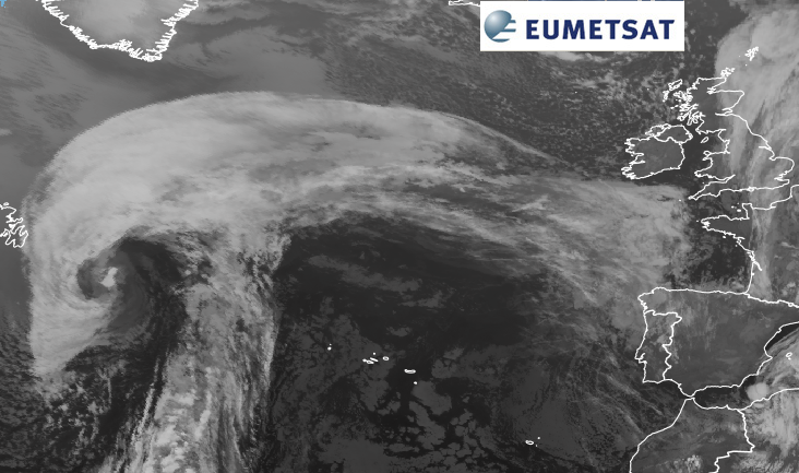
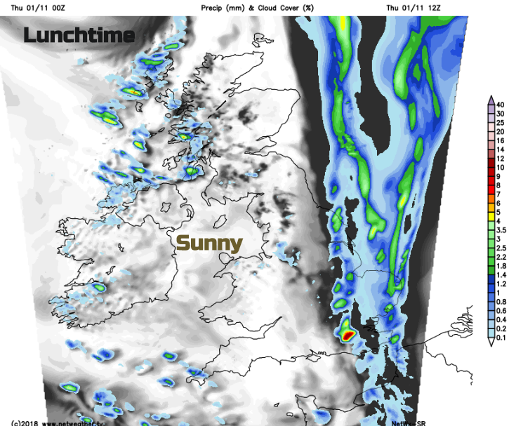
This morning we have clear and cold but calm conditions over Northern Ireland and western Britain with fog in places. Sunshine will cheer up the cool start, it’s been down to -4C in Co Down and Co Tyrone with a yellow warning for fog from the Met Office. We have an occluding front over eastern Scotland and more of England which is bringing a grey, murky and damp start to Thursday.
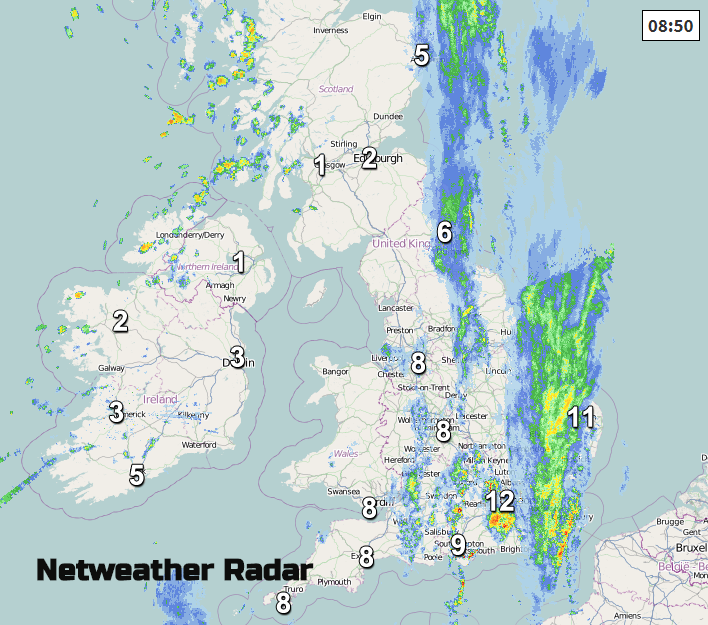
Here it is still mild with light winds. The frontal band will edge off into the North Sea today allowing more sunshine across Britain, but the cloud and patchy rain will take its time over East Anglia and Kent, not really clearing until late afternoon.
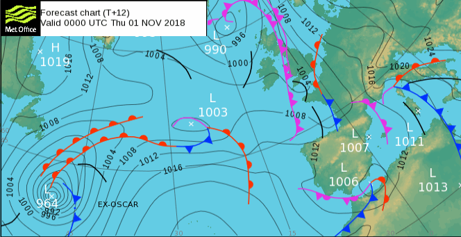
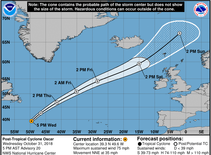
After a chilly night, Friday will be fine until a deep low pressure brings strong winds and gales to some parts of the UK. This system includes the remnants of ex-Hurricane Oscar, after a week meandering out in the mid-Atlantic. This extra energy (within, a by then, extra-tropical low) will bring stormy conditions to NW UK Friday night through til Saturday evening.
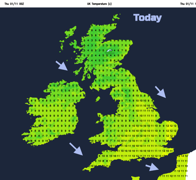
Today temperatures range from 7 to 12C with mostly light winds, the breeze will be from a cool NW direction, but sunny parts won’t feel too bad. Eastern England will stay cloudy with patchy rain as more of Wales and western then central England brightens up. A scattering of showers will move into western Scotland, with some wintriness for the mountains and a few showers will reach Co Tyrone and Derry.
Tonight, there will be a widespread frost with clear skies, light winds and maybe even a bit of ice, after the daytime dampness.
Ahead of the incoming Atlantic system will be a ridge of high pressure which will keep the fair, clear and calm weather over the UK on Friday. Temperatures will be 9 to 11C. During Friday evening the southerly winds strengthen. This brings milder air over the NW half of the UK, but it will be another nippy night for the south-eastern half.
The winds begin to pick up later on Friday as ex-Oscar moves in. Southerly gales even severe gales could clip western Scotland or coastal Northern Ireland Friday night, early Saturday.
It will be very wet for western Scotland from this low-pressure system with rain also for Northern Ireland, SW Scotland, Cumbria and western Wales.
Saturday will gradually become windy everywhere, just a moderate to fresh southerly wind for London but strong winds for Scotland and through the Irish Sea. A band of rain will move in from the west over Northern Ireland and western Scotland, but ahead of that, there should be some fine weather and relative warmth. Milder air will be caught up in the post-tropical system so temperatures around 11 to 16C across the UK.
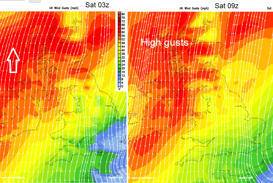
There will be a bout of stormy weather for the Western Isles during Saturday evening and it remains windy on Sunday for Scotland as the low centre finally begins to move away. There will be more cloud about and rain for some but lighter winds to end the weekend.