Halloween gives a mix of tricks and treats weather wise, with some rain the west and also the southeast if you're out and about this evening. We also have an ex-hurricane to watch out for as Oscar nears toward the end of the week.
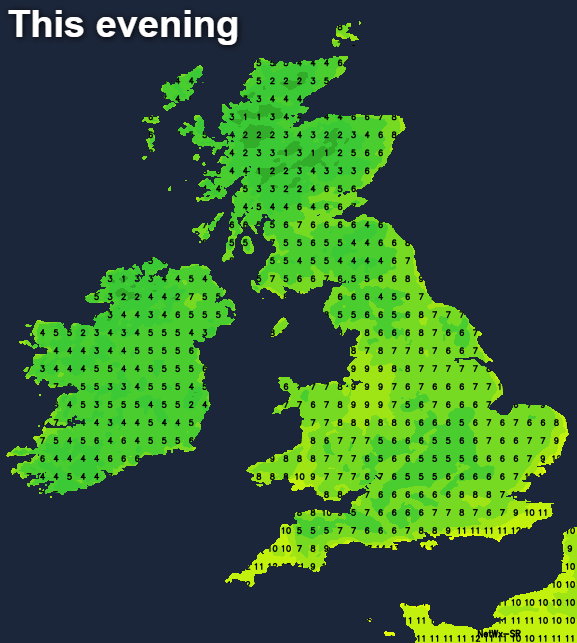
It's Halloween, and love it or hate it, the ghosts and ghouls will be out tonight. For many, it's set fair, but there will be some showers in western and northern parts, with some outbreaks of rain moving up into the southeast during the evening as well. Later in the week is when the more ghoulish weather arrives though, as the remnants of ex-hurricane Oscar move closer.
It's going to be a touch milder today than of late, with highs into the low-teens across the southern half of England, and reaching 8-12c elsewhere. It'll still be chilly enough this evening and overnight to need an extra layer or two if you're heading out for a spot of trick or treating.
Overnight and into tomorrow, the showers moving in from the west, and the rain moving up from the southeast will merge together and hang around across the southeast and East Anglia for a good part of the day. Elsewhere, after a pretty cloudy, murky start for many, it'll brighten up with sunny spells but also a few showers running into the west. Temperature wise, it'll be a fresh, cool day away from the southeast quarter of the country with highs of 8-10c typically. The cloudier and at times, wetter southeast will be warmest, even if it doesn't feel that way, with highs of 12-13c.
A cold night follows with frost in places, then with a ridge of high pressure moving over the country, Friday will be dry for the majority with plenty of Autumn sunshine. Don't expect a heatwave though, with maxes of 9-12c across the southern half of the country and 6-9c further north.
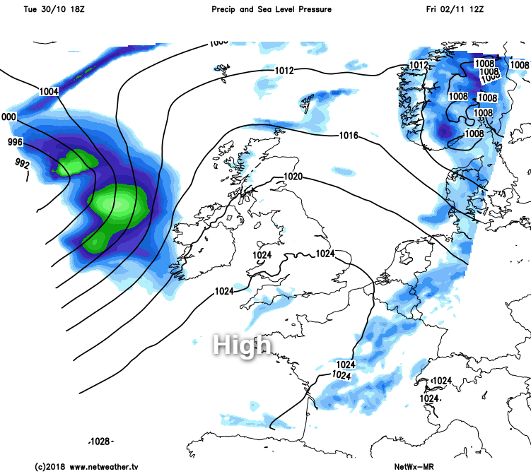
The fine weather is only part of the story on Friday though, as the remains of ex-hurricane Oscar will be lurking out in the Atlantic. There's still some uncertainty over the specifics, but the first of its weather fronts is likely to get into Ireland and western Scotland during the second half of the day, bringing with it some outbreaks of rain. And along with that, winds will be increasing from the west, with gales developing across a good part of Ireland, Scotland and Northern England, western and Northern Wales during the evening and overnight.
At the same time, the rain will move east giving Scotland and perhaps the far north of England a wet night. Into Saturday, the strong winds continue before easing away to the east, but at the same time, as the low nears from the west, they'll re-strengthen again. Another spell of rain will also move down from the northwest during Saturday, fading slowly as it does so, and probably not reaching the southeast of England until well after dark.
Sunday should see the worst of the windy weather ease away north, but it will continue to affect the northern Isles for much of the day. Elsewhere, it'll be a day of sunny spells and blustery showers, these mostly affecting western regions.
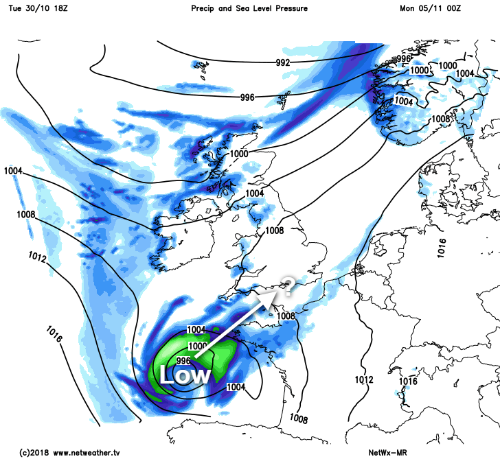
Later Sunday, and into Monday we'll have to keep an eye on another small area of low pressure which may zip up from the southwest to bring further rain and wind, but that's a long way off at this stage.