Rain around for those venturing out Wednesday evening for Halloween. Rain more widespread Thursday, then ex-Hurricane Oscar could bring a wet and windy weekend.
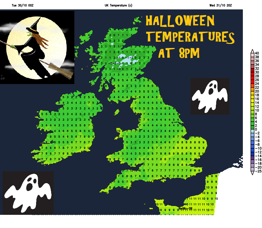
Nights have been cold and frosty over the last few days, temperature falling to -7.1C at Sennybridge in Powys, Wales at 6am this morning, making for the coldest night of the autumn so far. Today will bring another chilly day, with temperatures struggling to reach double figures. However, temperatures will begin to recover into double figures more widely for the rest of the week, with frost becoming less likely away from the Highlands and sheltered valleys in the west.
Which is good news for those venturing out trick-or-treating for Halloween tomorrow evening, though it will still be chilly enough for a few layers under that spooky cloak and perhaps a witches hat to keep you warm, certainly too cold for a skeleton. Some may also need a waterproof Halloween costume or brolly too, with rain forecast to move north across SE England and East Anglia during the evening, while an occluded front looks to spread showery bits of rain in from the west across parts of Scotland, northern England, Northern Ireland, northern and western Wales. The Midlands, east Wales, SW and central southern England probably staying mostly dry with clear spells and where it will turn most chilly quickly in the evening.
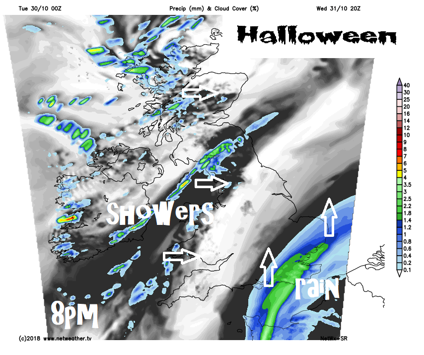
Rain will become more widespread on Thursday, thanks to a two-pronged attack from low pressure over the near continent and associated fronts spreading rain north across the eastern side of England, while a showery trough brings showery outbreaks of rain eastwards across northern and western parts during the day.
Friday daytime is actually looking quite pleasant, as a transitory ridge of high pressure slides east across the UK, bringing a mostly fine, dry and bright or sunny day. However, trouble is brewing over the Atlantic, as a deep depression formed from the post-tropical remnants of Hurricane Oscar tracks towards the far northwest for Saturday, with wet and windy conditions arriving across Ireland, N. Ireland and far west Friday evening.
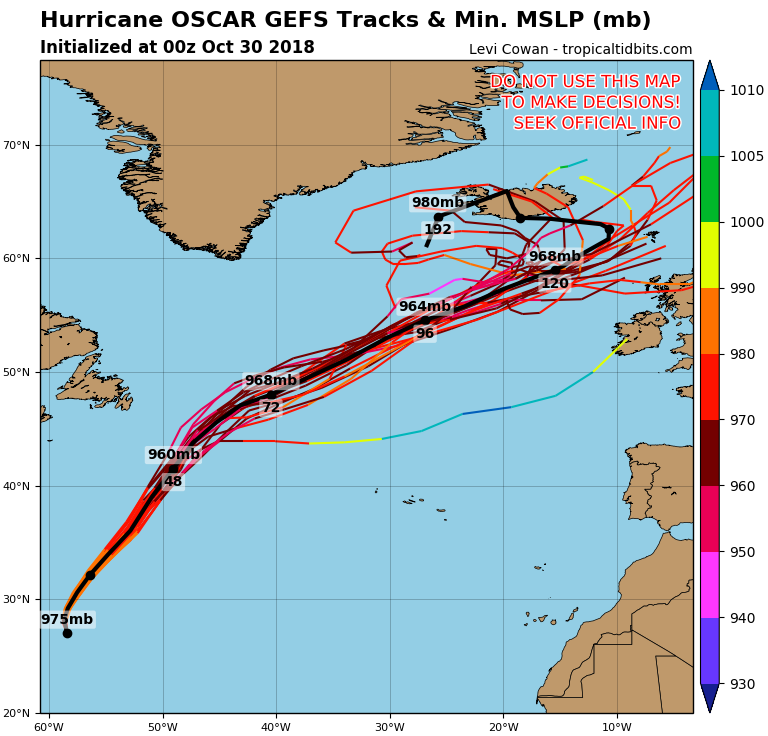
Hurricane Oscar, currently a category 2 storm over open waters of the Atlantic to the southeast of Bermuda, is forecast to track northeast across the North Atlantic for the rest of this week, becoming post-tropical by Thursday, as it engages with a mid-latitude trough moving east out of North America, the upper trough and strong westerly jet stream flowing around it will then push the low somewhere between Scotland and Iceland by Sunday. Uncertainty over track for now though. ECMWF has been tracking the deep low closer to Scotland than GFS and UKMO.
00z GFS ensemble tracks for Oscar
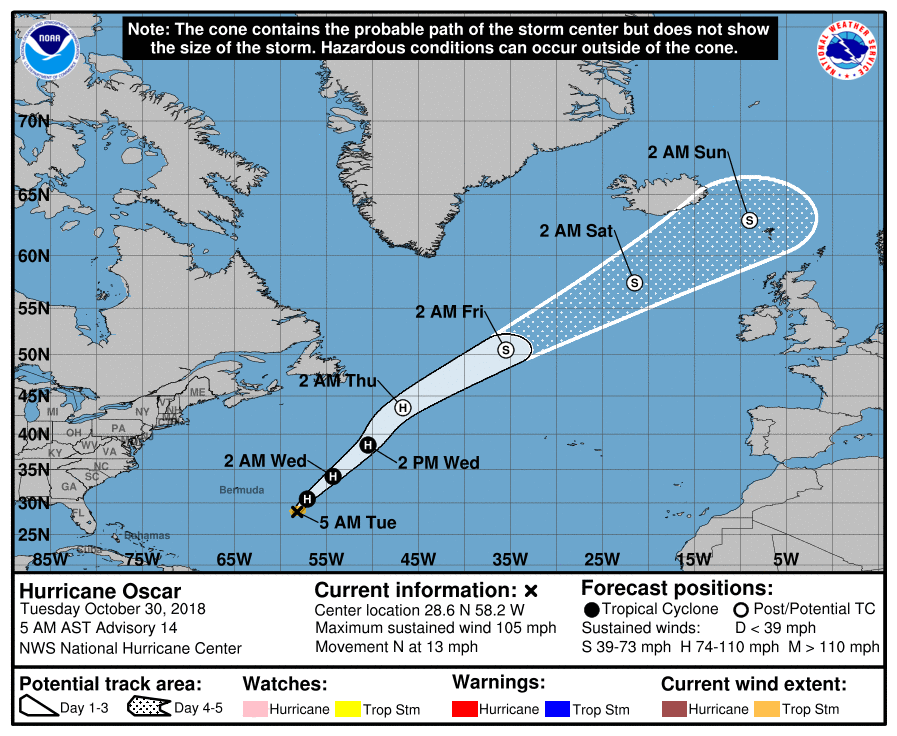
U.S. National Hurricane Centre Forecast track
00z ECMWF tracks ex-Oscar low closest to the UK for now
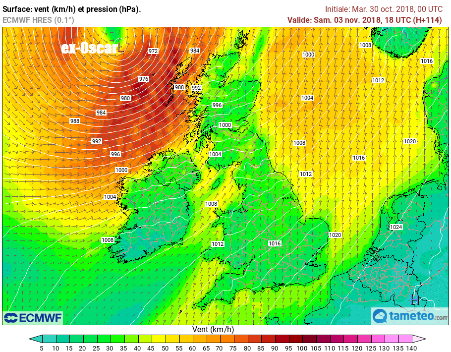
A spell of wet and windy weather for northern and western areas on Saturday as Oscar passes to the north, although how close this low gets will ultimately determine the strength of the winds, there is potential gales over coasts and hills in the north and west, perhaps severe gales in the far northwest. Rain perhaps not reaching the east until Saturday night. Potential for more wind and rain on Sunday, but a great deal of uncertainty over detail for now.