


A cold, ice scraping start to the week for many this morning. Temperatures will gradually recover but the weather is set to turn much more unsettled too with a potentially stormy end to the week.
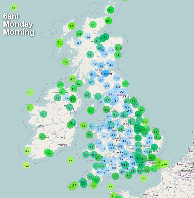
It’s cold out there this morning. Many inland areas are around or below freezing with frost. Much of the UK has light winds allowing the frost to forming stagnate air. We are in a col an area in-between two high centres and two low pressures, the no-mans land in the middle. Southeast England is slightly more under the influence of a large low pressure hitting the Mediterranean, so there will still be a brisk, chilly NE wind, but not as cold as in that straight northerly Arctic flow from the weekend.
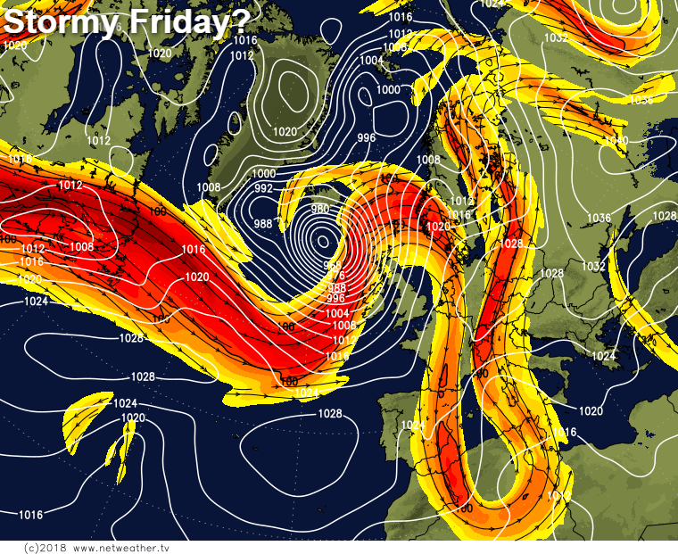
We'll be back to more usual late October temperatures this week. But it looks like there will be a spell of wet and windy, even stormy weather heading in from the Atlantic for the end of the working week as the jet stream fires a deep low toward the British Isles.
Today though, we have no such worries. After the chilly start temperatures will slowly recover to 6-10c, with the south of England being the spot with a chance of making it into double figures. Like yesterday, there'll be a scattering of showers in the east, with one or two making it into central parts, plus some wet weather scraping into the far west of Ireland and Scotland. But for most, it'll stay dry with plenty of crisp sunshine.
Into the evening, temperatures in central and western parts will quickly fall back to allow another frost to form. Further east, with a bit more cloud temperatures, stay a little milder, and the showers will start to become more widespread. Overnight, that process will continue, and they'll make their way further inland as the night wears on - falling as sleet and snow over the hills.
Tuesday will see low pressure moving up from the Continent and into the North Sea. That'll increase the winds in the east and south, making it feel quite raw here. There'll also be some heavy outbreaks of rain affecting the southeast and East Anglia during the first half of the day.
Elsewhere, there'll be more showers for eastern regions, with a few making it some way inland, and also a few coming into the west as well. In between, and away from them it'll be another fine day with plenty of sunny spells breaking through. Temperatures will be on a par with today.
If you're planning on heading out for some trick or treating on Wednesday evening, it's set fair for the majority. There will be some showery rain affecting western parts though - especially the northwest and there may be another batch of wet weather clipping into the southeast corner. It will be another chilly evening so add some insulating layers to the Halloween costumes.
During the day, there'll be sunny spells and a scattering of showers - these mostly in western parts. Temperatures will range from 7-11c typically.
Thursday will bring some further showers into the west, with some also moving through into other regions. The southeast may see some more persistent rain for a time too. After another cold start with a touch of frost in places, temperatures will rise a bit higher than we've been used to of late though, with the low-teens a possibility in the south and southeast especially.
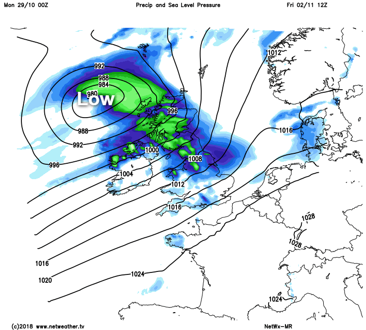
Then into Friday, confidence in the specifics drops, but after a dry, cold start in eastern and central parts, it looks likely that wet and increasingly windy weather will sweep in from the west. Potentially followed by another low bringing a second spell of rain and wind into the weekend.


