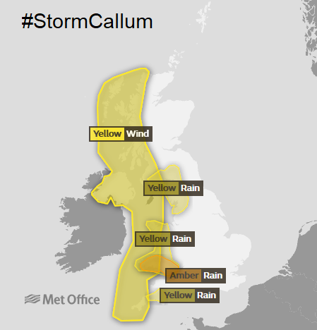
Gales and High Gusts. Heavy and continuous rain leading to flooding. Large waves and rough seas. #StormCallum
1.Gales and gusts over 70mph on Friday
2. Heavy and continuous rain into the weekend
3. Large waves, high seas
Impacts- Disruption to Friday travel - Ferries, road, air, rail, bridges, trees down
Flooding risk as rain continues Friday and Saturday, further disruption likely. Power outages and other services/schools affected
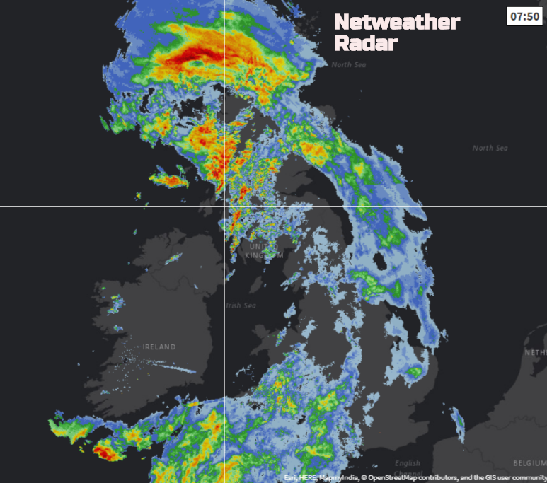
Click image for current position of rain, on Netweather Radar
Winds
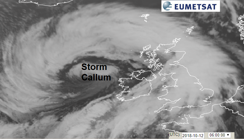
Strong to gales force winds will affect Ireland and the UK during Friday 12th Oct. Gusts of 60 to 70mph are forecast, possibly higher for exposed hills and coastlines. There will also be heavy and persistent rain across a swathe of Britain leading to flooding and further disruption.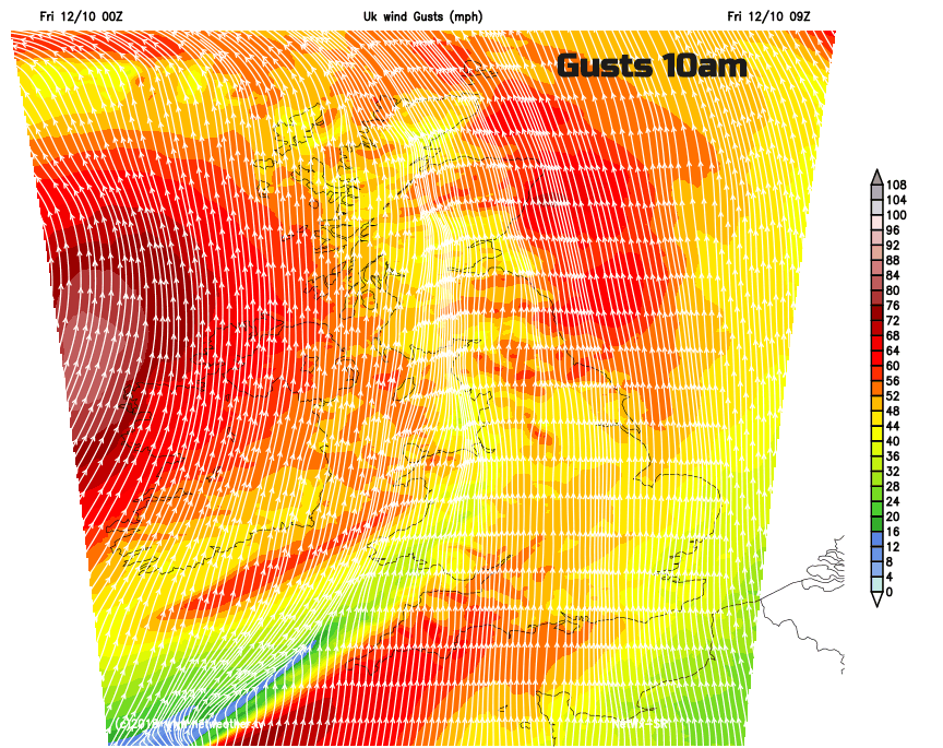
Along with a spell of heavy rain and high tides there is a risk of coastal flooding and damage.
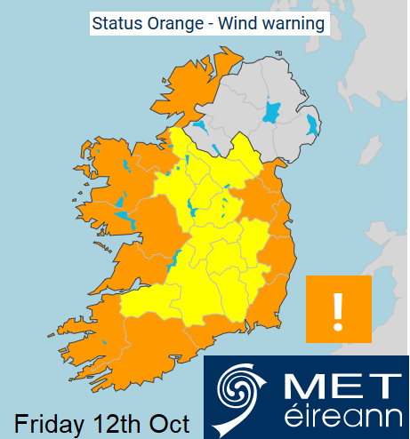
Southerly winds will reach gale to strong gale force today on all Irish coastal waters and on the Irish Sea. Winds will reach storm force this morning on coasts from Slyne Head to Malin Head with a risk of violent storm force for a time.
It’s likely that some coastal routes, sea fronts and coastal communities affected by large waves and rough seas as high tides are near their peak.
Rain
Storm Callum bringing periods of heavy rain during Friday and continuing into Saturday - particularly over south facing hills.
Driving conditions will be difficult, there is the risk of flooding. “Rainfall totals will reach 40-80 mm widely with 120-160 mm likely over the high ground exposed to the south and south west” Met Office
"Widespread flooding from surface water and rivers is probable across south Wales on Friday and Saturday and is possible elsewhere in Wales and parts of western England." Natural Resources Wales
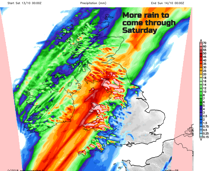
Prolonged heavy rain is expected across much of the country on Friday and again on Saturday. SEPA is expecting to issue a number of Flood Alerts for much of southern Scotland and the Central Belt over the next few days. SEPA
Already there are delays and cancellations to train and bus services. Also ferry and air travel, also trees down on some roads and restrictions on bridges.
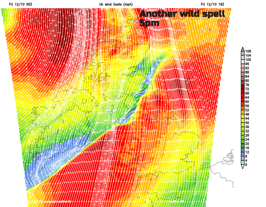
The strongest winds will be today, one bout this morning and another later this afternoon. The rain will continue from today into Saturday with over 100mm expected in places. SE Britain will miss the worst of the weather although the rainband will finally clear eastwards during Sunday.
Check the current Rain radar here
Storm Callum discussion and reports