Brisk winds will be a feature of our UK weather this week with severe gales in the far north. Rain for the NW, more sunshine in the south but frost is more likely later on.
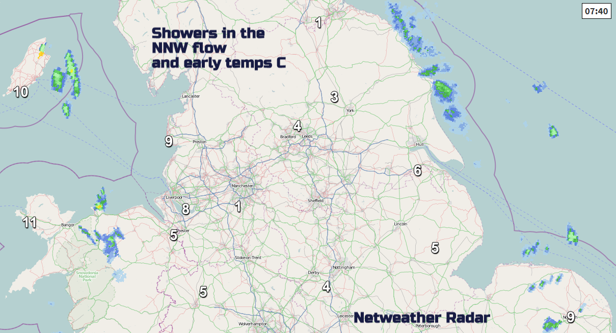
October is here and there is a chill in the air. In the north to northwest wind and with clear skies, temperatures fell away. -1.7C Dumfriesshire, -1.3 Northumberland and Cumbria, -1.0 Perthshire and -0.4C Co. Down. A sunny start for many with just a few blustery showers sneaking down from the north, clipping eastern Britain, north and west Wales and through the North Channel.
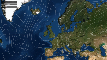
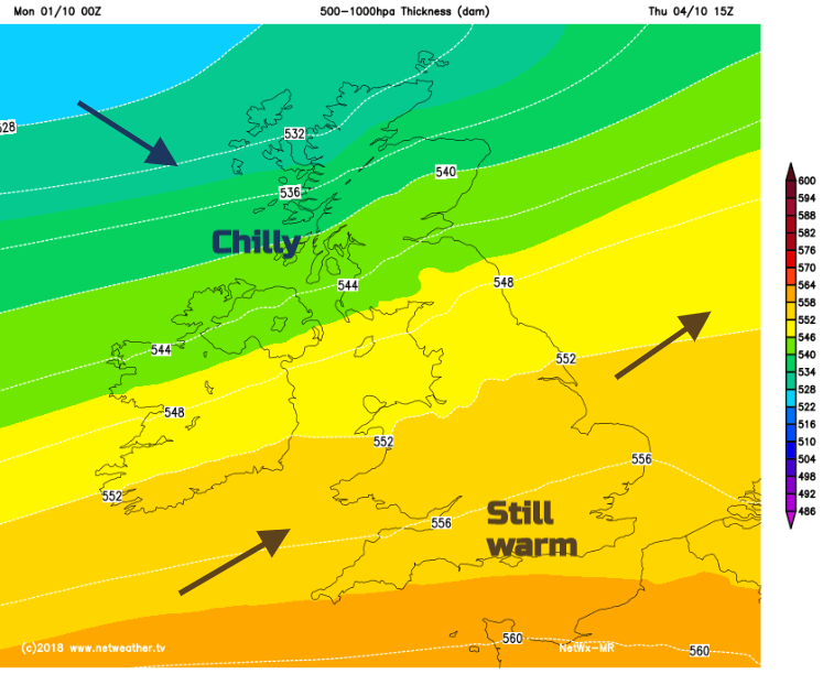
We’re in for a varied week as weather fronts stretch in from the Atlantic, they bring more cloud and rain, blustery winds and allow warmer air from the southwest with temperatures into the low twenties. Then cooler air from the NW will follow, keeping the nip in the air and the risk of frost by night, especially later in the week.
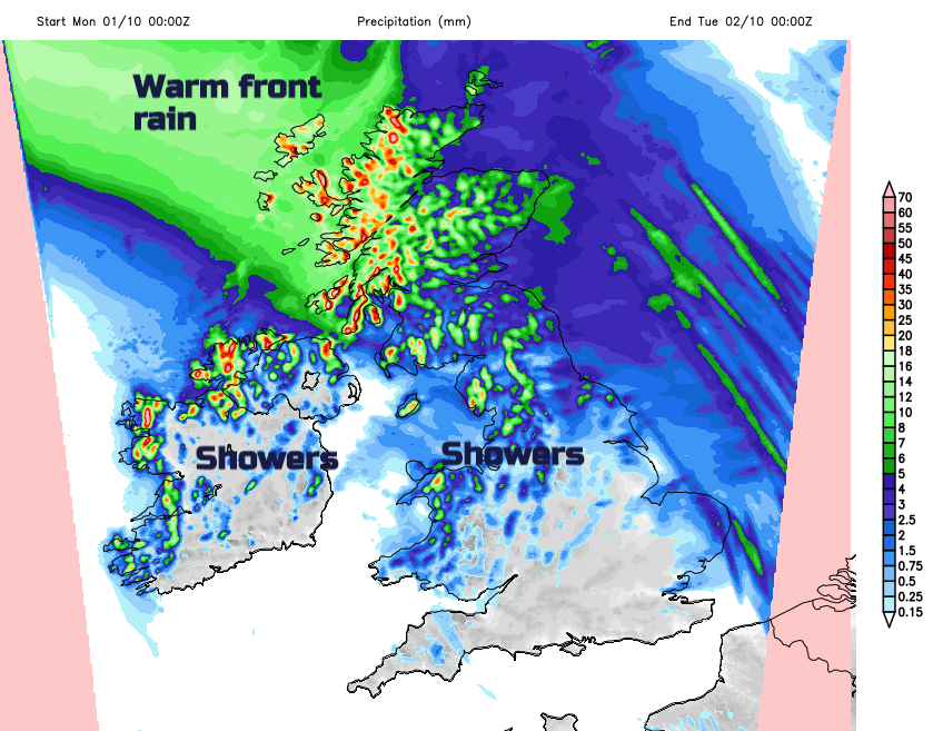
After the fine, bright start the first warm front begins to topple its rain in from the northwest. It will feel cool all day, especially in the brisk NW wind for East Anglia. The winds back to the SW as the rain sets in for NW Scotland and it turns wet for the rest of the day. The rain moves over Northern Ireland and northern Britain, reaching northern Wales late evening. Temperatures today will struggle everywhere 10 to 15C.
Overnight it will be blustery with more cloud and showery rain from the west. It will feel cold for Scotland by Tuesday morning in the wind, but milder further south as the warmer air reaches in. It stays windy but up to 21C for southern England with more cloud for western UK and patchy rain but sunny spells appearing further east, especially for NE Britain. Westerly gales are forecast for the Northern Isles as a deepening area of low pressure skirts past on its way to the Baltic Sea and it will be very windy around the Moray Firth with severe gales possible for Shetland into the evening.
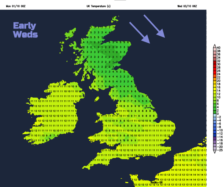
High pressure builds in through Tuesday night with a weak warm front keeping more cloud and light rain over a central swathe of the UK. Ahead of the front it will be cold again.
For Wednesday there will be fine, sunny weather over much of England and Wales, once the warm front moves away north. There will be more cloud in the west, even some dampness but the high pressure brings a more settled middle of the week. Further north there will again be cloud and rain, mainly in the NW.
By Thursday there will be another low near to Shetland with gales and the cold front bringing rain to Northern Ireland, Scotland and later northern England and north Wales. Another fine day for southern Britain although the wind will pick up.
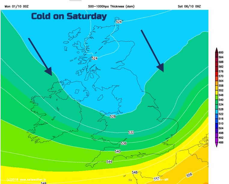
Colder air then appears from the north, leading to a frost risk for the next few nights and a much colder feel to things by the weekend. As you’d expect at this time of year there will be windy conditions, we’ll have to watch the gales in the far north and the usual rain divisions seem to be wet NW and drier for south and east. Friday or Saturday may bring an upset to that but there is quite low confidence about the rain bands from the west.