A mixed week of weather on the way, with up and down temperatures, often settled conditions in the south but spells of rain and wind moving through further north.
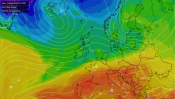
This year continues to race by with September vanishing in the blink of an eye. We're ending the month and will start October on a cool note, but despite some of the recent headlines, winter isn't beginning early, and the weather will be warming up for a time again this week.
For England and Wales, there's more cloud around to start than we saw yesterday, which has kept temperatures a touch milder overnight. But, with less sunshine, it'll not be a repeat of the glorious Autumn weather many had yesterday. The bringer of the cloud is a weak cold front slipping down from the northwest. It's already cleared Scotland and Northern England though, and here there will be some sunny spells, but also some showers - especially in the west, all blown in on a blustery northwest wind.
As you may expect, with the cloud, and the wind, it's not going to be the warmest feeling day, away from the far southeast at least, which will stay sunnier until later.
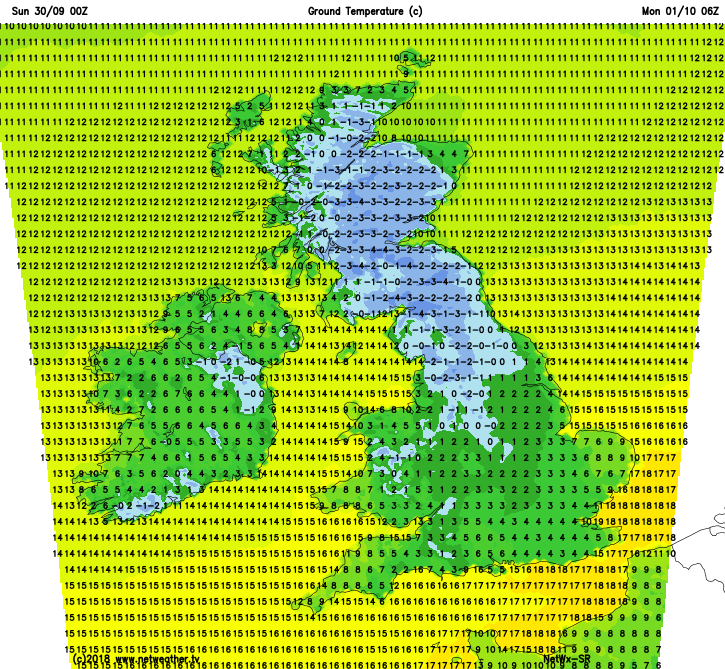
This evening and overnight, any showers in the north and west will tend to die away with just a few remaining near to northern, western and perhaps also eastern coasts. The cloud will clear too, leaving clear skies which will give temperatures a chance to fall away - a quite widespread ground frost is likely.
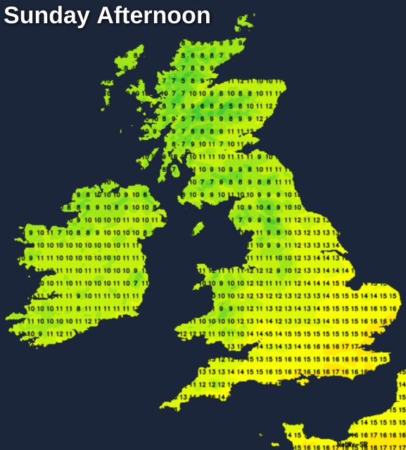
Monday then begins chilly, with lots of sunny spells. Cloud will thicken in the north and west through the day though, as an Atlantic system approaches, with rain eventually getting into the northern half of Scotland, with showery outbreaks spreading further southeast before the end of the day. The wind will be on the change tomorrow as well, with the north-northwest breeze easing. But at the same time, across Northern Ireland, Scotland and Northern Ireland a strong southwest wind will kick in with gales, maybe even severe, affecting parts of Scotland and Northern England later.
It'll be a cool day everywhere, with highs of 9-14c typical, but with the cloud, blustery winds and showery rain spreading southeast, it'll stay milder overnight.
Into Tuesday, with a warmer airmass having arrived, it'll be a warmer day across England and Wales, with highs into the low-twenties in the south and southeast. There will be some showers around, especially in the west and north of the country, with sunny spells developing elsewhere. Winds will have become lighter during the early hours across most parts, but another period of windier weather will affect the far north and east of Scotland.
Wednesday then starts quieter and cooler again, with just a few showers in the north and northwest. Winds will increase across the northern half of the country again as the day goes on though.
The north-south split then continues to the end of the week, with the south seeing the most settled, warmer and sunnier conditions. Whereas further north, there'll be more spells of wetter, windier weather coming through, but with some clearer interludes as well. Into next weekend, there's the threat of a more widespread spell of rain and wind to keep an eye on, but we'll have to wait a few days at least before firming up the details on this.


.png?w=350)