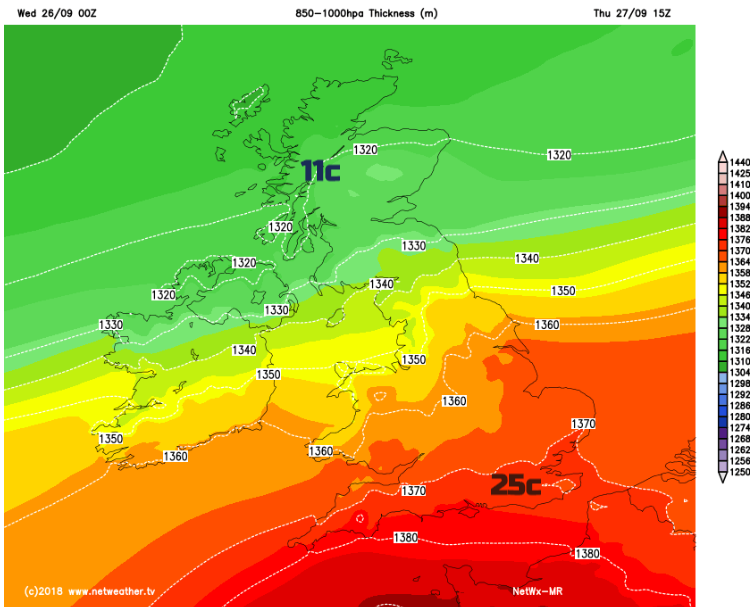
Minimums overnight were 1.6C in the south and 15.2C In the far north of Scotland. Seems a bit topsy-turvy. Normal service will soon resume. More fine, sunny weather for southern UK.
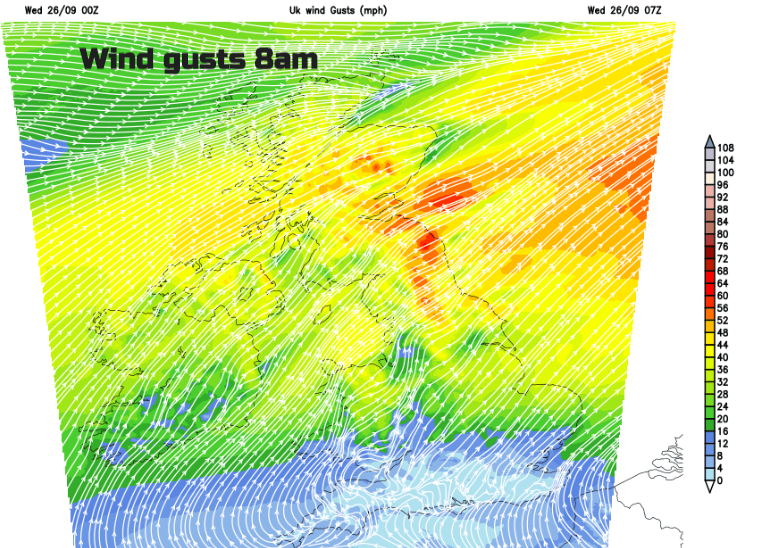
It’s chilly in the south this morning and very mild but windy in the north. 7am temperatures vary from 3C to 16 nearly 17C. Dorset dipped to +1.6C and Devon +2C overnight. In Moray, the lowest temperature overnight was a balmy 15.2C. The clear skies and still conditions have allowed any heat to radiate off into the night, with a touch of frost on the grass in places. Further north the west to SW winds are whistling in warmer air and with Fohn effect winds there will be more high temperatures to the east of high ground today. We have high pressure away to the south and a low pressure up in the Norwegian Sea. In-between strong, gusty winds and weather fronts over Scotland. The strongest gusts for SE Scotland, NE England into the Pennines will ease off this morning, but it stays blustery.
If you divided the UK SE/NW you would expect sunshine and fine weather in the SE portion and more cloud with some rain in the NW. The main area of rain is over NW Scotland as the frontal bands move about. There is also more cloud and some damp weather for NW England and Gwynedd, with a more mixed picture over Northern Ireland thanks to the brisk winds.
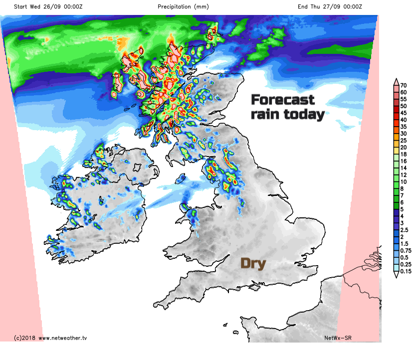
Eastern Scotland, NE England and much of Wales and the rest of England will be dry and sunny. Temperatures will reach into the low 20s C with light winds for SW and southern England.
By tonight the frontal bands will nudge north for a time, then the rain gathers itself and will begin to move southwards though Scotland into Northern Ireland for Thursday morning. There will be strong and gusty winds over northern Scotland during the night. It will be another cool night further south with light winds and the risk of mist and fog. It’s that time of year

The cold front is going to trudge its way southwards during Thursday as high pressure builds in from the west. The rain and cloud along the front fade but there will be a difference in temperatures and still blustery winds. There will be a kick in the winds to the NW and a much cooler feel to the air in the far north. For England and Wales, it stays warm and fine, more lovely September weather.
The frontal band of cloud with just a tiny bit of dampness moves through central England and Wales during Thursday afternoon and evening. By Thursday night there could be an air frost for inland Scotland, a swap around from today’s early temps.
By Friday, the last of the frontal cloud will clear away from the south coast and it will be a fair day everywhere. The weekend also looks pretty settled but cool. Chilly by night and a few scattered showers on Sunday as the winds turn to the northwest.