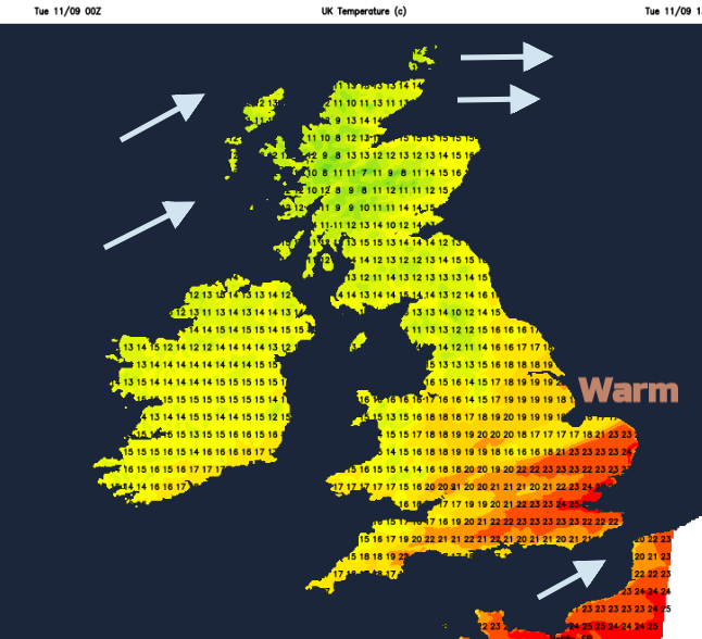
Isn't it warm? Temperatures in the southeast starting the day around 17C, not bad. Other parts of the UK have had wind and rain and are feeling cooler, that fresher feel will take hold but with sunshine.
Warm and muggy air has been transferred over SE Britain, you’ll notice that outside. We have some unsettled and blustery weather about with showers in the far northwest and a band of rain, a cold front sinking south-eastward over England and Wales. And there are still strong winds. There have been strong gusts over Northern Scotland, which are now moving away into the North Sea, but another spell of strong gusty winds will move through this evening.
This week there will be more rain from the west. Southern Britain will see pressure rising so the weather becomes more settled, drier with lighter winds but not as warm. Further north it will often be blustery, with showery rain from the west and the nights will turn colder.
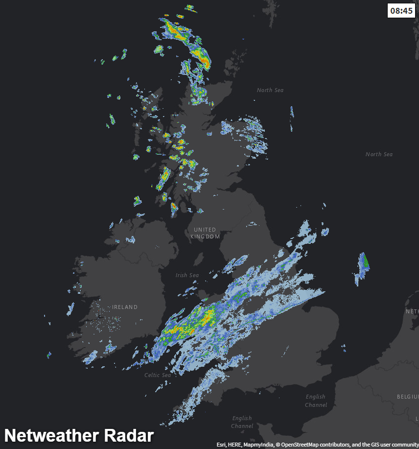
The cold front will be around for a while. It moves about, thins and returns. Today the band will move southwards and fade somewhat. There will be more cloud over Wales and western England with damp conditions spreading into SW England. BY the afternoon the brightening skies will have extended over northern England and into north Wales. There will be some bright spells over SE England, but it stays close and warm with temperatures up to 23 or 24C. For much of Northern Britain and Northern Ireland, there will be fine, bright but blustery weather with sunny spells. Western Scotland will keep more showers, whizzing over the Western Isles and NW Highlands.
The frontal band keeps cloud and dampness over southern Britain, edging down towards the English Channel. Then another pulse of cloud and rain moves over southern Ireland tonight and we have another line of rain across Wales and England for Wednesday. It won’t be as warm by Wednesday for London and the SE with a more northerly flow to start the day.
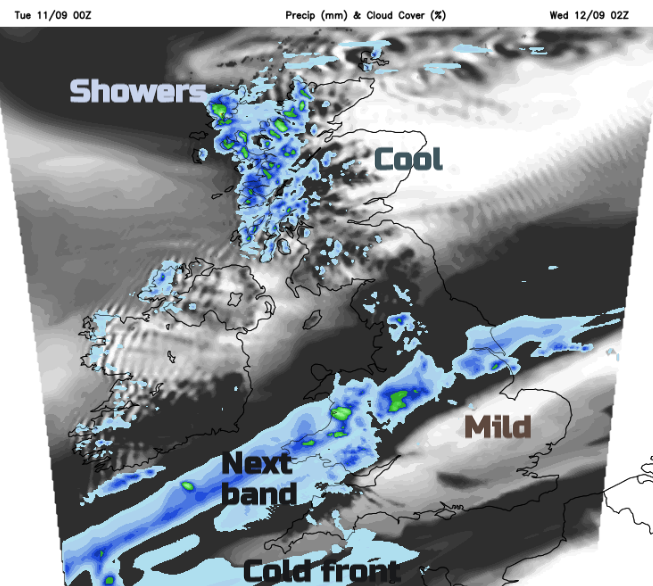
Winds will be light for the southern half of the UK and still a brisk westerly further north. Temperatures will be around average in the mid to high teens. The band of rain moves steadily towards Kent during Wednesday then the Channel Islands by the evening.
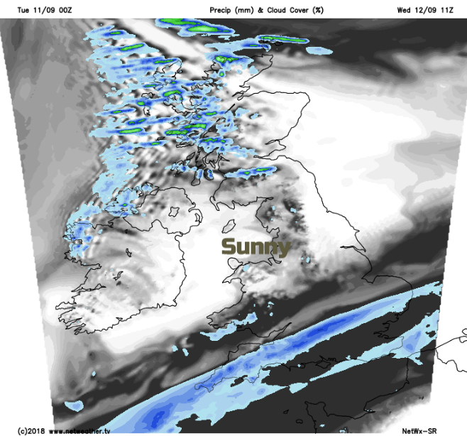
Wednesday night windy again for NW Scotland and cooler across the UK. There will be more nippy nights for the second half of the week, even a touch of frost. Daytime temperatures stay in the teens, until maybe Sunday when warmth could spread back over SE Britain, there is an Atlantic system wading in from the west that could give a blustery Sunday.

Talking of the Atlantic, there are currently three hurricanes in action all currently well out at sea. Isaac, heading towards the Lesser Antilles. Helene, which the Azores may need to watch next week and Hurricane Florence heading towards the US. Already evacuation plans are starting for South and North Carolina, also Virginia as a major storm surge, hurricane force winds and extreme and prolonged rains are forecast later this week. Forum discussion of Florence