


Fine & warm start to the week in the south, before cooler and more unsettled conditions with rain at times in the north moves south across all parts by mid-week.

Sunday saw warm and sunny weather in the south, with the highest temperature close to 25C at Heathrow in west London, while the north was cooler and windier with some rain. We start the new week in a similar vein, with the south seeing more warm sunshine today while the north sees increasing cloud and outbreaks of rain move in before spreading south and east on Tuesday followed by sunshine and showers further north, the southeast stay dry, sunny, warm and humid. Cloud and patchy rain will slowly clear the south on Wednesday, then we are all in the same boat of cool, breezy and showery conditions for the rest of the week, though most of the showers will be in the north and west.
For now, there are some showers from the word go across western Scotland, heavy across the northwest, it’s windy across Scotland too, with gusts of 30-40mph locally. Further south across England and Wales it’s mostly dry if rather cloudy for the morning commute bar the odd light shower in the north and west.
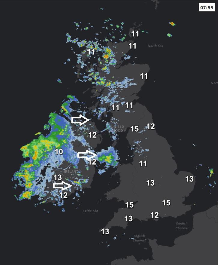
The showers across western Scotland will clear east through the country in the next few hours, heavy in the north, then thickening cloud and outbreaks of rain arriving across western Ireland and Northern Ireland will spread eastwards later this morning and through the afternoon across Scotland, NW England and north Wales. Further south and east across south Wales, central, southern and eastern England it will stay generally dry and bright or sunny, though with a fair bit of high cloud, the odd light shower can’t be ruled out in the west.
It will be a breezy day for all, rather windy in the north at first though winds easing here. Not quite as warm in the south as yesterday as a result, reaching 18-22C, in the north 14-17C, the lower end of this temperature range when the rain arrives later.
.png)
Wet and windy conditions across N. Ireland, Scotland, NW England and north Wales this evening eventually sinking south across Wales, northern England and the Midlands, staying dry to the south, while Scotland and Northern Ireland become drier and clearer but with a few showers across NW Scotland.
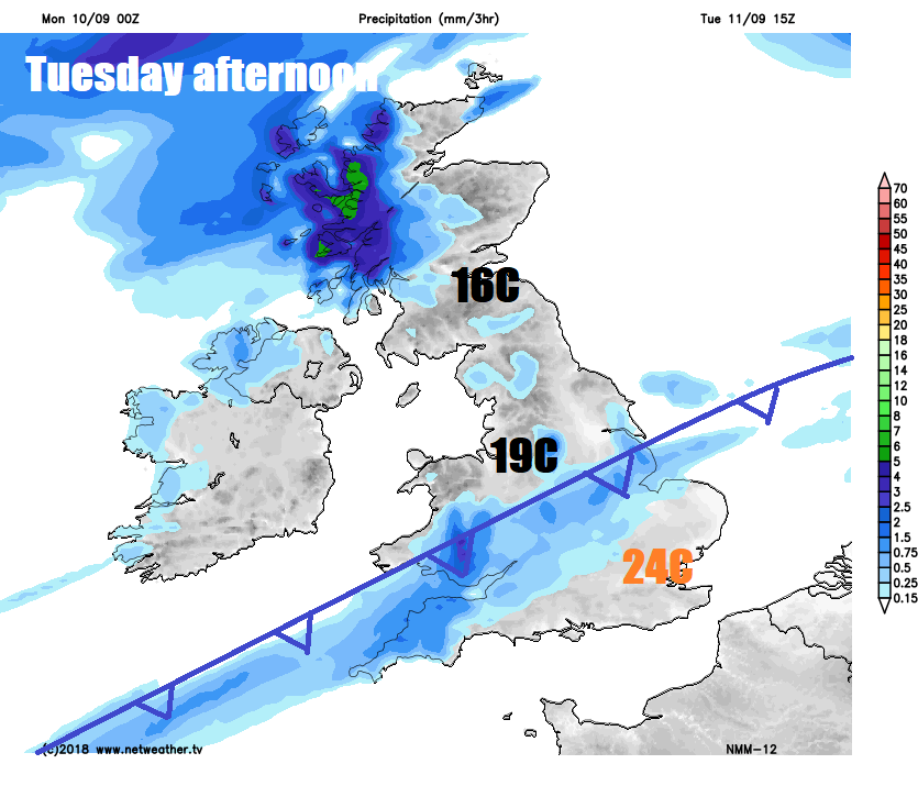
A band of cloud and outbreaks of rain along a trailing cold front will tend to stall and linger through Wales, the Midlands and part of northern England through Tuesday. Dry, warm and humid to the south across southern England – where temperatures could reach 22-25C. Cooler and fresher with sunny spells for N. Ireland, far north of England and Scotland, with heavy showers affecting western Scotland, temperatures for Wales, northern England and northwards reaching 15-19C.
That trailing front will slowly sink south across southern England and south Wales on Wednesday, bringing a cooler and cloudy day here with outbreaks of rain. Sunny spells further north, but also scattered showers affecting Scotland and Northern Ireland. Temperatures ranging from 12C in NW Scotland to 17C across SE England – so cooler for all.
Warm air across the south Tuesday kicked out by Wednesday
Generally cool and breezy conditions winning out for the rest of the week, with some showers around and some chilly nights returning. After a chilly start on Thursday, sunny spells for most, and for many staying dry away from Scotland where will see some showery rain move in. Some sunny spells but also some showery rain spreading southeast on Friday across many parts, though the southeast of England may stay dry.


