A look at the Atlantic hurricane season so far and the tricky forecast for Florence, who did become a Cat 4 hurricane mid Atlantic. Also in the Pacific, Hawaii eyes Olivia
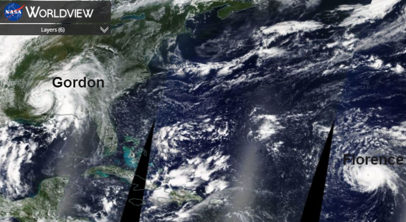
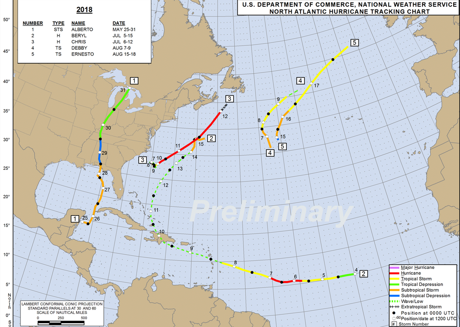
The Atlantic hurricane season, after a slow start, is beginning to pick up. Florence did become the first Cat 3 then Cat 4 storm of the 2018 season, so into the Major hurricane category for a time. It is well out at sea, mid-Atlantic. However, the variety of forecast tracks do take her westwards, some very close to the highly populated eastern seaboard of the US. These cyclones can also influence the UK weather, disrupting the Atlantic weather patterns and adding their tropical energy into systems which head our way.
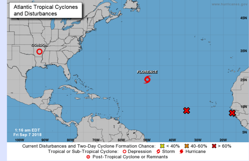
Tropical Storm Gordon hit the southern states of the US on Weds 5th Sept and is still bringing heavy rain. It was just shy of hurricane status as it came ashore on the northern Gulf coast near the Alabama Mississippi border. The Florida panhandle also saw heavy rain but the threat has moved north this week into the midwest as flooding continues. The other two red crosses are areas with a high change of a new cyclone forming.
Valid 12Z Fri Sep 07 2018 - 12Z Sun Sep 09 2018 ...Heavy rain possible over parts of the Ohio Valley into the Middle Mississippi Valley...
...Heavy rain possible over parts of the Mid-Atlantic and parts of Southern Plains into parts of the Lower Mississippi Valley...
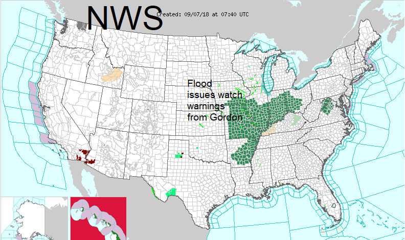
Tropical Depression Gordon is forecast to move northeastward from parts of the Lower Mississippi Valley to the Middle Mississippi Valley by Saturday evening. Gordon will become extratropical by Saturday morning. The system will produce showers and thunderstorms. NWS
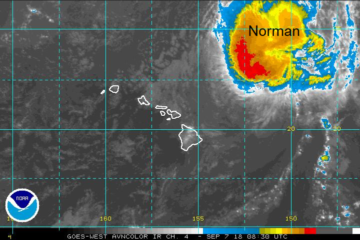
The Pacific has had an active season with Hurricane Norman forecast to move NW of the Hawaiian Islands and further east is Hurricane Olivia heading west. The Hawaiian Islands are on Hurricane Watch, that is the red colouring on the inset picture above, with very high seas expected.
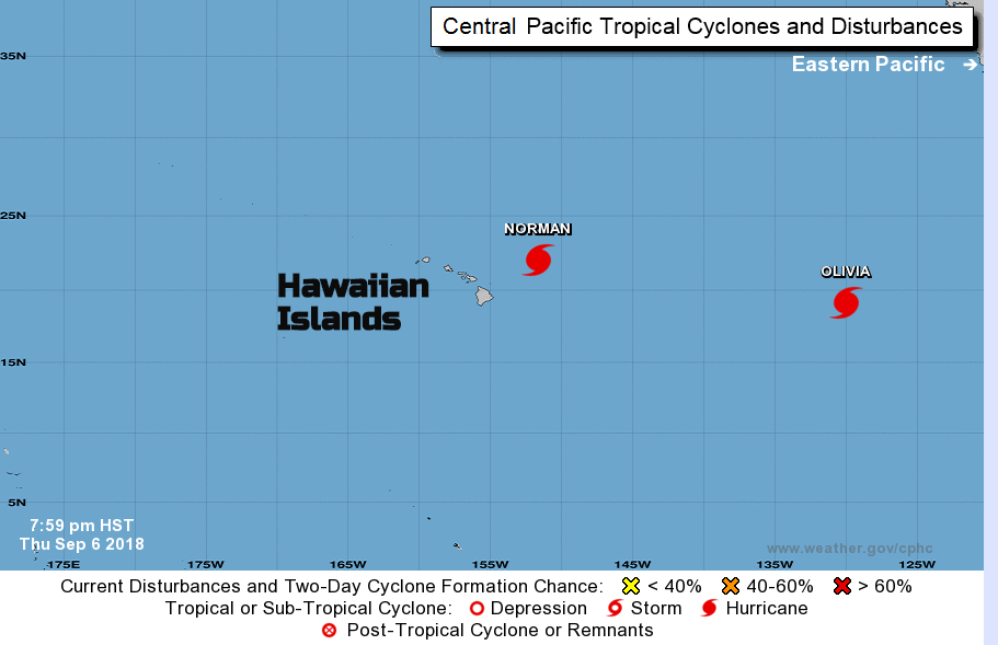
Hurricane Oliva may give the most cause for concerns out of these two as she heads west.
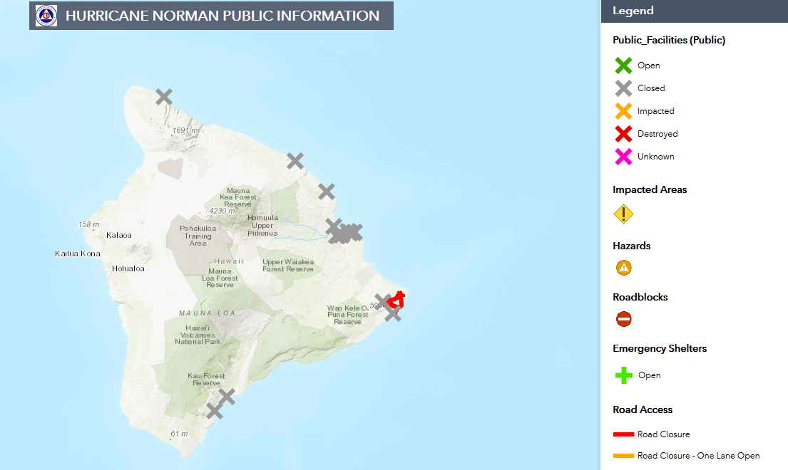
This twitter feed covers volcano and cyclone information @CivilDefenseHI With an intriguing legend, Destroyed!
 Tropical Storm Florence
Florence
If you have been watching the tracks of Florence you will have seen great variation. A day ago, Bermuda was centre field, now it is just on the northernmost flank of the envelope. "Building swells from Tropical Storm Florence will cause hazardous surf/rip currents, especially along the South Shore." Bermuda Weather Service.
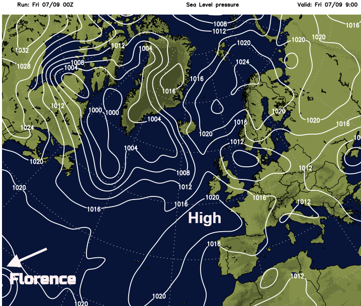
Shear has weakened Florence, now down to Tropical Storm strength but she keeps on going and is forecast to pickup back to major hurricane status after the weekend. Some eastern States have Primary voting next week. Hurricane Sandy caused upheaval for the Presidential election back in 2012 around New York, politicians won't want another storm on their doorstep even at this early stage.
How far away is Florence at the moment? If you look on the Netweather GFS charts you can see she is barely still visible today. However, by next Friday the chart looks quite scary off Newfoundland, although as mentioned there are huge variations in the path of Florence and some models do better than others with tropical cyclones. It will be interesting to watch and discuss.
Hence the concerns but better to look at a spread of solutions, probabilistic rather than deterministic solution at this stage. Most plots do curve away NE before reaching the US but a few charge right at the east coast.
The Met Office is predicting an average season for the North Atlantic, with 11 Tropical Storms likely, 6 Hurricanes but broader bands in the forecast too.
What have we had so far? Only Ernesto affected the UK, bringing heavy rain during the weekend of 18th/19th August. The season traditionally runs from June to November so Alberto did make a slightly early break for it.
Will watch Florence with interest next week.