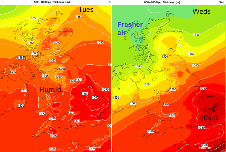
Warm and humid air will be over much of the UK today and on Tuesday but then a cold front pushes southwards, bringing fresher conditions and some rain.
During the weekend we’ve experienced warm and humid air as it was pulled up from the south and some areas saw a wet Sunday thanks to the remnants of Tropical Storm Ernesto. It rained all day long for me in SE Scotland. Moderate persistent rain, great. The Scottish Borders recorded 25.4mm of rain on Sunday, that’s an inch.
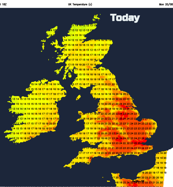
A weather divide remains across the UK, north-south. There is still the trailing front, just of cloud this morning and a little patchy rain but the temperature contrast is more pronounced. To the south is the warm, humid air with temperatures into the 20s Celsius and to the north cooler, fresher conditions in the mid to high teens. Where the sun comes out in the north it will feel pleasantly warm, in the south, it will feel quite muggy. Tuesday and Wednesday will be the warmest days this week for East Anglia and SE England. Temperatures could rise to 26 or 27C, maybe a degree or so higher.
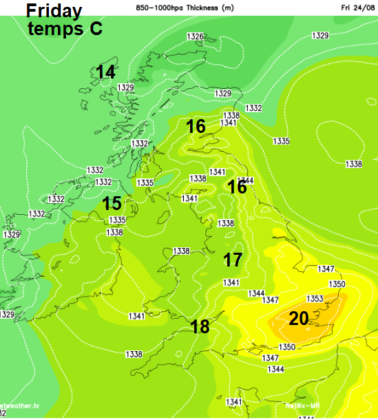
Later in the week, everywhere will feel fresher as the cooler air sinks down from the NW. By Friday 20C could be the top temperature with many places only reaching the mid to high teens in a freshening NW wind. Friday night will bring a nip in the air.
Over the next few days, the frontal bands will ripple in from the Atlantic, producing heavier bursts as a low pressure forms during Tuesday and the whole lot surges northwards. Then sweeping south-eastwards midweek to gradually introduce the cooler air.
Today will be quite mixed with some places seeing a lot of cloud and dampness in the air, around Irish Sea coasts, the SW Britain, Northern Ireland. Ahead of that, there will be breaks and warm sunny spells. A few showers will break out inland as the day progresses but for most, it will be a fair day. The winds will be very light and temperatures between 17 to 25C
Through the night more showers feed in from the west and will be over western Scotland by Tuesday morning and a few stragglers from today still lurking over eastern England. Much of the UK will have a warm sunny day. More of a SW wind picks up as heavier frontal rain sets in for north and west Scotland and Northern Ireland during Tuesday night. This band tries to move all the way down through the UK but even by Wednesday night it has only reached the Bristol Channel across to The Wash and is fading. It pulls over SE Britain on Thursday morning bringing some patchy rain and more cloud for a time, before clusters of heavy showers race in from the far NW around a low to the north.