Cool and changeable for many over the weekend, with some rain for most. Next week becoming mostly dry and warmer in the south, but not heatwave returning.
The polar front jet stream has been to the north and west of the UK for much of June and July, allowing high pressure to dominate bringing very dry, settled and very warm or hot conditions across much of Britain. However, over the last week the jet stream has slipped south across NW Europe, so the weather has become increasingly unsettled and cooler, as low pressure systems move across the UK from the Atlantic, bringing fresh and cool westerly winds, sunshine and showers or longer spells of rain for all.
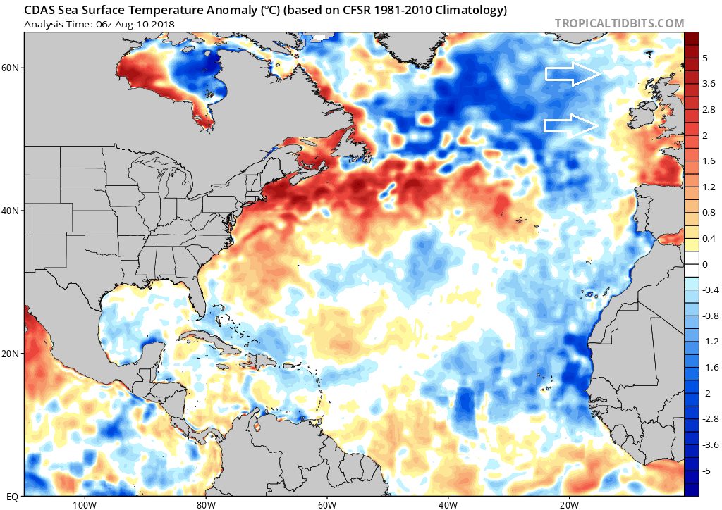
Sea surface temperatures over the North Atlantic are cooler than average, so the westerly winds today and over the weekend will contribute to the fresher feel for all over the next few days, particularly noticeable at night, with temperatures dipping quite low in rural areas and even in towns and cities it will feel chilly first thing.
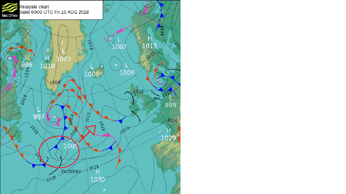
The rejuvenation of the Atlantic low pressure conveyor aimed at the UK over the coming days will have the additional boost of ex-tropical storm Debby, over the NW Atlantic this morning and moving east today carried on the nose of a jet streak which will deepen it somewhat as it then moves northeast to the west of Ireland over the weekend.
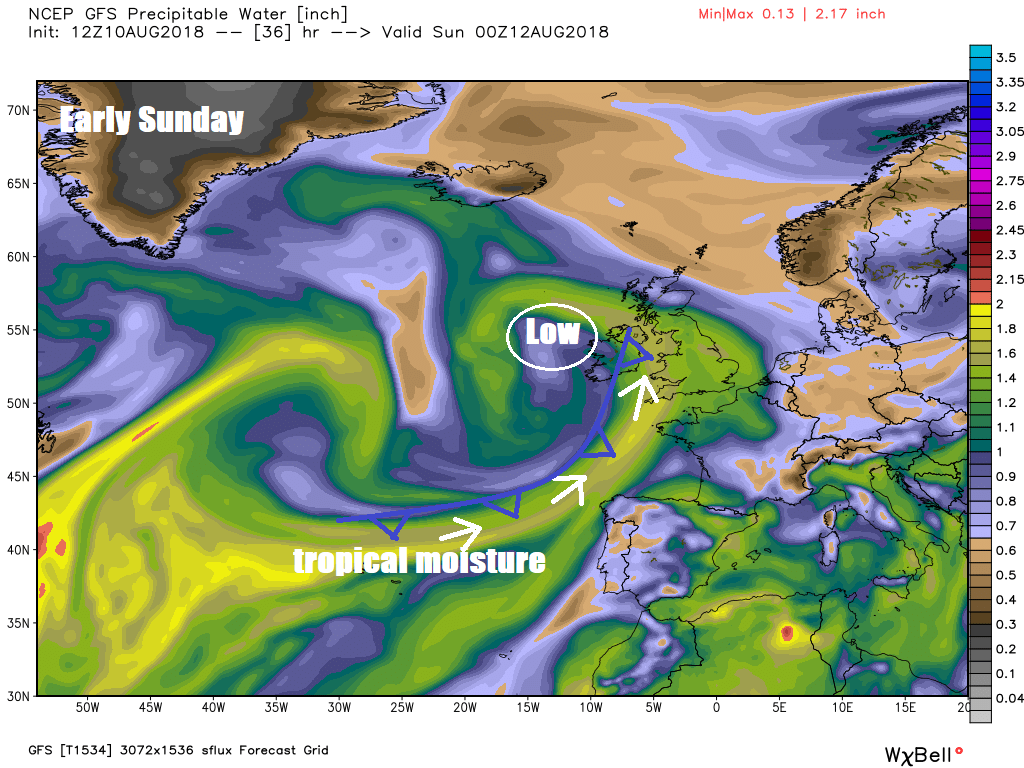
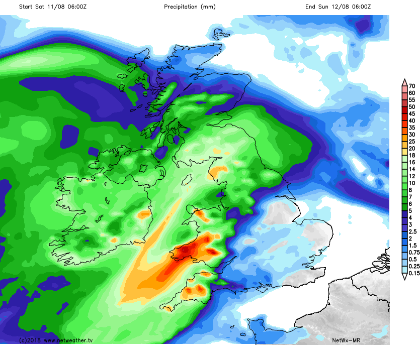
The injection of tropical moisture into what is otherwise a normal summer depression moving over the Atlantic will bring the potential of heavy rainfall across the western side of Britain later on Saturday and into Sunday morning, particularly over western hills over windward slopes – so potential here for some flooding.
Remnants of ex-tropical storm Debby will move to west of Ireland late on Saturday, pumping lots of moisture up western side of Britain.
24hr Rainfall totals by Sunday 6am
Surge of warm and moist air ahead of cold front bringing rain in from the west may allow temperatures to reach 25-26C across SE England and East Anglia, before rain moves in from the west here to end the day.
Next week we continue to look to the west for our weather, as a fairly strong jet stream continues to move west to east across the UK. The jet stream across the north initially, so after some showers across the east on Monday, cloud and rain mostly confined to northern Britain Tuesday to Thursday, before the jet looks like dipping further south briefly towards the end of the week, bringing cloud and rain south with it on Thursday, before dry and settled weather resumes across the south on Friday. With the wind direction generally from the west off the cool Atlantic ocean, don’t expect the kind of heat we’ve seen (temperatures in the low 30s) to return again in the next seven days. Having said that, southern counties of England, particularly towards SE England and East Anglia, could see temperatures reach the mid-twenties Celsius apart from Monday. Temperatures in the high teens across Scotland and N. Ireland to low twenties across northern and western England along with Wales.
Apart from showers on Monday and band of rain spreading southeast on Thursday, much of southern UK dry for much of next week while turning increasingly warm, though no heatwave.
Next weekend looks to continue seeing the influence of Atlantic low pressure close to the north, driving a changeable westerly or southwesterly flow, bringing spells of rain or showers at times, but where the sun comes out, still feeling pleasantly warm in the south – with temperatures in the low to mid-twenties Celsius, cooler in the north closer to low pressure.
So no solid signs of another heatwave returning, as defined by the Met Office, though I suppose personal definitions of a heatwave can vary depending on how one copes with heat, for me a spell of more than a few days where temperatures exceed 30C.