


Away from the far north, mostly dry, fine and warm or hot this weekend and into early next week, before cooler and fresher conditions spread across all parts by Wednesday.

For much of the UK it will be a fine and dry weekend, thanks to an extension of the Azores High keeping the weather settled. The exception will be across northern and western Scotland – where it will tend to be cloudier, with occasional rain at times and the odd shower can’t be ruled elsewhere across the north.
The heatwave continues across the south too, following a high of 33.2C at Kew Gardens in west London yesterday, temperatures may be a tad less high this weekend, but still we are looking at reaching 30C today and tomorrow in the southeast. Spare a thought for those in Portugal though, where the peak of their extreme heatwave this weekend could see tempeatures reach 47C. But if you are fed up with the heat and humidity back here, the good news is that after a hot start to next week a cold front looks to move east across all parts by mid-week, bringing cooler and fresher conditions across all parts. So after temperatures as high as 30C in London early in the week, temperatures on Thursday may only reach 21C.
Relief from the heat and humidity in the south on the way, but not until Wednesday ...
For now, it’s a rather overcast morning across the northern half of Britain, cloud thick enough to bring some patchy rain or drizzle across NW Scotland, though there are some breaks in the cloud towards the eastern side of Scotland and NE England, allowing some morning sunshine. Some hazy sunshine further south across Wales and the rest of England, thicker cloud towards western coasts, best of the sunshine this morning towards SE England and East Anglia. But for most it’s dry.
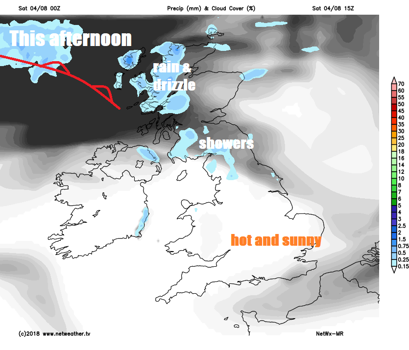
NW Scotland will be fresher and hang onto thicker cloud with some patchy light rain at times throughout the day, otherwise much of the UK will be dry with sunny spells after early cloud thins and breaks, while prolonged sunny spells will be enjoyed across central, southern and eastern England. The cloud may bubble up to bring the odd isolated shower across the north, but most here will miss them. Warm or very warm generally, temperatures reaching 19-23C in the north and far west, but across much of Wales, central, southern and eastern England temperatures will reach 24-28C, perhaps 29-30C towards the south coast. Light winds generally.
Cloudy with light rain or drizzle across NW Scotland tonight, otherwise dry with lengthy clear spells elsewhere. Staying warm and uncomfortable for sleeping in towns in cities in the south, where temperatures may drop no lower than high teens or low twenties.
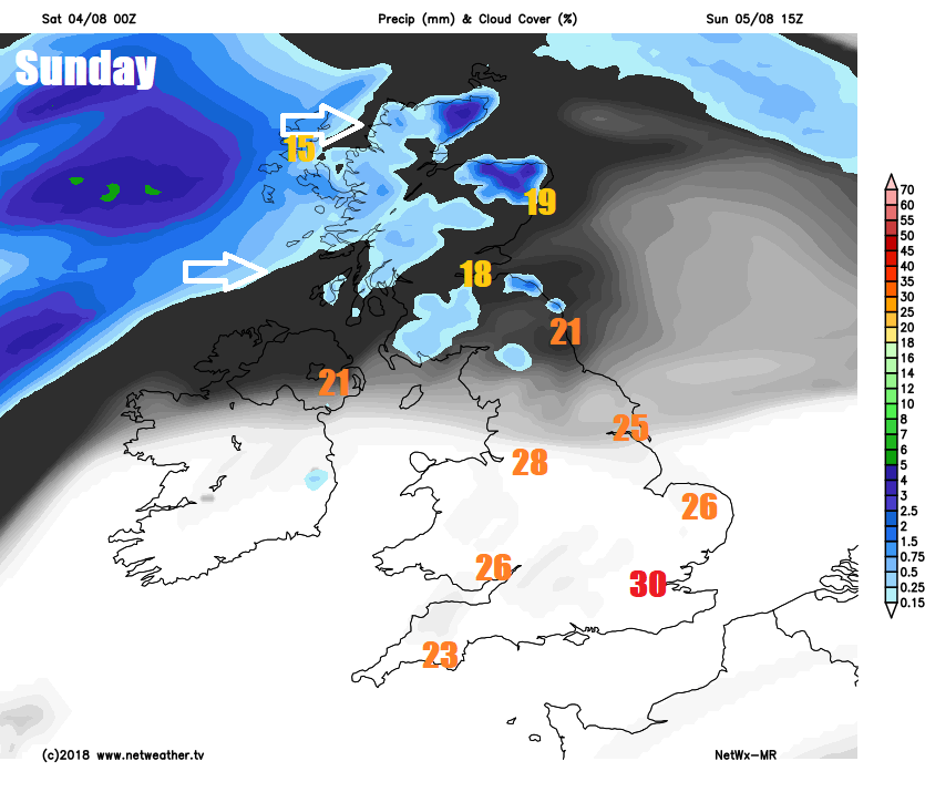
A repeat performance on Sunday for England and Wales, so dry and fine with plenty of sunshine, temperatures reaching 22-26C across northern England, north Wales and the Midlands, 27-29C across south Wales, southern England and East Anglia, perhaps 30C in London. Southern Scotland may stay sunny, but northern Scotland and N. Ireland will likely have a cloudier and breezier day, with some patchy drizzle or light rain and some more persistent rain moving across northern and western Scotland during the afternoon and evening. Temperatures reaching 18-21C across Scotland and N. Ireland.
A spell of rain overnight across northern Scotland clearing first thing on Monday, followed by sunshine and showers across Scotland, Northern Ireland and the north of England, most of the showers towards the west. The rest of England and Wales staying dry, sunny and very warm, hot towards the southeast – where temperatures may reach 30-31C, elsewhere 24-29C elsewhere.
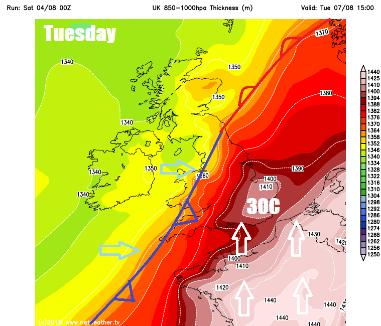
We keep the sunshine and heat across the south on Tuesday, with temperatures reaching the high twenties across southern England, low pressure close to the northwest will bring cooler, cloudier and breezier conditions with showers to western Scotland, N. Ireland and NW England. Small risk of thunderstorms moving in or developing across southeast England.
Last dose of heat for the southeast on Tuesday before cooler conditions move in from the west Wednesday
Cold front looks to clear east across all parts by Wednesday, so a fresher and cooler day across all parts, dry and sunny for central, southern and eastern areas, cloudier with showers towards the north and west. Thursday mostly dry and sunny across England and Wales, temperatures more comfortable in the low twenties, sunshine and showers across and N. Ireland. Friday is looking mostly dry and fine across the board, cloudier with some rain across the far north.


