The weather will be changing now, more storms, some rain (but still not for everyone) so not as hot and humid by Saturday. However, one last attempt at 37C today for East Anglia and Kent in the heatwave.
The UK heatwave is beginning to loosen its grip. If you barely slept last night, that may not be soon enough, but at least it is Friday. Temperatures at 11 pm on Thursday night were still at 26 or 27C in parts of the SE, that is very warm even for daytime temps. The top daytime temp on Thursday was at Faversham with 35.3C after a few late results coming in mid-morning today.
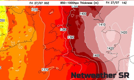
The 1000-850hPa thickness charts show how hot the air is. The pressure difference being a thicker layer of warmer air, colder air is a more contracted thinner layer. It is the 1420m (or 142dm, d for 10) layer which is of interest. This was present for the UK's hottest day back in 2003. Today has started off much warmer than yesterday and there is clear sunshine. Temperatures will whizz up this morning, we'll just have to watch where the convection, and so cloud, appears.
The most intense heat today will be for the far east of Britain, for East Anglia, Kent and East Sussex. There is still the chance of 37C, the July record is 36.7C, the all-time UK record 38.5C. Whatever we reach it will still be humid, hot and uncomfortable. Elsewhere, things are changing
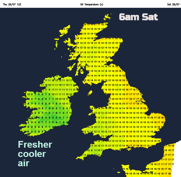
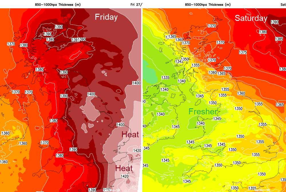 Cooler, fresher air is managing to finally work its way in from the Atlantic; a cold front has worked its way over Ireland during the night with Belfast starting the day at 18C, still warm but not as close even under the western cloud.
This band of rain was lurking yesterday and will fade a bit as it stumbles over the Irish Sea. Later another front moves in from the far west bringing another band of rain. Ahead of all this and mixed up with the last of the intense heat will be more thunderstorms.
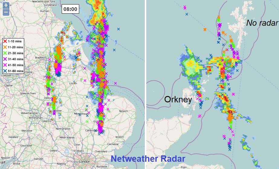
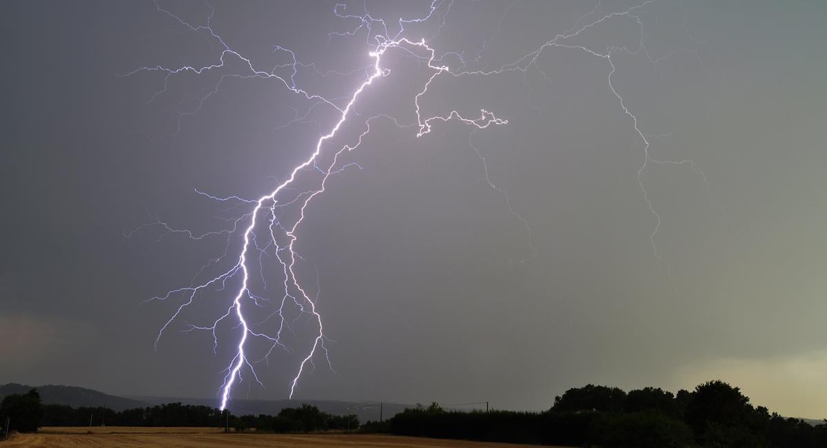
Eastern Britain has already seen a whole crop of storms on Thursday with another cluster move up from the Channel Islands through more central parts of Britain. Some of these are still lingering this morning, bringing more cloud with a crop over the Northern Isles and another from Yorkshire across to East Anglia. There is a yellow severe weather warning from the Met Office for thunderstorms this afternoon and evening.
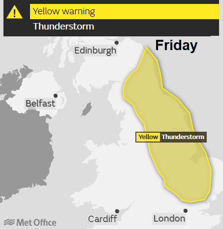
Again, some areas will miss the downpours; other areas will be at risk of torrential rain, sudden gusty winds, lightning and flooding. We already have thunderstorms now with quite a lightning show over eastern England but there will be extra energy and new storms by this afternoon. You just need to keep an eye on the radar, to see where the storms are popping up and which way they are moving. It is very difficult to forecast exactly where will get a thunderstorm.
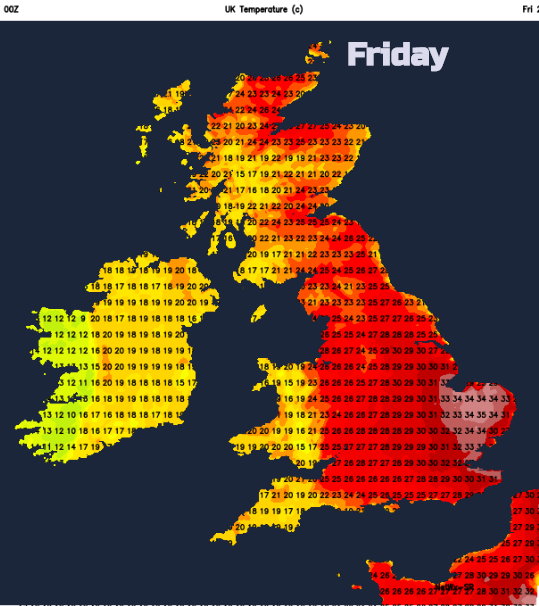
It will still be intensely hot and humid for East Anglia and the far SE of England today. Temperatures will rise into the thirties with 35C forecast again, and 37C possible. The July record is 36.7C, getting above 37C in the UK is rare. Northern Ireland, Wales, western Scotland and SW England will be more comfortable around 18 -22C with more cloud and a scattering of showers. For the rest of the UK, there will be strong sunshine, heat and temperatures in the mid to high twenties C.
This evening there will be a lunar eclipse although, with quite a lot of cloud over the UK, it will be worth having a look around 7 - 10 pm tonight, nearby Mars will be bright and red too. It will still be warm overnight for eastern and central Britain but not as hot as last night, high teens
Weekend
You can see on the temp frame for early Sat; the cooler fresher air is arriving. The frontal bands and hefty downpours need to twist away from NE Britain during Saturday, so it could still feel rather muggy here with more cloud and outbreaks of rain. There will be sunny spells, a few showers from the southwest and a very different feel to the air. Top temperatures 22-25C in eastern Britain. A pleasantly warm day.
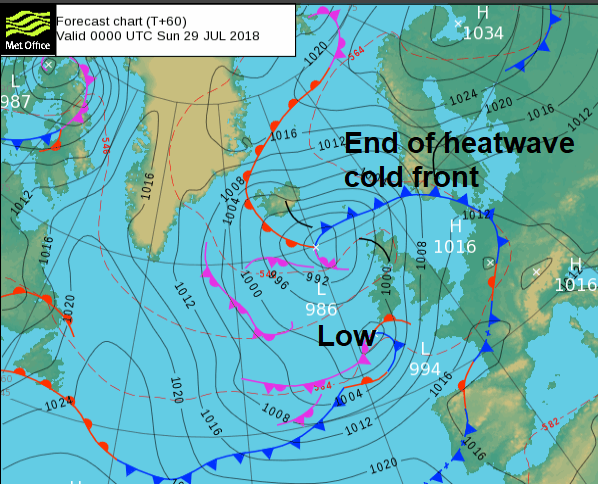
By Sunday western Britain and again Northern Ireland could see some proper rain. It’s not going to counteract the months of dry, hot weather but at least it will be something. A low pressure will through its frontal bands in from the west.
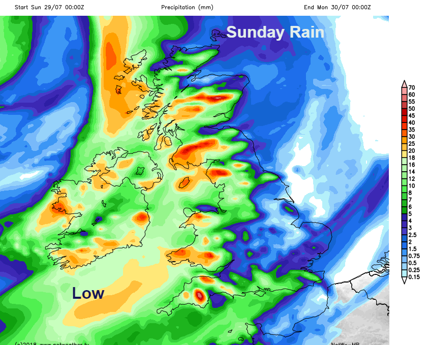
Sunday looks windy with a fresh to strong southerly wind which will veer to the west as the front clears Ireland in the afternoon. SE Britain should manage mid-twenties Celsius for the start of the week. High teens low twenties elsewhere with a bit of a breeze.
More on the longest Lunar Eclipse this century on Friday evening.