


A few sharp showers likely today and tomorrow as high pressure moves away temporarily, it's still very warm and mainly dry though and the high pressure will be back in charge by the end of the week.
It's been a very unusual summer to date, with virtually no rain and cloudless skies for weeks, accompanied at times by some record-breaking high temperatures. Although many are enjoying it, it's not to everyone's liking, with water shortages already beginning to appear, together with several quite serious grass and moorland fires around Greater Manchester and across Lancashire and North Wales. For today, though high pressure as temporarily released its grip, with nothing more than a few 'hit and miss' showers 'on the menu' mostly in the South, the emphasis remains very much on the dry weather.
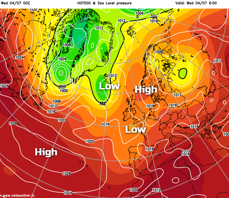
Some central and eastern areas are waking to a grey start, but this'll quickly burn back to the coast. It'll then be another fine day particularly over North Wales, the North West, much of Scotland and Northern Ireland, with a good deal of sunshine again. Elsewhere cloud amounts will be more variable particularly in the South, where we have already seen have a few showers. These are mostly over Devon, Cornwall and the Channel Islands with a few more expected to develop through the day that could be quite sharp, mainly across the South, South Wales and the Home Counties. They could also briefly affect the tennis at Wimbledon, but most parts stay dry with the showers very much hit and miss.
A storm forecast has been issued for today - read it here.
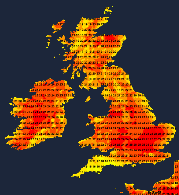
Winds'll be lighter than of late and mostly from an easterly quarter in the South. Temperatures will reach 21 to 25C generally, but a hot 26 to 28C in the sunnier spots. Sea breezes will keep some coasts cooler, however, particularly where very low cloud or mist comes ashore.
Most parts have a fine, summery evening, but cloud amounts will continue to vary. A sharp shower perhaps with thunder at first is still possible mostly in the South, but for most, it'll keep dry. Overnight a weakening front could bring primarily patchy light rain to Northern Ireland and West Scotland, but any showers elsewhere should fade. Light winds allow it to turn misty in places, with perhaps a few short-lived fog patches in rural areas towards dawn, as temperatures fall to between 9 and 11C in the North and 13 to 15C further South.
Thursday sees a weak front giving cloud and some patchy light rain or drizzle across Scotland and parts of Northern Ireland at first, with dry much fresher weather moving in from the West later to give some sunshine. Cumbria and the far North of England could also see cloud and some patchy drizzle for a time before the front finally fizzles out. Elsewhere apart from the odd rogue shower mostly in the East and South East where cloud amounts may be more variable, it'll be another fine, dry day with sunny periods, in a light West or North Westerly breeze.
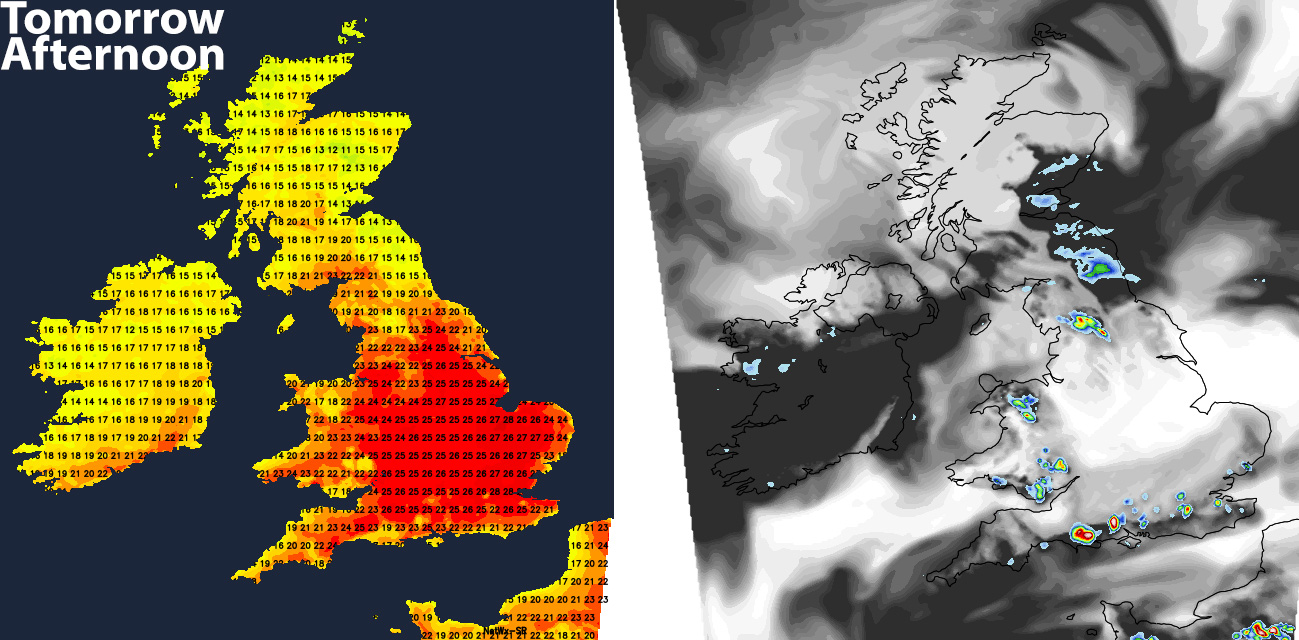
It'll become warm or very warm locally hot, with the thermometer reaching 22 to 25C generally, and 26 to 28C in the sunnier spots these probably across the West Country and Wales. Over Scotland and Northern Ireland, however, it'll be cooler, with top temperatures here only 14 or 15C in the far North West and 17 to 19C elsewhere.
Any rogue showers will soon fade into the evening, and with pressure beginning to build again across the country, it'll become dry overnight. Clear spells will develop and with only a light North Westerly breeze, a few mist patches will form again in rural areas towards morning. These'll be very short-lived however quickly dispersing after sunrise, with lowest temperatures 8 to 11C in the North and 12 to 15C in the South.
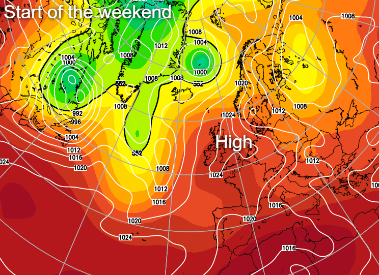
As pressure continues to build on Friday and into the weekend, there'll be much of the same, with little end in sight to this very long spell of dry, very warm weather.
Although unusual, there appears to be a pattern of magnificent summer s that tend to occur approximately every 21 years. The marvellous summers of 1997,1995, 1976, 1975 come to mind, with more mature of us remembering the hot July and Augusts of 1955, 1934 and 1933. A closer look will reveal these wonderful summers sometimes come in pairs, so what's the betting on another decent summer next year? Nice!


