


Northern Ireland record is 30.8C, under threat today. 32C possible near Glasgow. Heat, sunshine and dry conditions continue into next week. Hotter in south at weekend.
High pressure is right over the UK today. That means that winds are light for most and we have more low cloud and murk around to start the day for central and eastern areas where the cloud rolled in overnight. That will retreat to the east coasts once more today. Most place then sit out Thursday with clear blue skies, sunshine and heat.
Temperatures will again creep into the low thirties Celsius with the highest temperatures for Scotland, Northern Ireland and western Britain. Quite a brisk NE breeze will develop today over SE Britain and the flow off the North Sea with the clearing cloud will keep eastern counties fresher for a time.
Wednesday’s temperatures Porthmadog, NW Wales 31.9C, 90F. Aviemore 31.3C Carlisle 30.3C and Castlederg, NI 30C. Today 31 or 32C looks likely for inland Scotland, towards Glasgow. Maybe 31C for Northern Ireland breaking their overall record for max temperature or NW England.
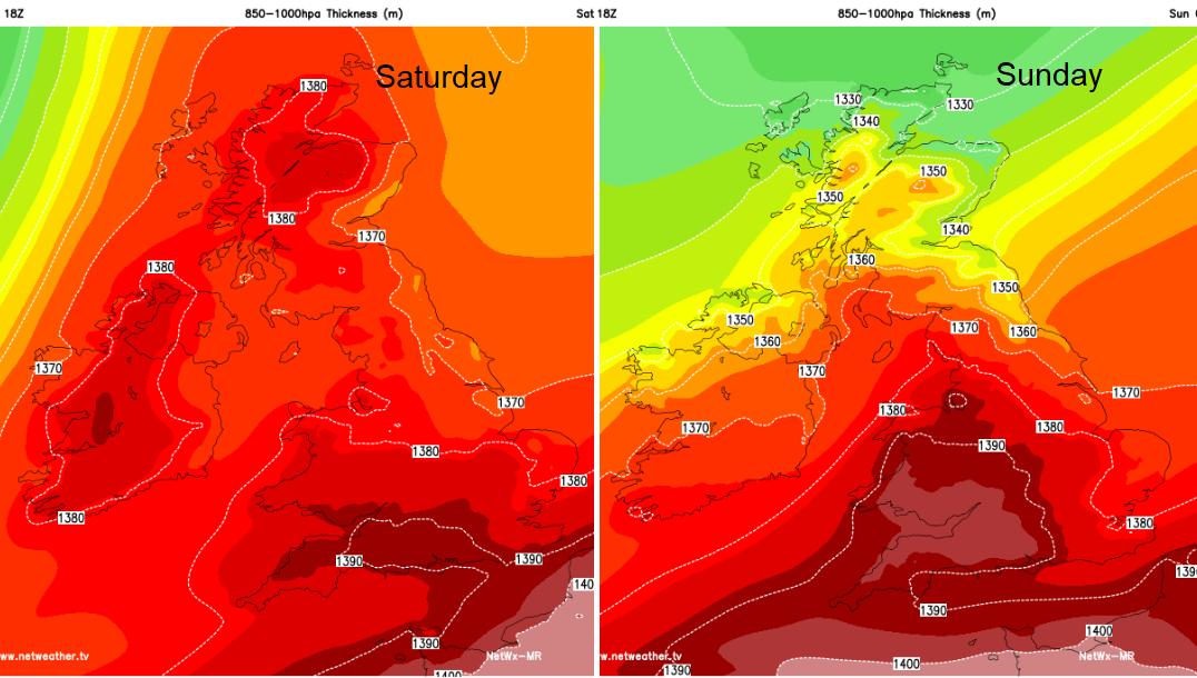
For the highest daytime maximums, look for the areas of highest thickness below (and clear sunshine)
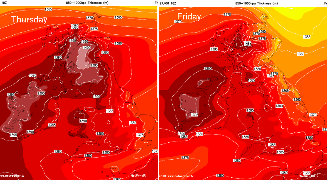
The area of intense heat changes over the next few days. Gradually leaving Scotland and Northern Ireland, becoming centred over southern Britain by the weekend. On Friday the NE Winds will bring the fresher flow further inland, so a difference in the air for more northern and eastern areas. By the weekend, inland parts of southern Britain could see high twenties or 30/31C. Scotland and Northern Ireland look much cooler by Sunday when a brisk N to NE breeze picks up.
There is still very little rain in the forecast. The odd hefty showers may pop off in the Scottish Highlands today, there is a signal on the model, but we’ll wait and see. Also, the low pressure nearing SW Britain through the weekend still brings the potential for some heavy thundery downpours, but that threat seems to have retreated somewhat from yesterday’s charts.
There is also a weak weather front coming in from the NW with more cloud and patchy rain. This starts as a cold front but weakens and waves Saturday night into Sunday
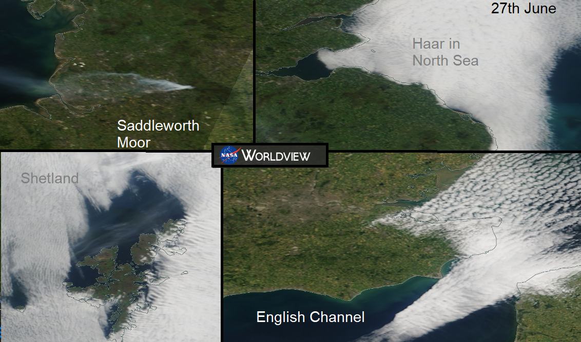
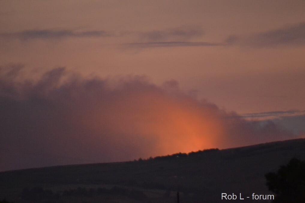
No rain in the forecast for Saddleworth moor as the blazes continue. Photo from Netweather Community NW England community thread
Next week
Overall more dry, warm and sunny weather. Still plenty of heat which spreads north again by Tuesday after a bit of a blip. High pressure is back with light winds, hardly any rain and heat, again up into the low 30sC looks possible.


