Fresher & cooler conditions have swept south overnight, but remaining dry and settled as we end the week.
It’s the summer solstice today, so the most daylight of the year and for those in the far north there will be nearly 19 hours of daylight. The weather is certainly in summer mode, with high pressure continuing to dominate the weather over the next 7 to 10 days, so there will be little prospect for rain for most for the rest of June. For some areas of England and Wales, we could be looking at a very dry, if not record-breaking dry, June.
A dry cold front sweeping south has introduced cooler and fresher conditions for all today, but for many it will remain dry and sunny for the rest of the week, through the weekend and into next week, as high pressure dominates. Nights and mornings will initially be cool, but it looks to turn increasingly warmer as we head into next week, so much so that we could see the mercury hitting 30C or more by the middle of the week.
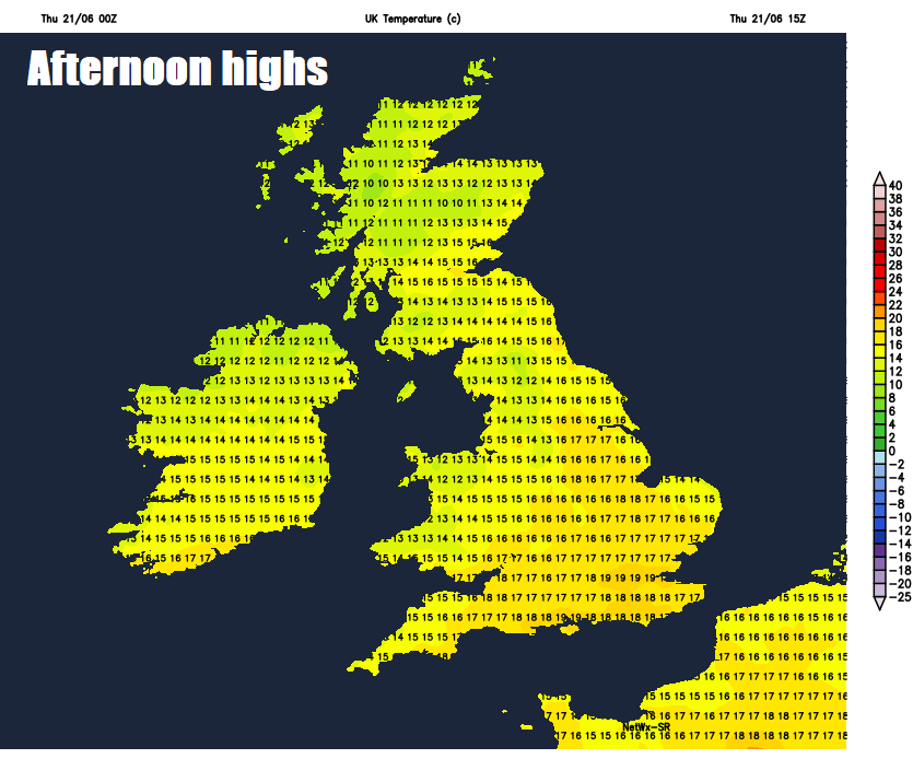
For now, Thursday morning brings fresher and breezier conditions across all parts, thanks to a cold front, which has been separating warm and humid air across the south and fresher air in the north, clearing south overnight. Most places will have another dry day with plenty of sunshine, though there will be some mostly light showers dotted around across northern Scotland. Temperatures reaching 14-17C in the north, 17-20C in the south, so down on recent days in the south, but feeling warm enough in the strong June sun out of the brisk northwesterly wind across all areas.

Showers across northern Scotland will tend to fade away though the evening and other than some thicker cloud perhaps across western Scotland most areas will have widespread clear skies which will lead to a rather cool night in the fresh northwesterly flow.
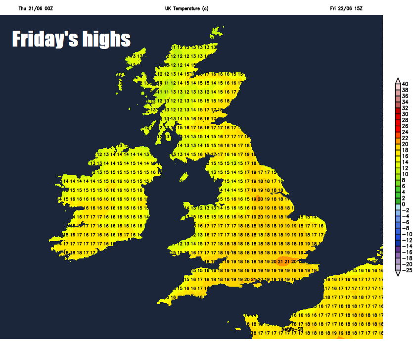
So a sunny but fresh and even chilly start on Friday morning, but with another dry and sunny day in store as high pressure builds in from the west, the warm June sunshine will quickly warm up the air. Winds will be lighter than today too, so feeling a touch warmer as well. Temperatures reaching 16-19C generally, 20-22C inland across southern England and south Wales cooler around the coasts.
Little change as we head through the weekend, with high pressure firmly in control centred across the UK, so we lose the northwesterly wind with little wind inland and sea breezes around coasts. Despite some cool nights and early mornings still, it will be warmer during the day with the light winds. Temperatures on Saturday reaching 17-19C in the north, 20-24C in the south; on Sunday warmer still – reaching 19-23C generally, perhaps 25C towards the southeast. Most places dry and sunny throughout the weekend, cloudier skies with a little light showery rain at first on Saturday across the north of Scotland.
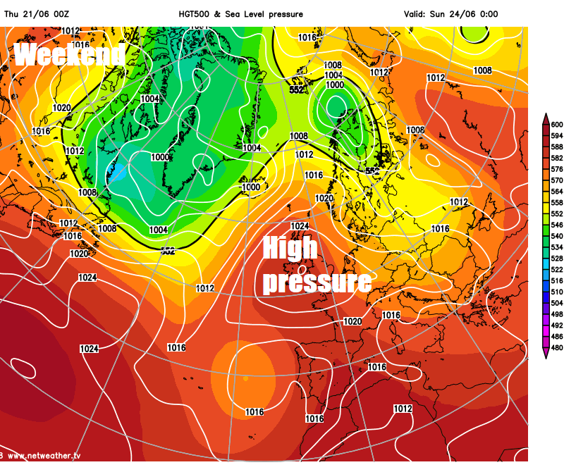
Continuing dry, fine and settled through much of next week, as high pressure remains firmly in control, temperatures on the climb day by day, so on Wednesday and Thursday we could see temperatures reach the mid-to-high twenties widely, perhaps as high as 30C across southern England.