Sunday the better half of the weekend, becoming dry and increasingly warm in the south next week, perhaps 27C on Wednesday.
Sunday is looking the better half of the weekend, with many places seeing outbreaks of rain or showers at some point today and rather on the cool side for mid-June, while tomorrow should be drier and warmer with some sunshine, though cloud will increase from the west in the afternoon.
A strong Atlantic jet stream continues to flow west to east above the UK this weekend, so we will be under a cool, fresh and changeable westerly flow, but where the sun comes out, it will feel pleasant enough. Next week, the jet stream shifts further north to be across Scotland, while pressure begins to rise across the south, this means it will become fine, sunny and very warm across southern areas, while northern areas are cooler, cloudier and breezier with some rain, mainly across the northwest.
Strong Atlantic jet stream across the UK this weekend, shifts north next week - meaning drier and increasingly warm in the south.
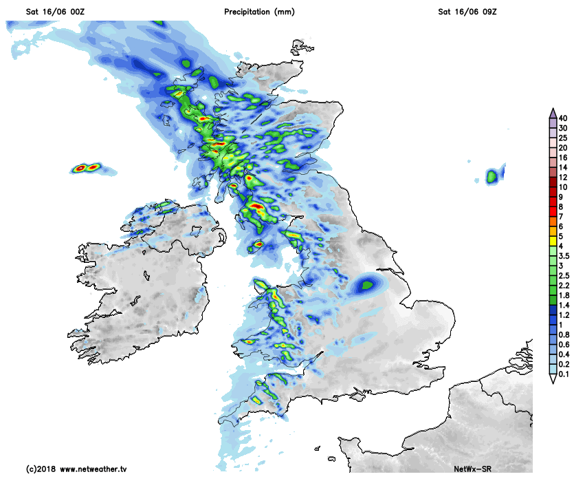
There is rather a lot of cloud to start the day across much of the UK, as an Atlantic frontal system brings outbreaks of showery rain eastwards across many parts this morning. Most of the rain will be from north Wales, The Midlands and East Anglia northwards, heavy across western Scotland and NW England, drier and somewhat brighter across southern England.
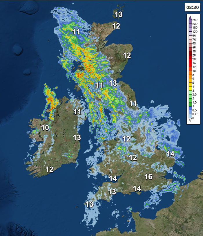
The morning showery rain will eventually clear eastwards to allow brighter skies to move in from the west across many parts, but with heavy showers with hail and thunder locally spreading in across northern areas. Southern England staying mostly dry and bright or sunny.
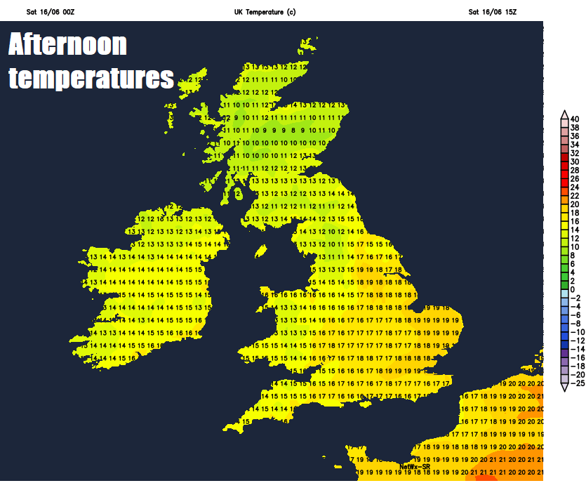
There will be a brisk southwesterly wind across the south and generally it will be on the cool side everywhere, temperatures reaching 12-15C across Scotland and Northern Ireland, 15-19C across England and Wales.
Any heavy thundery showers across northern and eastern areas will clear eastwards through the evening to leave most areas to have a dry night with clear spells, though a cool night. Thickening cloud and some light rain or drizzle may move in across Ireland, Northern Ireland and SW England in the early hours.
A fine start for much of the UK, with some sunshine for eastern areas in the morning, cloudier across the far west, with some patchy drizzle or light rain across Ireland, N. Ireland and the far SW of England. These cloudy skies and damp conditions at times spreading further east across western areas through the afternoon and into the evening, staying bright or sunny across eastern areas, though here turning increasingly cloudier too through the day. A little warmer than today, temperatures reaching 15-19C generally, perhaps up to 20C towards the southeast.
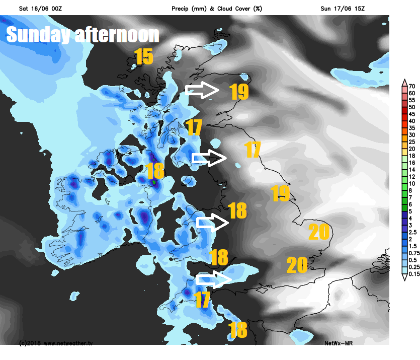
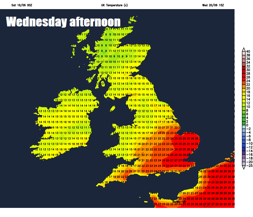
After perhaps a cloudy start, generally dry and bright with increasing sunshine across the south on Monday, cloudier and breezier with some patchy rain across the north. Dry, fine and bright or sunny generally on Tuesday, warm in the south, where temperatures will reach the low 20s Celsius. Dry, fine, sunny and warmer still across the south on Wednesday, temperatures perhaps reaching 25-27C across SE England, low twenties elsewhere across England and Wales, cloudy with rain for Scotland, N. Ireland and later northern England.
Potentially very warm on Wednesday in the south
Band of rain slipping south across Engand and Wales generally fizzling out on Thursday, otherwise remaining or becoming mostly dry, fine and increasingly sunny for many, as high pressure builds north, still warm in the south.