UK Weather forecast shows more settled conditions midweek before heavy thundery showers appear from the south. Hit and miss as always, but turning muggy
The middle of this week is looking more steady and settled although still with grey skies for some with low cloud reaching in from the North Sea. There will be sunshine and warmth for others with a lot of dry weather. Gradually though, heavy, thundery showers spill up from the south, as bands rotate around a low pressure over western Europe. High pressure to the north lessens the risk. The storm risk starts on Thursday in the far south but could take off at the weekend with the likelihood of scattered downpours spreading north through Britain.
Again, as this is showers, the downpours will be hit and miss. You’ll see shower or thunderstorm symbols on your weather apps, but it doesn’t mean that your location WILL get rain, it’s just the potential and that showers are likely. Winds will be light and so any downpours will be slow moving if you do encounter them.
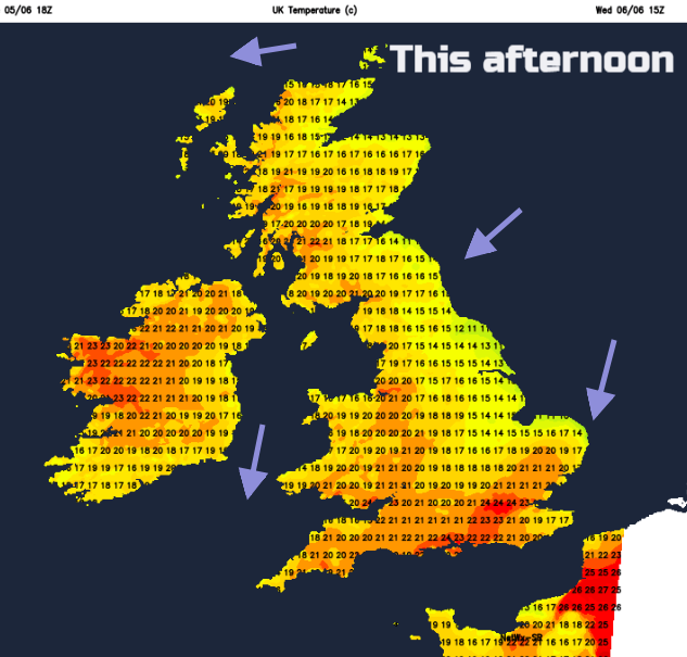
Overall the midweek wind flow stays from the north or northeast, keeping the air cool for eastern Britain and as we’ve seen, again and again, western Britain has fared well with temperatures into the low twenties. It is a cool, fresh feeling start today but the low pressure will push up warmer and more humid air for the rest of the week, so it will feel close and muggy.
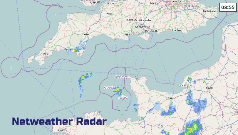
After the low cloud begins to break and retreat, still keen on east coasts, there will be plenty of fine, bright weather about. Wednesday and Thursday won’t be completely dry across the UK. There will be a few downpours for Co Tyrone and Co. Fermanagh today, maybe one or two over the Scottish Highlands. By Thursday there is the risk of heavy showers brushing Devon and Cornwall, maybe Somerset from the English Channel. SW Britain looks more at risk from showers by Friday morning with bands reaching over Wales and southern England into the Midlands through the day.
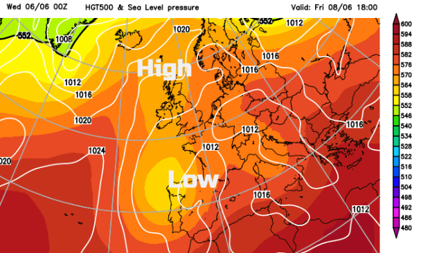
The low pressure develops more, right up through the atmosphere and the showers intensify. This then becomes the focus of the weather forecast as the current settled conditions get disturbed.
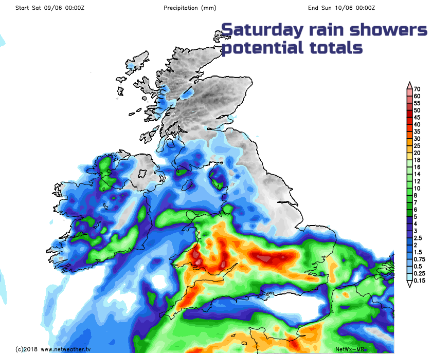
By Saturday the risk looks to be for Northern Ireland and the southwestern half of Britain, although pulses of heavy showers and maybe thunderstorms will begin to march northwards. In between these clusters will be fine, warm sometimes sunny weather. This is the problem with forecasting in this kind of situation, we can outline the themes but not pinpoint the detail. Not until the storms and showers start to appear, it’s a very short-term type of forecasting called nowcasting. Don’t mock; it’s not the same as looking out of the window and saying oh nice day. It is tool using the radar, the steering winds and a shorter window of prediction for where the downpours will track.