
Lots of cloud today, but the rest of the week will see more sunshine, away from eastern coastal counties at least. There will be a shower risk each day, but not as widespread as last week.
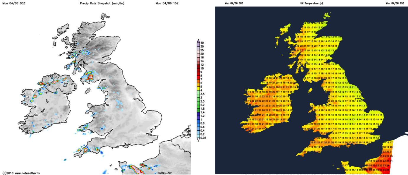
It's a cloudy start to the week for much of the UK and Ireland, with many eastern parts staying that way through the day. But elsewhere the cloud will begin to lift and break, to bring some brighter or sunny spells. As has often been the case recently, there are going to be a few showers around by this afternoon, these mostly in the west where the sunshine will help to trigger them.
The risk of thundery showers is going to be ongoing this week, but perhaps with the showers fewer and further between than we saw last week. Initially, it's western parts most likely to see them, but by the second half of the week, it's the southern half of the UK which is expected to see the bulk of them again.
Once we've got through today, where sunshine will be at more of a premium, there'll be plenty of sunny spells on offer through the week. With winds coming in from an easterly direction though, the east coast is again going to be prone to seeing more cloud and cooler temperatures. Elsewhere, highs into the low-mid twenties are going to be quite common, with western and southern parts often warmest and sunniest.
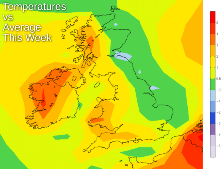
This map about sums up the week, with eastern coastal counties seeing close to or below average temperatures, whereas further west it's warmer than average, following hot on the heels of a record-breaking May for both sunshine and daytime temperatures.
The shower risk today will head further west during tomorrow with Ireland in the firing line, and just the low risk of an isolated one or two popping in western coastal counties of Britain.
By Wednesday, it's Ireland's turn again but they should be fewer and further between than today. Then for the latter part of the week, as low pressure over the continent nears, it's southern Britain we'll need to keep an eye on.

Further north, with high pressure closeby, there'll be a continuation of the fine weather, although we'll have to watch the progress of a weather front which may try to move in from the northwest into the weekend. If it does arrive it'll bring some extra cloud and perhaps a few showery bits of rain - but that's a long way off.


