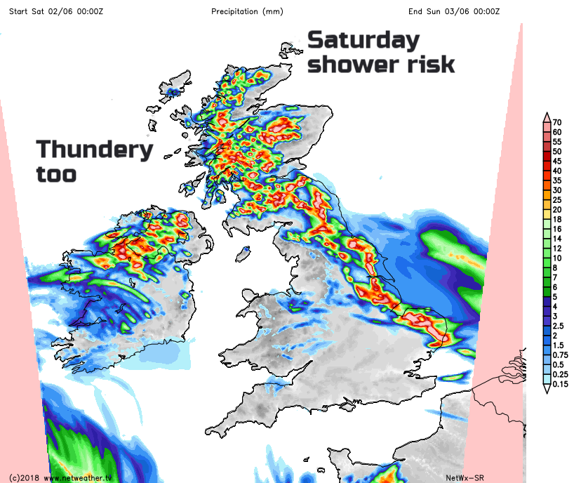
The risk of heavy showers continues with UK thunderstorms, but for many, there will be fine weather this weekend with temperatures into the twenties.
Plenty more warmth, humidity and the tricky mix of heavy sometimes thundery showers with bright or sunny spells.
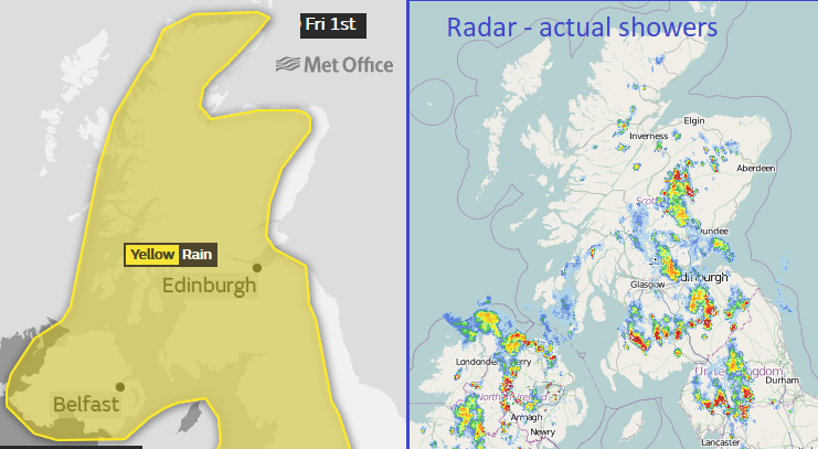
It is difficult to pinpoint where will get the downpours and where will stay dry. Remember the Met Office warning areas are parts of the UK that have the potential to see impacts from severe weather. This time, heavy rain. There is a yellow warning in place today for northern and eastern England and by late morning for Scotland and Northern Ireland
Where the hefty showers hit there could be flooding, there will be difficult conditions on the roads due to spray and surface water and there could be issues from lightning strike. If you were in a warning area yesterday or have plans for today and are worried, do understand that not all places will get a shower or a thunderstorm.
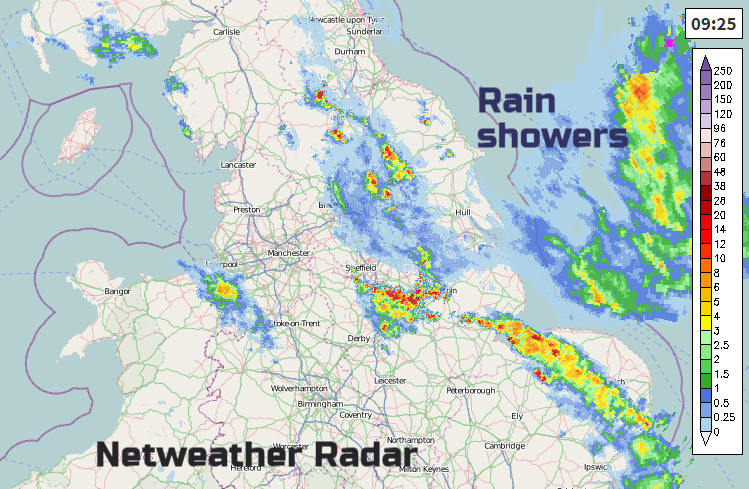
This snapshot from one part of Friday afternoon shows how the showers are scattered within the warning area. Later, of course, they have drifted NW so other areas get wet, but they are scattered with gaps in-between.
If you look at just England and Wales today, the SW half is drier, warm with more sunshine. Not immune to showers, there will be a few for the Midlands and inland Wales but overall fine and warm. The early cloud will thin and break, so remember your sunscreen. The showers over Northern Ireland look more likely for northern and western counties. In Scotland, there seems to be some protection for counties around the northeast and far north but there will be some lingering low cloud. Winds are light everywhere, so the showers will be slow moving.
If you are out today you can hope for fine, warm sunny conditions but need to prepare for a torrential downpour and a soaking, just in case.
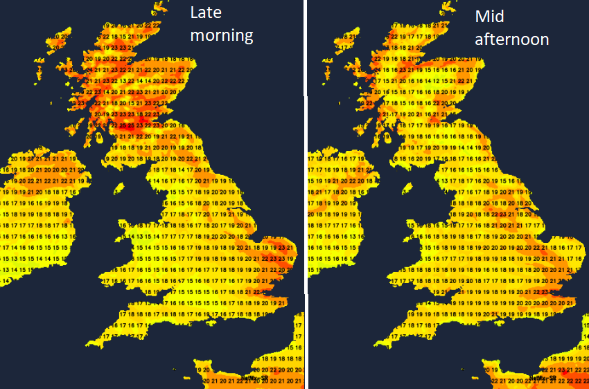
It will feel quite close although temperatures will reach into the high teens and low twenties as the cloud increase around the showers. 24C is a likely maximum for the UK.
Some of the hefty showers continue for north and NE England and inland Scotland, particularly central and southern areas. It will be a still warm night, slightly fresher for SW Britain. There is a low pressure churns about away to the SW of the UK. It will draw an easterly breeze along the English Channel, but winds still look light for Sunday
It will be warm enough with plenty of sunshine for much of England and Wales. Temperatures widely into the low twenties, mid-twenties for London. The shower threat will remain for inland northern England, parts of Scotland and Counties Londonderry and Tyrone
There is high pressure away to the north and this begins to have more influence by the end of the weekend. So next week looks more settled with the thunderstorm threat lessening.
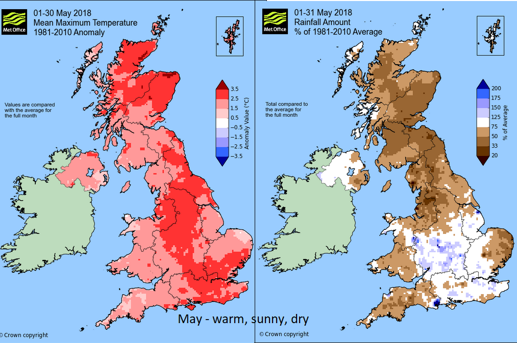
Provisional figures are out from the Met Office showing May 2018 was warm, sunny and dry. It looks record breaking for the daily maximum temperatures and sunshine amounts. The records are from 1910 and the average daily max would be 17C. The warming trend continues.