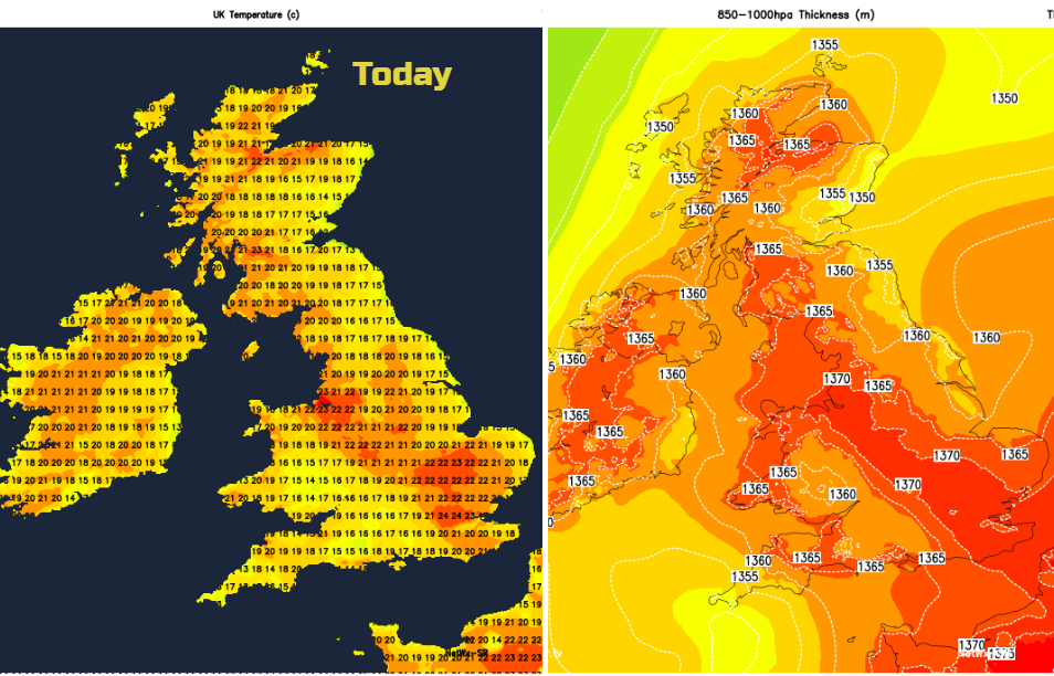
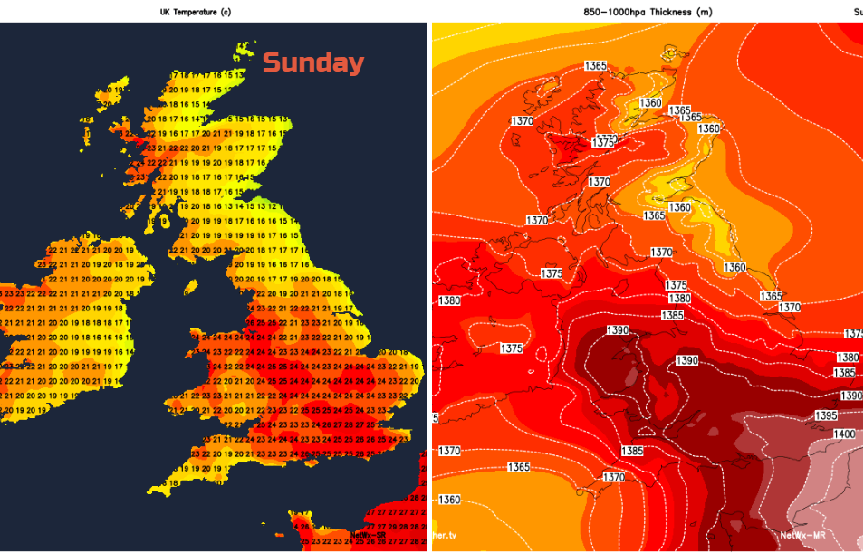
Warm again with sunshine for western areas, more low cloud and coolness in the east. Also showery cloud for southern UK with thunderstorms threat. Mid twenties Celsius , maybe 30C at the weekend
Overall the end of the week, including the Bank Holiday looks very warm and fine. However, it is not that simple story. Many people will get to enjoy a hot and sunny weekend but there is a threat of heavy thundery showers for southern Britain.
High pressure is sitting over Scandinavia and the northern North Sea, there is another anticyclone in the central Mediterranean. In between is a cool, sometimes brisk easterly flow off the North Sea. This has been bringing plenty of low cloud in, making it feel quite cold for NE Britain. Inland it disappears quite quickly during the morning and sunshine appears. Western Britain and Northern Ireland have been seeing some glorious sunshine in this easterly flow.
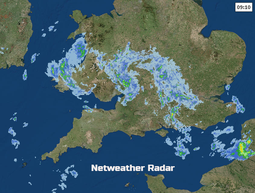
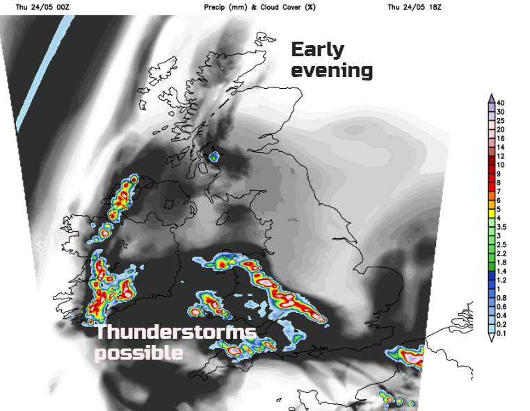
We have clusters of showers to start the day over England and Wales, As the sunshine gets to work and the warmth of the day builds so will clouds. Today’s thunderstorm risk has been highlighted by Nick Finnis, click for more details. Not every part of the grey area will see rain or lightning, but the potential is there.
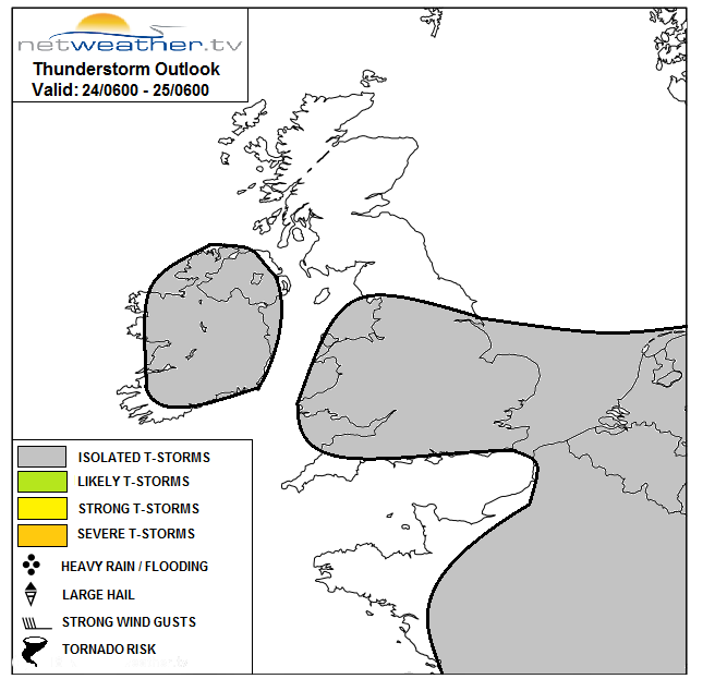
Added onto that picture this morning, is a large clump of cloud with showery rain, which thunderstorms overnight in the SE. Areas like this will sweep across southern Britain over the next few days, bringing the threat of isolated hefty downpours and thunderstorms. It will all be very hit and miss. Forecasting exactly where will see heavy rain is not possible with these lead times, that will need to be nearer the time, looking at the radar. However, we can highlight areas at risk and those less likely to see any storms. Northern Britain looks drier and most of Northern Ireland.
This threat of heavy thundery downpours lurks for the next few days. It means there won’t always be sunshine for southern Britain, but when the clouds do break the temperatures will leap up. If you are caught by a downpour, you will certainly know about it and the areas at risk do shift day to day.
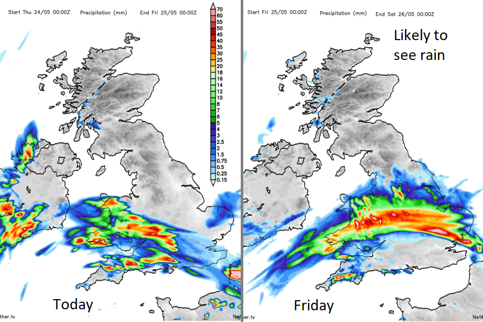
Today southwest Britain (Wales, SW England and central southern England into the W. Midlands) look at risk. Also, Co Fermanagh and Co Tyrone. Around dawn another cluster of showers head into eastern England bringing the rain risk to East Anglia, the Midlands then across to Wales during Friday.
Before noon yesterday, Porthmadog in NW Wales had reached 24C. Devon and Cornwall managed very near to that by mid-afternoon on Wednesday. Hotter air will spill in from the SE with temperatures forecast to rise into the high twenties. This year the top temperature so far was 29.1C on the 19th April in London, well over a month ago. The last Bank holiday Monday managed 28.7C in London (84F).
Temperatures are likely to peak around these values again during this late May bank holiday, maybe a 30C which is 86F. The UK May record is 32.8C which occurred in several parts of SE England back in 1944, so not record breaking but with two hot, sunny bank holidays likely this May that is certainly something.
Where the thunderstorms do appear, there will be the risk of torrential downpours, frequent lightning and hail with gusty winds. Also, localised flooding with temporary bad conditions on the roads due to poor visibility and surface spray. These will be a severe interruption to any outdoor events, so do keep an eye on the radar to see where the storms are moving in from, which way they are heading and if you click the Lightning button you can see the strikes over the past hour. For most, there won’t be anything to worry about.
The wind will be quite noticeable by Saturday a fresh NE to E wind. This will make it feel cooler for NE Britain’s coastal counties but will affect many parts of the UK on Saturday with lighter winds for the West Country by Sunday., With this area becoming more prone to hefty showers and thunderstorms, that will mean any downpours will be slow moving here.